Monjarás elevation
Monjarás (Choluteca), Honduras elevation is 14 meters and Monjarás elevation in feet is 46 ft above sea level [src 1]. Monjarás is a populated place (feature code) with elevation that is 529 meters (1736 ft) smaller than average city elevation in Honduras.
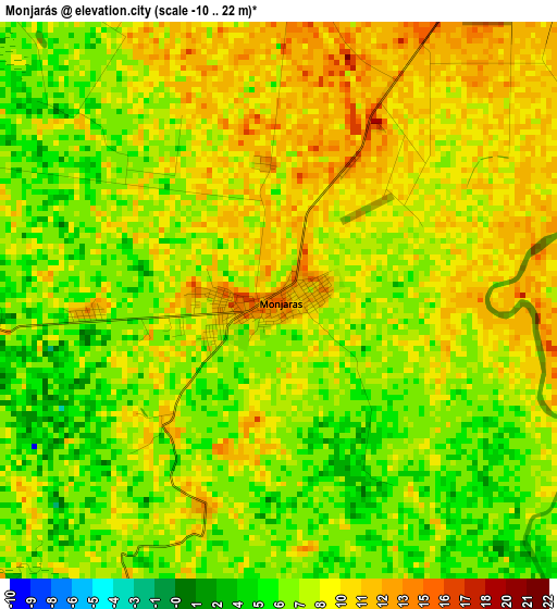
Below is the Elevation map of Monjarás, which displays elevation range with different colors. Scale of the first map is from -10 to 22 m (-33 to 72 ft) with average elevation of 8 meters (=26 ft) [note 1]
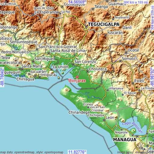
These maps also provides idea of topography and contour of this city, they are displayed at different zoom levels. More info about maps, scale and edge coordinates you can find below images.
| \ | Map #1 | Map #2 | Topo.Map |
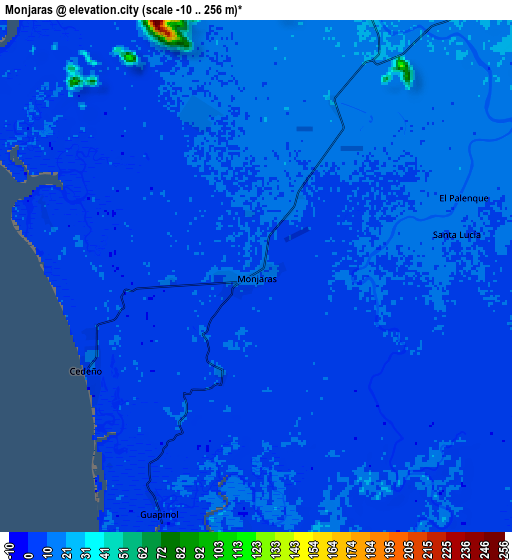
| Scale [m] | -10..22 m | -10..256 m | × |
| Scale [ft] | -33..72 ft | -33..840 ft | × |
| Average | 8 m = 26 ft | 9.9 m = 32 ft | × |
| Width | 9.51 km = 5.9 mi | 19.03 km = 11.8 mi | 304.4 km = 189.1 mi |
| Height | 9.51 km = 5.9 mi | 19.03 km = 11.8 mi | 304.5 km = 189.2 mi |
| ↑Max Latitude | 13.24334° | 13.286113° | 14.56569° |
| Latitude at center | 13.20056° | 13.20056° | 13.20056° |
| ↓Min Latitude | 13.157772° | 13.114977° | 11.82776° |
| ← Min Longitude | -87.418115° | -87.462061° | -88.78042° |
| Longitude center | -87.37417° | -87.37417° | -87.37417° |
| →Max Longitude | -87.330225° | -87.286279° | -85.96792° |
Nearby cities:
Cities around Monjarás sort by population:
• Ciudad Choluteca elevation 53 m
22.7 km,  60°
60°
• San Lorenzo 16 m
26.1 km,  342°
342°
• San Jerónimo 39 m
25.9 km,  95°
95°
• Marcovia 23 m
12 km,  35°
35°
• Santa Ana de Yusguare 69 m
30.3 km,  68°
68°
• Namasigüe 54 m
25.5 km,  88°
88°
• El Puente 243 m
29.4 km, 71°
• Santa Cruz 21 m
7 km,  23°
23°
• El Obraje 51 m
26.8 km, 101°
• San José de Las Conchas 18 m
14.1 km,  350°
350°
• Los Llanitos 25 m
10.5 km, 24°
• La Criba 51 m
28.5 km, 351°
Multilingual:
 En español:
Monjarás elevación 14 m.
 En France:
Monjarás élévation 14 m.


Sources and notes:
- [note 1] Map square and city borders are not equal. Map elevation data is calculated only from area inside that square.
- [src 1] Elevation data from geonames database provided with same terms of usage.
- [src 2] The elevation map of Monjarás is generated using elevation data from NASA's 3 arcsec (90m) resolution SRTM data.
- [src 3] Base (background) map © OpenStreetMap contributors tiles are generated by Geofabrik and OpenTopoMap.
Copyright & License:
This Monjarás Elevation Map is licensed under CC BY-SA. You may reuse any part from this page, if you give a proper credit by linking to this URL:
 More info on terms of use page.