San Lorenzo elevation
San Lorenzo (Valle), Honduras elevation is 16 meters and San Lorenzo elevation in feet is 52 ft above sea level [src 1]. San Lorenzo is a populated place (feature code) with elevation that is 527 meters (1729 ft) smaller than average city elevation in Honduras.
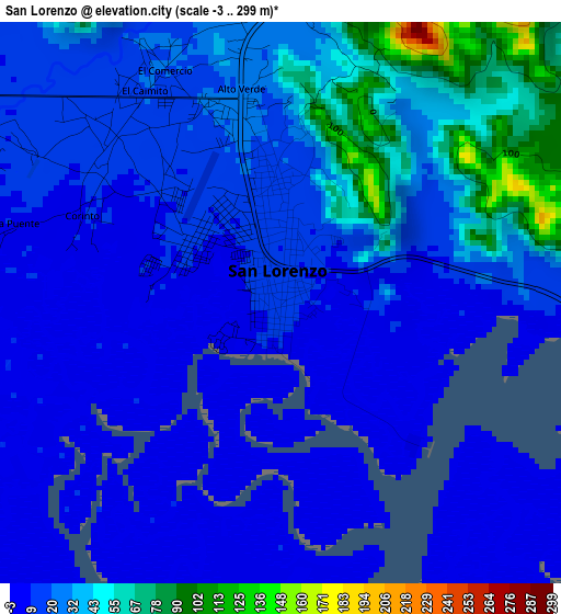
Below is the Elevation map of San Lorenzo, which displays elevation range with different colors. Scale of the first map is from -3 to 299 m (-10 to 981 ft) with average elevation of 23.3 meters (=76 ft) [note 1]
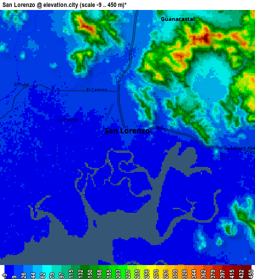
These maps also provides idea of topography and contour of this city, they are displayed at different zoom levels. More info about maps, scale and edge coordinates you can find below images.
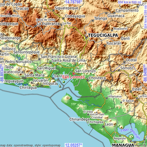
| \ | Map #1 | Map #2 | Topo.Map |
| Scale [m] | -3..299 m | -9..450 m | × |
| Scale [ft] | -10..981 ft | -30..1476 ft | × |
| Average | 23.3 m = 76 ft | 46.3 m = 152 ft | × |
| Width | 9.51 km = 5.9 mi | 19.01 km = 11.8 mi | 304.1 km = 189 mi |
| Height | 9.51 km = 5.9 mi | 19.01 km = 11.8 mi | 304.2 km = 189 mi |
| ↑Max Latitude | 13.466911° | 13.509644° | 14.78798° |
| Latitude at center | 13.42417° | 13.42417° | 13.42417° |
| ↓Min Latitude | 13.381422° | 13.338666° | 12.05257° |
| ← Min Longitude | -87.491165° | -87.535111° | -88.85347° |
| Longitude center | -87.44722° | -87.44722° | -87.44722° |
| →Max Longitude | -87.403275° | -87.359329° | -86.04097° |
Nearby cities:
Cities around San Lorenzo sort by population:
• Nacaome elevation 36 m
13.2 km,  340°
340°
• Agua Fría 15 m
12.3 km,  293°
293°
• Pespire 123 m
20.8 km,  26°
26°
• Marcovia 23 m
21.2 km,  135°
135°
• El Tular 18 m
8.7 km,  302°
302°
• Jícaro Galán 55 m
12 km,  4°
4°
• Goascorán 103 m
25.5 km,  314°
314°
• El Cubolero 5 m
24.2 km,  281°
281°
• Santa Cruz 21 m
21.3 km,  149°
149°
• San José de Las Conchas 18 m
12.3 km, 153°
• Los Llanitos 25 m
19.5 km, 141°
• La Criba 51 m
4.9 km,  48°
48°
Multilingual:
 En español:
San Lorenzo elevación 16 m.
 En France:
San Lorenzo élévation 16 m.
 Auf Deutsch:
San Lorenzo höhe über dem Meeresspiegel ist 16 m.

Sources and notes:
- [note 1] Map square and city borders are not equal. Map elevation data is calculated only from area inside that square.
- [src 1] Elevation data from geonames database provided with same terms of usage.
- [src 2] The elevation map of San Lorenzo is generated using elevation data from NASA's 3 arcsec (90m) resolution SRTM data.
- [src 3] Base (background) map © OpenStreetMap contributors tiles are generated by Geofabrik and OpenTopoMap.
Copyright & License:
This San Lorenzo Elevation Map is licensed under CC BY-SA. You may reuse any part from this page, if you give a proper credit by linking to this URL:
 More info on terms of use page.