Chiquimulilla elevation
Chiquimulilla (Santa Rosa, Municipio de Chiquimulilla), Guatemala elevation is 285 meters and Chiquimulilla elevation in feet is 935 ft above sea level [src 1]. Chiquimulilla is a populated place (feature code) with elevation that is 982 meters (3222 ft) smaller than average city elevation in Guatemala.
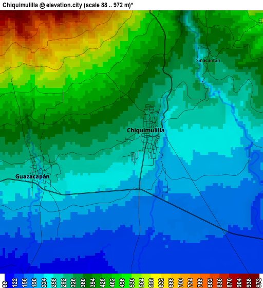
Below is the Elevation map of Chiquimulilla, which displays elevation range with different colors. Scale of the first map is from 88 to 972 m (289 to 3189 ft) with average elevation of 318 meters (=1043 ft) [note 1]
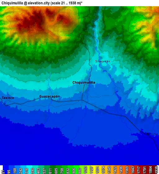
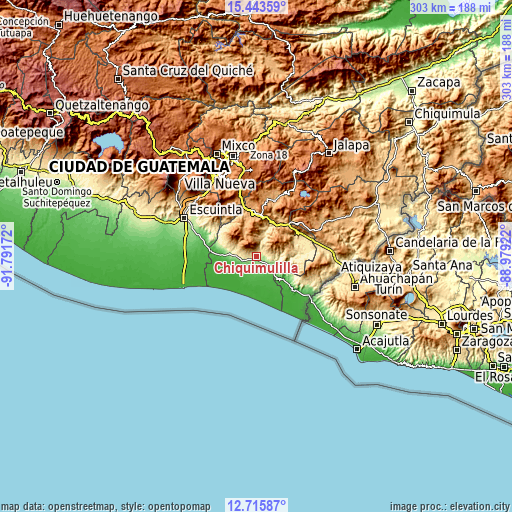
These maps also provides idea of topography and contour of this city, they are displayed at different zoom levels. More info about maps, scale and edge coordinates you can find below images.
| \ | Map #1 | Map #2 | Topo.Map |
| Scale [m] | 88..972 m | 21..1938 m | × |
| Scale [ft] | 289..3189 ft | 69..6358 ft | × |
| Average | 318 m = 1043 ft | 452.5 m = 1485 ft | × |
| Width | 9.48 km = 5.9 mi | 18.96 km = 11.8 mi | 303.3 km = 188.5 mi |
| Height | 9.48 km = 5.9 mi | 18.96 km = 11.8 mi | 303.3 km = 188.5 mi |
| ↑Max Latitude | 14.12642° | 14.169033° | 15.44359° |
| Latitude at center | 14.0838° | 14.0838° | 14.0838° |
| ↓Min Latitude | 14.041172° | 13.998535° | 12.71587° |
| ← Min Longitude | -90.429415° | -90.473361° | -91.79172° |
| Longitude center | -90.38547° | -90.38547° | -90.38547° |
| →Max Longitude | -90.341525° | -90.297579° | -88.97922° |
Nearby cities:
Cities around Chiquimulilla sort by population:
• Barberena elevation 1186 m
25 km,  5°
5°
• Cuilapa 902 m
23.4 km,  23°
23°
• Oratorio 1034 m
27.7 km,  54°
54°
• Moyuta 1285 m
33.2 km,  98°
98°
• Guazacapán 265 m
3.5 km,  252°
252°
• Taxisco 180 m
9.1 km,  258°
258°
• Santa Cruz Naranjo 1174 m
33.9 km,  2°
2°
• Pueblo Nuevo Viñas 1231 m
18.6 km,  328°
328°
• Santa María Ixhuatán 1285 m
16.8 km, 45°
• Guanagazapa 345 m
31.9 km,  299°
299°
• San Juan Tecuaco 414 m
12.8 km,  90°
90°
• Pasaco 136 m
22.7 km,  121°
121°
Multilingual:
 En español:
Chiquimulilla elevación 285 m.
 En France:
Chiquimulilla élévation 285 m.
 Auf Deutsch:
Chiquimulilla höhe über dem Meeresspiegel ist 285 m.

Sources and notes:
- [note 1] Map square and city borders are not equal. Map elevation data is calculated only from area inside that square.
- [src 1] Elevation data from geonames database provided with same terms of usage.
- [src 2] The elevation map of Chiquimulilla is generated using elevation data from NASA's 3 arcsec (90m) resolution SRTM data.
- [src 3] Base (background) map © OpenStreetMap contributors tiles are generated by Geofabrik and OpenTopoMap.
Copyright & License:
This Chiquimulilla Elevation Map is licensed under CC BY-SA. You may reuse any part from this page, if you give a proper credit by linking to this URL:
 More info on terms of use page.