Moyuta elevation
Moyuta (Jutiapa), Guatemala elevation is 1285 meters and Moyuta elevation in feet is 4216 ft above sea level [src 1]. Moyuta is a seat of a second-order administrative division (feature code) with elevation that is 18 meters (59 ft) bigger than average city elevation in Guatemala.
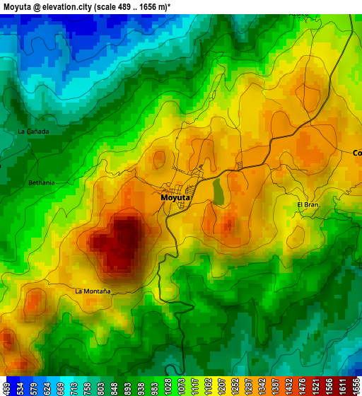
Below is the Elevation map of Moyuta, which displays elevation range with different colors. Scale of the first map is from 489 to 1656 m (1604 to 5433 ft) with average elevation of 1043.5 meters (=3424 ft) [note 1]
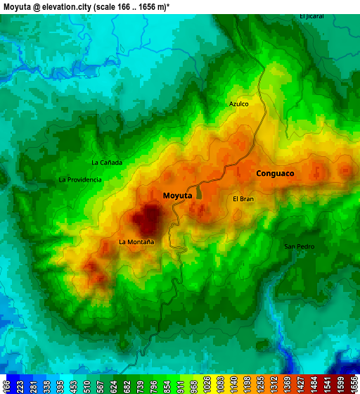
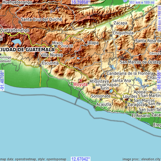
These maps also provides idea of topography and contour of this city, they are displayed at different zoom levels. More info about maps, scale and edge coordinates you can find below images.
| \ | Map #1 | Map #2 | Topo.Map |
| Scale [m] | 489..1656 m | 166..1656 m | × |
| Scale [ft] | 1604..5433 ft | 545..5433 ft | × |
| Average | 1043.5 m = 3424 ft | 745.8 m = 2447 ft | × |
| Width | 9.48 km = 5.9 mi | 18.96 km = 11.8 mi | 303.4 km = 188.5 mi |
| Height | 9.48 km = 5.9 mi | 18.96 km = 11.8 mi | 303.4 km = 188.5 mi |
| ↑Max Latitude | 14.081239° | 14.12386° | 15.39868° |
| Latitude at center | 14.03861° | 14.03861° | 14.03861° |
| ↓Min Latitude | 13.995973° | 13.953329° | 12.67042° |
| ← Min Longitude | -90.124775° | -90.168721° | -91.48708° |
| Longitude center | -90.08083° | -90.08083° | -90.08083° |
| →Max Longitude | -90.036885° | -89.992939° | -88.67458° |
Nearby cities:
Cities around Moyuta sort by population:
• Chiquimulilla elevation 285 m
33.2 km,  278°
278°
• Jalpatagua 587 m
13.9 km,  34°
34°
• Oratorio 1034 m
23.4 km,  334°
334°
• San José Acatempa 1346 m
25.7 km,  348°
348°
• Santa María Ixhuatán 1285 m
26.8 km,  308°
308°
• Conguaco 1283 m
5.4 km,  83°
83°
• Quesada 974 m
26.1 km,  9°
9°
• San Juan Tecuaco 414 m
20.6 km, 284°
• El Adelanto 1188 m
30.3 km,  61°
61°
• Pasaco 136 m
15.2 km,  243°
243°
• Zapotitlán 867 m
28.7 km,  68°
68°
• Comapa 1276 m
19.7 km, 63°
Multilingual:
 En español:
Moyuta elevación 1285 m.
 En France:
Moyuta élévation 1285 m.


Sources and notes:
- [note 1] Map square and city borders are not equal. Map elevation data is calculated only from area inside that square.
- [src 1] Elevation data from geonames database provided with same terms of usage.
- [src 2] The elevation map of Moyuta is generated using elevation data from NASA's 3 arcsec (90m) resolution SRTM data.
- [src 3] Base (background) map © OpenStreetMap contributors tiles are generated by Geofabrik and OpenTopoMap.
Copyright & License:
This Moyuta Elevation Map is licensed under CC BY-SA. You may reuse any part from this page, if you give a proper credit by linking to this URL:
 More info on terms of use page.