Lívingston elevation
Lívingston (Izabal, Municipio de Lívingston), Guatemala elevation is 16 meters and Lívingston elevation in feet is 52 ft above sea level [src 1]. Lívingston is a seat of a second-order administrative division (feature code) with elevation that is 1251 meters (4104 ft) smaller than average city elevation in Guatemala.
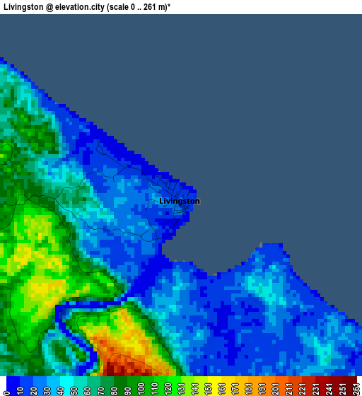
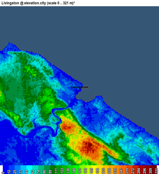
Below is the Elevation map of Lívingston, which displays elevation range with different colors. Scale of the first map is from 0 to 261 m (0 to 856 ft) with average elevation of 58.2 meters (=191 ft) [note 1]
These maps also provides idea of topography and contour of this city, they are displayed at different zoom levels. More info about maps, scale and edge coordinates you can find below images.
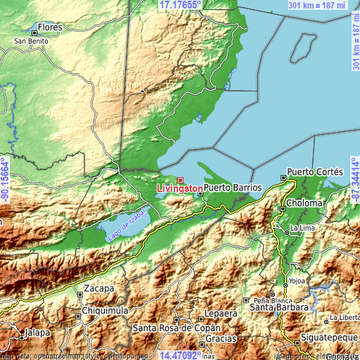
| \ | Map #1 | Map #2 | Topo.Map |
| Scale [m] | 0..261 m | 0..321 m | × |
| Scale [ft] | 0..856 ft | 0..1053 ft | × |
| Average | 58.2 m = 191 ft | 72.7 m = 239 ft | × |
| Width | 9.4 km = 5.8 mi | 18.8 km = 11.7 mi | 300.8 km = 186.9 mi |
| Height | 9.4 km = 5.8 mi | 18.8 km = 11.7 mi | 300.9 km = 187 mi |
| ↑Max Latitude | 15.870535° | 15.9128° | 17.17655° |
| Latitude at center | 15.82826° | 15.82826° | 15.82826° |
| ↓Min Latitude | 15.785977° | 15.743684° | 14.47092° |
| ← Min Longitude | -88.794335° | -88.838281° | -90.15664° |
| Longitude center | -88.75039° | -88.75039° | -88.75039° |
| →Max Longitude | -88.706445° | -88.662499° | -87.34414° |
Nearby cities:
Cities around Lívingston sort by population:
• Puerto Barrios elevation 7 m
20.1 km,  123°
123°
• Panzós 175 m
109.1 km,  244°
244°
• Gualán 123 m
102.2 km,  219°
219°
• Morales 37 m
39 km,  190°
190°
• Poptún 533 m
90.5 km,  308°
308°
• El Estor 92 m
72.1 km, 242°
• Dolores 446 m
104.1 km,  316°
316°
• Chahal Guatemala 178 m
91.5 km,  267°
267°
• San Luis 381 m
84.5 km,  299°
299°
• Cahabón 522 m
117.8 km,  255°
255°
• La Unión 994 m
111.9 km,  211°
211°
• Los Amates 99 m
73.6 km, 210°
Multilingual:
 En español:
Lívingston elevación 16 m.
 En France:
Lívingston élévation 16 m.
 Auf Deutsch:
Lívingston höhe über dem Meeresspiegel ist 16 m.

Sources and notes:
- [note 1] Map square and city borders are not equal. Map elevation data is calculated only from area inside that square.
- [src 1] Elevation data from geonames database provided with same terms of usage.
- [src 2] The elevation map of Lívingston is generated using elevation data from NASA's 3 arcsec (90m) resolution SRTM data.
- [src 3] Base (background) map © OpenStreetMap contributors tiles are generated by Geofabrik and OpenTopoMap.
Copyright & License:
This Lívingston Elevation Map is licensed under CC BY-SA. You may reuse any part from this page, if you give a proper credit by linking to this URL:
 More info on terms of use page.