Chahal Guatemala elevation
Chahal Guatemala (Alta Verapaz), Guatemala elevation is 178 meters and Chahal Guatemala elevation in feet is 584 ft above sea level [src 1]. Chahal Guatemala is a populated place (feature code) with elevation that is 1089 meters (3573 ft) smaller than average city elevation in Guatemala.
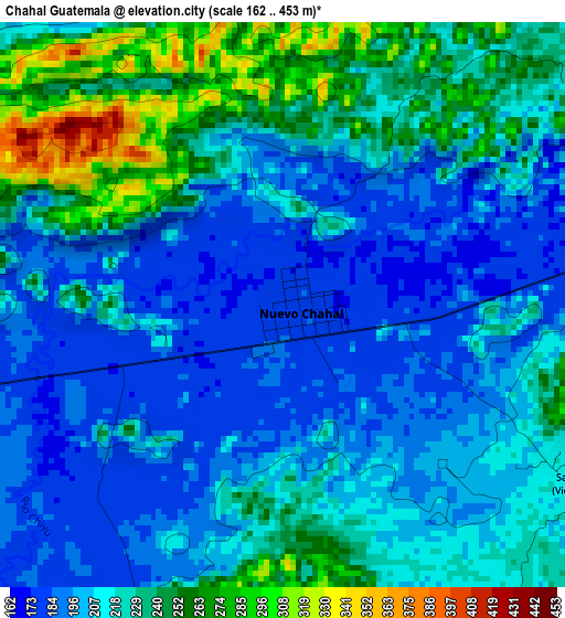
Below is the Elevation map of Chahal Guatemala, which displays elevation range with different colors. Scale of the first map is from 162 to 453 m (531 to 1486 ft) with average elevation of 216.7 meters (=711 ft) [note 1]
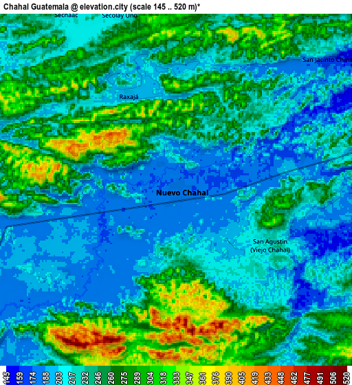
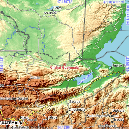
These maps also provides idea of topography and contour of this city, they are displayed at different zoom levels. More info about maps, scale and edge coordinates you can find below images.
| \ | Map #1 | Map #2 | Topo.Map |
| Scale [m] | 162..453 m | 145..520 m | × |
| Scale [ft] | 531..1486 ft | 476..1706 ft | × |
| Average | 216.7 m = 711 ft | 241.7 m = 793 ft | × |
| Width | 9.4 km = 5.8 mi | 18.81 km = 11.7 mi | 300.9 km = 187 mi |
| Height | 9.4 km = 5.8 mi | 18.81 km = 11.7 mi | 300.9 km = 187 mi |
| ↑Max Latitude | 15.833502° | 15.875776° | 17.13976° |
| Latitude at center | 15.79122° | 15.79122° | 15.79122° |
| ↓Min Latitude | 15.748929° | 15.706629° | 14.43364° |
| ← Min Longitude | -89.649125° | -89.693071° | -91.01143° |
| Longitude center | -89.60518° | -89.60518° | -89.60518° |
| →Max Longitude | -89.561235° | -89.517289° | -88.19893° |
Nearby cities:
Cities around Chahal Guatemala sort by population:
• Panzós elevation 175 m
44 km,  188°
188°
• Poptún 533 m
63.3 km,  18°
18°
• Chisec 219 m
72.6 km,  272°
272°
• El Estor 92 m
39.6 km,  136°
136°
• San Luis 381 m
48.6 km, 21°
• Senahú 1323 m
49.9 km,  209°
209°
• Tucurú 570 m
73.7 km,  222°
222°
• Cahabón 522 m
33.7 km, 222°
• Lanquín 556 m
46.1 km,  237°
237°
• La Tinta 100 m
60.6 km, 209°
• Raxruhá 146 m
46.6 km,  280°
280°
• Fray Bartolomé de Las Casas 180 m
30.5 km, 275°
Multilingual:
 En español:
Chahal Guatemala elevación 178 m.
 En France:
Chahal Guatemala élévation 178 m.
 Auf Deutsch:
Chahal Guatemala höhe über dem Meeresspiegel ist 178 m.

Sources and notes:
- [note 1] Map square and city borders are not equal. Map elevation data is calculated only from area inside that square.
- [src 1] Elevation data from geonames database provided with same terms of usage.
- [src 2] The elevation map of Chahal Guatemala is generated using elevation data from NASA's 3 arcsec (90m) resolution SRTM data.
- [src 3] Base (background) map © OpenStreetMap contributors tiles are generated by Geofabrik and OpenTopoMap.
Copyright & License:
This Chahal Guatemala Elevation Map is licensed under CC BY-SA. You may reuse any part from this page, if you give a proper credit by linking to this URL:
 More info on terms of use page.