Nuevo Progreso elevation
Nuevo Progreso (San Marcos), Guatemala elevation is 606 meters and Nuevo Progreso elevation in feet is 1988 ft above sea level [src 1]. Nuevo Progreso is a seat of a second-order administrative division (feature code) with elevation that is 661 meters (2169 ft) smaller than average city elevation in Guatemala.
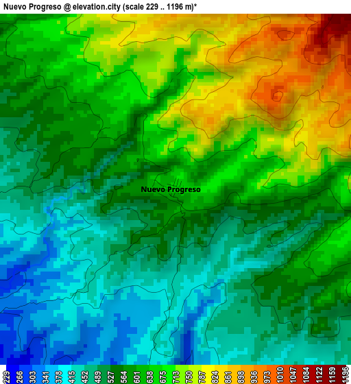
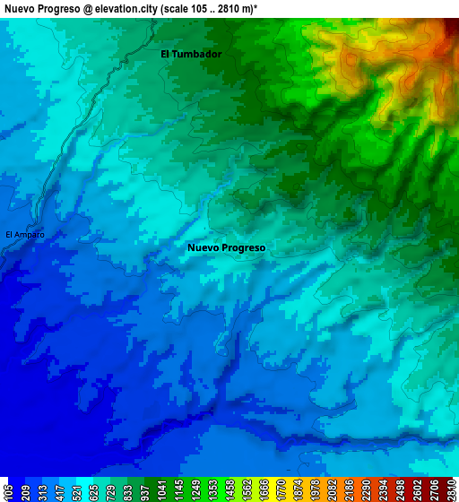
Below is the Elevation map of Nuevo Progreso, which displays elevation range with different colors. Scale of the first map is from 229 to 1196 m (751 to 3924 ft) with average elevation of 589 meters (=1932 ft) [note 1]
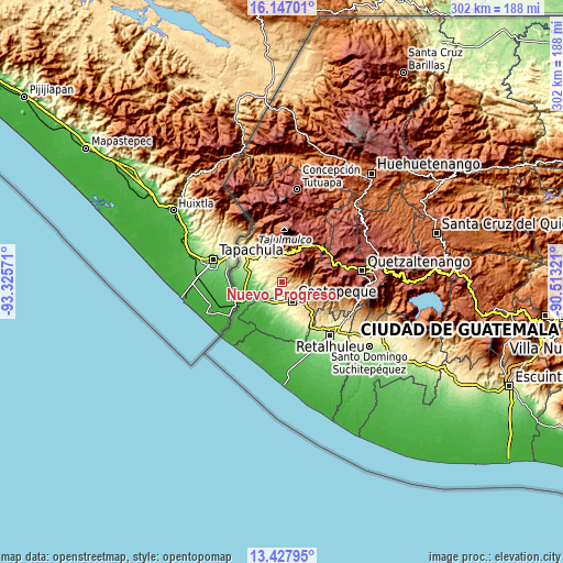
These maps also provides idea of topography and contour of this city, they are displayed at different zoom levels. More info about maps, scale and edge coordinates you can find below images.
| \ | Map #1 | Map #2 | Topo.Map |
| Scale [m] | 229..1196 m | 105..2810 m | × |
| Scale [ft] | 751..3924 ft | 344..9219 ft | × |
| Average | 589 m = 1932 ft | 656.7 m = 2155 ft | × |
| Width | 9.45 km = 5.9 mi | 18.9 km = 11.7 mi | 302.3 km = 187.8 mi |
| Height | 9.45 km = 5.9 mi | 18.9 km = 11.7 mi | 302.4 km = 187.9 mi |
| ↑Max Latitude | 14.834225° | 14.876701° | 16.14701° |
| Latitude at center | 14.79174° | 14.79174° | 14.79174° |
| ↓Min Latitude | 14.749247° | 14.706745° | 13.42795° |
| ← Min Longitude | -91.963405° | -92.007351° | -93.32571° |
| Longitude center | -91.91946° | -91.91946° | -91.91946° |
| →Max Longitude | -91.875515° | -91.831569° | -90.51321° |
Nearby cities:
Cities around Nuevo Progreso sort by population:
• Coatepeque elevation 492 m
11.4 km,  148°
148°
• San Pablo 617 m
18.1 km,  329°
329°
• El Quetzal 784 m
11.3 km,  103°
103°
• Flores Costa Cuca 316 m
18.7 km,  161°
161°
• San Cristóbal Cucho 2350 m
19.5 km,  49°
49°
• Pajapita 99 m
14.7 km,  237°
237°
• El Tumbador 867 m
8.2 km,  348°
348°
• La Reforma 1127 m
10.5 km,  84°
84°
• San Rafael Pie de la Cuesta 1044 m
15.4 km,  2°
2°
• Catarina 227 m
18.3 km,  292°
292°
• El Rodeo 693 m
15 km,  335°
335°
• Esquipulas Palo Gordo 2475 m
19.5 km,  31°
31°
Multilingual:
 En español:
Nuevo Progreso elevación 606 m.
 En France:
Nuevo Progreso élévation 606 m.
 Auf Deutsch:
Nuevo Progreso höhe über dem Meeresspiegel ist 606 m.

Sources and notes:
- [note 1] Map square and city borders are not equal. Map elevation data is calculated only from area inside that square.
- [src 1] Elevation data from geonames database provided with same terms of usage.
- [src 2] The elevation map of Nuevo Progreso is generated using elevation data from NASA's 3 arcsec (90m) resolution SRTM data.
- [src 3] Base (background) map © OpenStreetMap contributors tiles are generated by Geofabrik and OpenTopoMap.
Copyright & License:
This Nuevo Progreso Elevation Map is licensed under CC BY-SA. You may reuse any part from this page, if you give a proper credit by linking to this URL:
 More info on terms of use page.