Ocós elevation
Ocós (San Marcos), Guatemala elevation is 9 meters and Ocós elevation in feet is 30 ft above sea level [src 1]. Ocós is a seat of a second-order administrative division (feature code) with elevation that is 1258 meters (4127 ft) smaller than average city elevation in Guatemala.
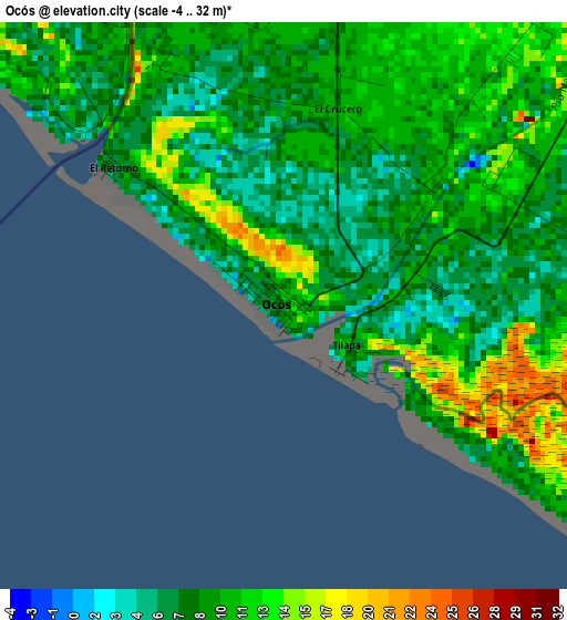
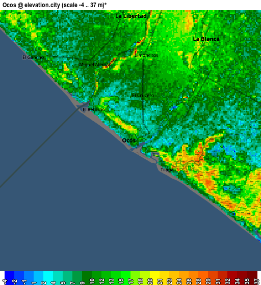
Below is the Elevation map of Ocós, which displays elevation range with different colors. Scale of the first map is from -4 to 32 m (-13 to 105 ft) with average elevation of 9.7 meters (=32 ft) [note 1]
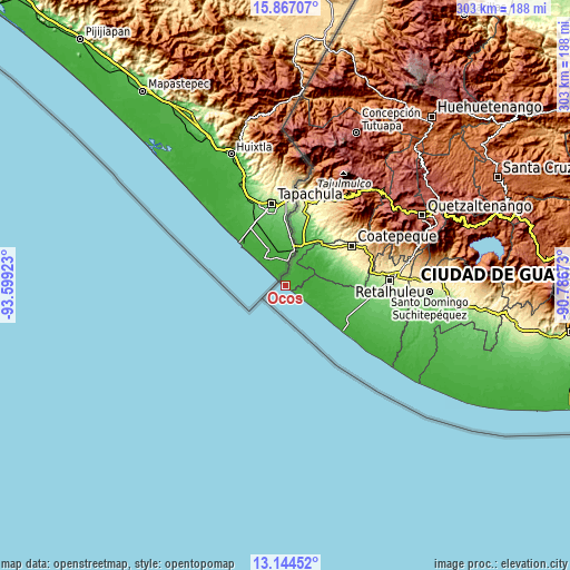
These maps also provides idea of topography and contour of this city, they are displayed at different zoom levels. More info about maps, scale and edge coordinates you can find below images.
| \ | Map #1 | Map #2 | Topo.Map |
| Scale [m] | -4..32 m | -4..37 m | × |
| Scale [ft] | -13..105 ft | -13..121 ft | × |
| Average | 9.7 m = 32 ft | 11.5 m = 38 ft | × |
| Width | 9.46 km = 5.9 mi | 18.92 km = 11.8 mi | 302.7 km = 188.1 mi |
| Height | 9.46 km = 5.9 mi | 18.92 km = 11.8 mi | 302.7 km = 188.1 mi |
| ↑Max Latitude | 14.55252° | 14.595051° | 15.86707° |
| Latitude at center | 14.50998° | 14.50998° | 14.50998° |
| ↓Min Latitude | 14.467432° | 14.424876° | 13.14452° |
| ← Min Longitude | -92.236925° | -92.280871° | -93.59923° |
| Longitude center | -92.19298° | -92.19298° | -92.19298° |
| →Max Longitude | -92.149035° | -92.105089° | -90.78673° |
Nearby cities:
Cities around Ocós sort by population:
• Coatepeque elevation 492 m
41.4 km,  58°
58°
• Malacatán 387 m
46.9 km,  18°
18°
• El Quetzal 784 m
49.6 km,  54°
54°
• Flores Costa Cuca 316 m
38 km,  69°
69°
• Ciudad Tecún Umán 29 m
19.5 km, 16°
• Pajapita 99 m
29 km,  35°
35°
• Nuevo Progreso 606 m
43 km, 43°
• Champerico 1 m
38.7 km,  128°
128°
• El Tumbador 867 m
48.2 km, 35°
• Génova 352 m
40.5 km, 72°
• Catarina 227 m
40.2 km, 18°
• La Blanca 16 m
9.5 km, 35°
Multilingual:
 En español:
Ocós elevación 9 m.
 En France:
Ocós élévation 9 m.


Sources and notes:
- [note 1] Map square and city borders are not equal. Map elevation data is calculated only from area inside that square.
- [src 1] Elevation data from geonames database provided with same terms of usage.
- [src 2] The elevation map of Ocós is generated using elevation data from NASA's 3 arcsec (90m) resolution SRTM data.
- [src 3] Base (background) map © OpenStreetMap contributors tiles are generated by Geofabrik and OpenTopoMap.
Copyright & License:
This Ocós Elevation Map is licensed under CC BY-SA. You may reuse any part from this page, if you give a proper credit by linking to this URL:
 More info on terms of use page.