Patulul elevation
Patulul (Suchitepeque), Guatemala elevation is 342 meters and Patulul elevation in feet is 1122 ft above sea level [src 1]. Patulul is a seat of a second-order administrative division (feature code) with elevation that is 925 meters (3035 ft) smaller than average city elevation in Guatemala.
Below is the Elevation map of Patulul, which displays elevation range with different colors. Scale of the first map is from 205 to 775 m (673 to 2543 ft) with average elevation of 401 meters (=1316 ft) [note 1]
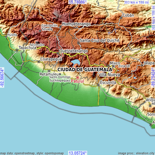
These maps also provides idea of topography and contour of this city, they are displayed at different zoom levels. More info about maps, scale and edge coordinates you can find below images.
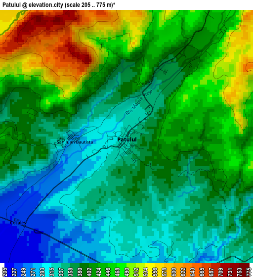
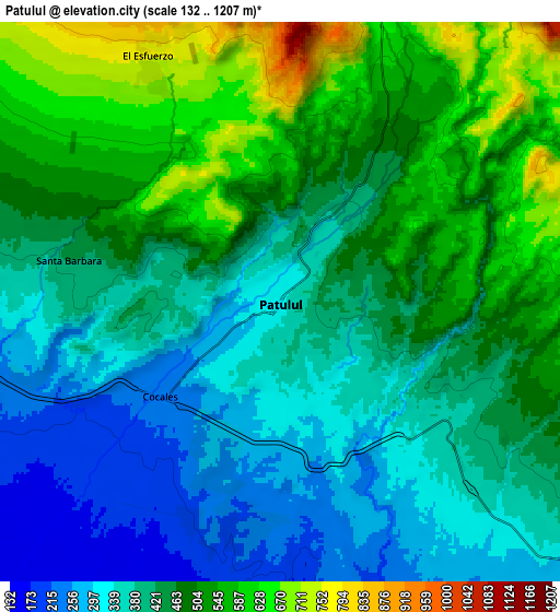
| \ | Map #1 | Map #2 | Topo.Map |
| Scale [m] | 205..775 m | 132..1207 m | × |
| Scale [ft] | 673..2543 ft | 433..3960 ft | × |
| Average | 401 m = 1316 ft | 440.1 m = 1444 ft | × |
| Width | 9.46 km = 5.9 mi | 18.93 km = 11.8 mi | 302.8 km = 188.2 mi |
| Height | 9.46 km = 5.9 mi | 18.93 km = 11.8 mi | 302.9 km = 188.2 mi |
| ↑Max Latitude | 14.465766° | 14.508314° | 15.78086° |
| Latitude at center | 14.42321° | 14.42321° | 14.42321° |
| ↓Min Latitude | 14.380646° | 14.338073° | 13.05724° |
| ← Min Longitude | -91.204435° | -91.248381° | -92.56674° |
| Longitude center | -91.16049° | -91.16049° | -91.16049° |
| →Max Longitude | -91.116545° | -91.072599° | -89.75424° |
Nearby cities:
Cities around Patulul sort by population:
• Santa Lucía Cotzumalguapa elevation 392 m
17.7 km,  123°
123°
• Santiago Atitlán 1603 m
25 km,  342°
342°
• Chicacao 505 m
22.3 km,  306°
306°
• Tiquisate 71 m
26.6 km,  234°
234°
• San Lucas Tolimán 1576 m
19.1 km,  4°
4°
• Santa Bárbara 405 m
7.3 km,  280°
280°
• Yepocapa 1404 m
23.9 km,  68°
68°
• Río Bravo 161 m
17.1 km,  261°
261°
• Pochuta 953 m
15.5 km,  29°
29°
• San Juan Bautista 291 m
2 km,  268°
268°
• San Miguel Panán 389 m
25.2 km,  297°
297°
• Siquinalá 353 m
24.8 km, 121°
Multilingual:
 En español:
Patulul elevación 342 m.
 En France:
Patulul élévation 342 m.


Sources and notes:
- [note 1] Map square and city borders are not equal. Map elevation data is calculated only from area inside that square.
- [src 1] Elevation data from geonames database provided with same terms of usage.
- [src 2] The elevation map of Patulul is generated using elevation data from NASA's 3 arcsec (90m) resolution SRTM data.
- [src 3] Base (background) map © OpenStreetMap contributors tiles are generated by Geofabrik and OpenTopoMap.
Copyright & License:
This Patulul Elevation Map is licensed under CC BY-SA. You may reuse any part from this page, if you give a proper credit by linking to this URL:
 More info on terms of use page.