Yepocapa elevation
Yepocapa (Chimaltenango), Guatemala elevation is 1404 meters and Yepocapa elevation in feet is 4606 ft above sea level [src 1]. Yepocapa is a seat of a second-order administrative division (feature code) with elevation that is 137 meters (449 ft) bigger than average city elevation in Guatemala.
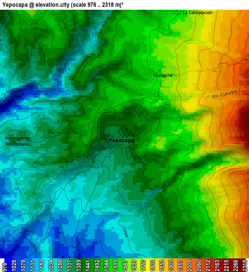
Below is the Elevation map of Yepocapa, which displays elevation range with different colors. Scale of the first map is from 976 to 2318 m (3202 to 7605 ft) with average elevation of 1478.4 meters (=4850 ft) [note 1]
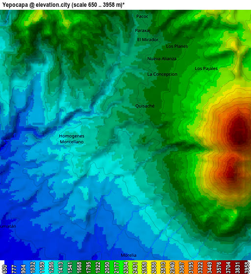
These maps also provides idea of topography and contour of this city, they are displayed at different zoom levels. More info about maps, scale and edge coordinates you can find below images.
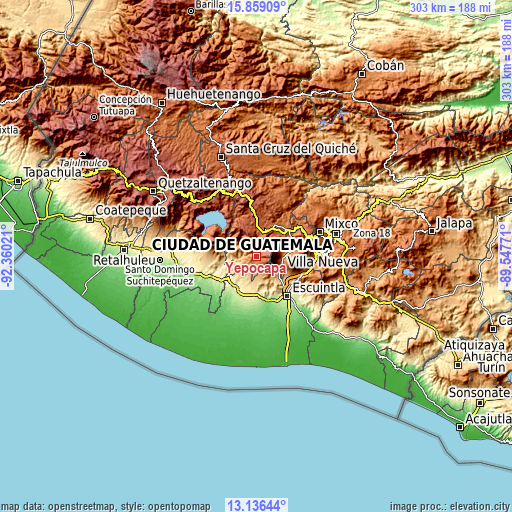
| \ | Map #1 | Map #2 | Topo.Map |
| Scale [m] | 976..2318 m | 650..3958 m | × |
| Scale [ft] | 3202..7605 ft | 2133..12986 ft | × |
| Average | 1478.4 m = 4850 ft | 1605.9 m = 5269 ft | × |
| Width | 9.46 km = 5.9 mi | 18.92 km = 11.8 mi | 302.7 km = 188.1 mi |
| Height | 9.46 km = 5.9 mi | 18.92 km = 11.8 mi | 302.8 km = 188.2 mi |
| ↑Max Latitude | 14.544491° | 14.587024° | 15.85909° |
| Latitude at center | 14.50195° | 14.50195° | 14.50195° |
| ↓Min Latitude | 14.459401° | 14.416843° | 13.13644° |
| ← Min Longitude | -90.997905° | -91.041851° | -92.36021° |
| Longitude center | -90.95396° | -90.95396° | -90.95396° |
| →Max Longitude | -90.910015° | -90.866069° | -89.54771° |
Nearby cities:
Cities around Yepocapa sort by population:
• Santa Lucía Cotzumalguapa elevation 392 m
20 km,  201°
201°
• San Andrés Itzapa 1858 m
17.9 km,  41°
41°
• Alotenango 1368 m
15.9 km,  98°
98°
• Patzicía 2129 m
14.8 km,  11°
11°
• Parramos 1740 m
20.1 km,  53°
53°
• Zaragoza 2083 m
17.8 km,  22°
22°
• San Miguel Dueñas 1459 m
16.8 km,  82°
82°
• Santa Cruz Balanyá 2036 m
20.7 km, 10°
• San Antonio Aguas Calientes 1503 m
19.3 km, 75°
• Acatenango 1486 m
5.9 km, 10°
• Pochuta 953 m
15.3 km,  288°
288°
• Santa Catarina Barahona 1556 m
18.9 km,  73°
73°
Multilingual:
 En español:
Yepocapa elevación 1404 m.
 En France:
Yepocapa élévation 1404 m.
 Auf Deutsch:
Yepocapa höhe über dem Meeresspiegel ist 1404 m.

Sources and notes:
- [note 1] Map square and city borders are not equal. Map elevation data is calculated only from area inside that square.
- [src 1] Elevation data from geonames database provided with same terms of usage.
- [src 2] The elevation map of Yepocapa is generated using elevation data from NASA's 3 arcsec (90m) resolution SRTM data.
- [src 3] Base (background) map © OpenStreetMap contributors tiles are generated by Geofabrik and OpenTopoMap.
Copyright & License:
This Yepocapa Elevation Map is licensed under CC BY-SA. You may reuse any part from this page, if you give a proper credit by linking to this URL:
 More info on terms of use page.