Samayac elevation
Samayac (Quetzaltenango), Guatemala elevation is 621 meters and Samayac elevation in feet is 2037 ft above sea level [src 1]. Samayac is a populated place (feature code) with elevation that is 646 meters (2119 ft) smaller than average city elevation in Guatemala.
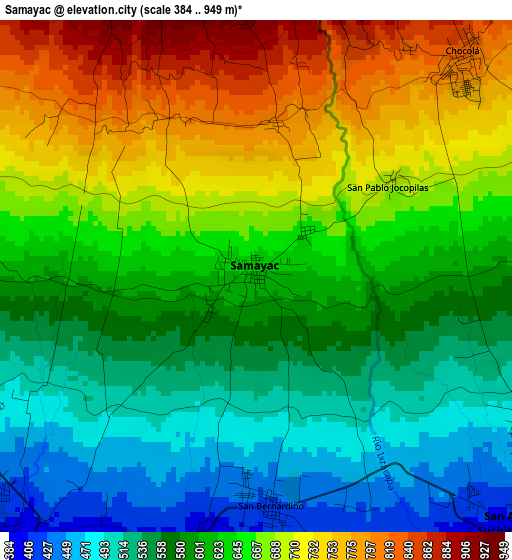
Below is the Elevation map of Samayac, which displays elevation range with different colors. Scale of the first map is from 384 to 949 m (1260 to 3114 ft) with average elevation of 625.5 meters (=2052 ft) [note 1]
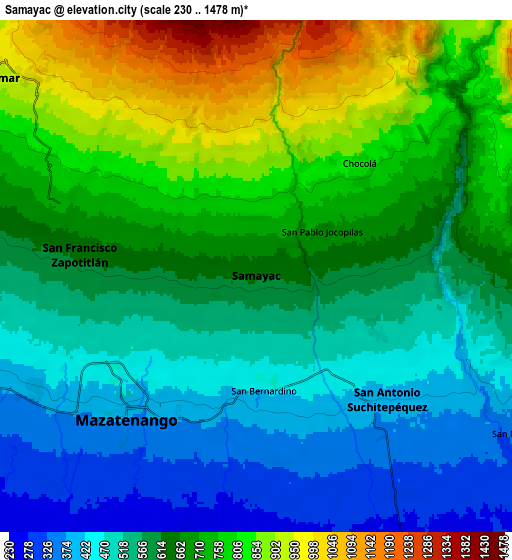
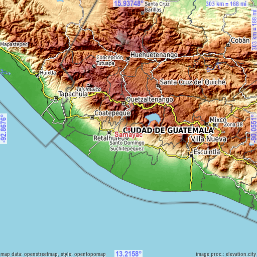
These maps also provides idea of topography and contour of this city, they are displayed at different zoom levels. More info about maps, scale and edge coordinates you can find below images.
| \ | Map #1 | Map #2 | Topo.Map |
| Scale [m] | 384..949 m | 230..1478 m | × |
| Scale [ft] | 1260..3114 ft | 755..4849 ft | × |
| Average | 625.5 m = 2052 ft | 635.6 m = 2085 ft | × |
| Width | 9.46 km = 5.9 mi | 18.92 km = 11.8 mi | 302.6 km = 188 mi |
| Height | 9.46 km = 5.9 mi | 18.92 km = 11.8 mi | 302.6 km = 188 mi |
| ↑Max Latitude | 14.623366° | 14.665884° | 15.93748° |
| Latitude at center | 14.58084° | 14.58084° | 14.58084° |
| ↓Min Latitude | 14.538306° | 14.495764° | 13.2158° |
| ← Min Longitude | -91.505295° | -91.549241° | -92.8676° |
| Longitude center | -91.46135° | -91.46135° | -91.46135° |
| →Max Longitude | -91.417405° | -91.373459° | -90.0551° |
Nearby cities:
Cities around Samayac sort by population:
• Mazatenango elevation 373 m
6.9 km,  221°
221°
• San Pablo Jocopilas 663 m
1.4 km,  48°
48°
• San Francisco Zapotitlán 600 m
6.5 km,  278°
278°
• San Antonio Suchitepéquez 389 m
6.8 km,  132°
132°
• Santo Tomás La Unión 870 m
7.9 km,  43°
43°
• Santo Domingo Suchitepéquez 230 m
11.6 km,  191°
191°
• San Bernardino 439 m
4.3 km,  175°
175°
• San Gabriel 285 m
9.2 km,  212°
212°
• Pueblo Nuevo 974 m
11.2 km,  311°
311°
• Zunilito 783 m
6.3 km,  304°
304°
• San Lorenzo 224 m
11.9 km, 207°
• San Miguel Panán 389 m
11.7 km,  119°
119°
Multilingual:
 En español:
Samayac elevación 621 m.
 En France:
Samayac élévation 621 m.


Sources and notes:
- [note 1] Map square and city borders are not equal. Map elevation data is calculated only from area inside that square.
- [src 1] Elevation data from geonames database provided with same terms of usage.
- [src 2] The elevation map of Samayac is generated using elevation data from NASA's 3 arcsec (90m) resolution SRTM data.
- [src 3] Base (background) map © OpenStreetMap contributors tiles are generated by Geofabrik and OpenTopoMap.
Copyright & License:
This Samayac Elevation Map is licensed under CC BY-SA. You may reuse any part from this page, if you give a proper credit by linking to this URL:
 More info on terms of use page.