Soloma elevation
Soloma (Huehuetenango), Guatemala elevation is 2270 meters and Soloma elevation in feet is 7448 ft above sea level [src 1]. Soloma is a seat of a second-order administrative division (feature code) with elevation that is 1003 meters (3291 ft) bigger than average city elevation in Guatemala.
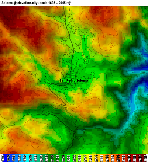
Below is the Elevation map of Soloma, which displays elevation range with different colors. Scale of the first map is from 1698 to 2945 m (5571 to 9662 ft) with average elevation of 2391.7 meters (=7847 ft) [note 1]
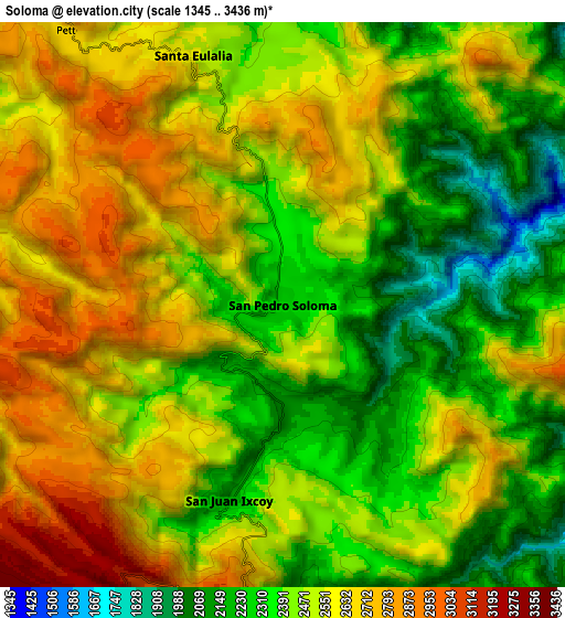
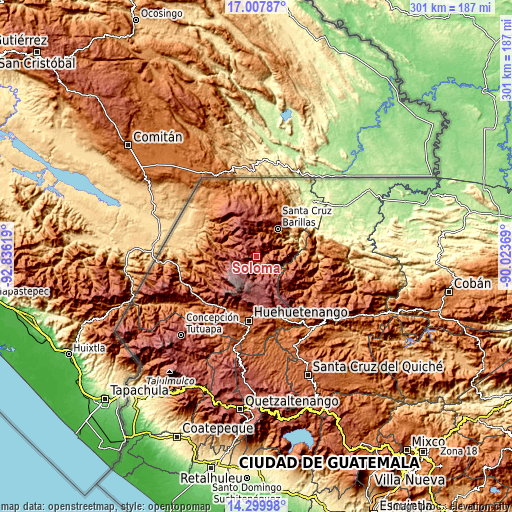
These maps also provides idea of topography and contour of this city, they are displayed at different zoom levels. More info about maps, scale and edge coordinates you can find below images.
| \ | Map #1 | Map #2 | Topo.Map |
| Scale [m] | 1698..2945 m | 1345..3436 m | × |
| Scale [ft] | 5571..9662 ft | 4413..11273 ft | × |
| Average | 2391.7 m = 7847 ft | 2491.1 m = 8173 ft | × |
| Width | 9.41 km = 5.8 mi | 18.82 km = 11.7 mi | 301.1 km = 187.1 mi |
| Height | 9.41 km = 5.8 mi | 18.82 km = 11.7 mi | 301.1 km = 187.1 mi |
| ↑Max Latitude | 15.70072° | 15.743021° | 17.00787° |
| Latitude at center | 15.65841° | 15.65841° | 15.65841° |
| ↓Min Latitude | 15.616091° | 15.573764° | 14.29998° |
| ← Min Longitude | -91.473885° | -91.517831° | -92.83619° |
| Longitude center | -91.42994° | -91.42994° | -91.42994° |
| →Max Longitude | -91.385995° | -91.342049° | -90.02369° |
Nearby cities:
Cities around Soloma sort by population:
• Jacaltenango elevation 1459 m
30.2 km,  271°
271°
• Barillas 1462 m
20.2 km,  37°
37°
• San Mateo Ixtatán 2599 m
20 km,  345°
345°
• Concepción Huista 2238 m
25.5 km,  261°
261°
• Chiantla 1995 m
33.9 km,  185°
185°
• Santa Eulalia 2593 m
8.6 km,  339°
339°
• Todos Santos Cuchumatán 2500 m
25 km,  228°
228°
• San Miguel Acatán 1792 m
18.7 km,  285°
285°
• San Juan Ixcoy 2185 m
6.7 km,  195°
195°
• San Juan Atitán 2524 m
32.9 km,  219°
219°
• San Rafael La Independencia 2518 m
12.3 km, 292°
• San Sebastián Coatán 2357 m
16.6 km,  301°
301°
Multilingual:
 En español:
Soloma elevación 2270 m.
 En France:
Soloma élévation 2270 m.


Sources and notes:
- [note 1] Map square and city borders are not equal. Map elevation data is calculated only from area inside that square.
- [src 1] Elevation data from geonames database provided with same terms of usage.
- [src 2] The elevation map of Soloma is generated using elevation data from NASA's 3 arcsec (90m) resolution SRTM data.
- [src 3] Base (background) map © OpenStreetMap contributors tiles are generated by Geofabrik and OpenTopoMap.
Copyright & License:
This Soloma Elevation Map is licensed under CC BY-SA. You may reuse any part from this page, if you give a proper credit by linking to this URL:
 More info on terms of use page.