Tacaná elevation
Tacaná (San Marcos), Guatemala elevation is 2427 meters and Tacaná elevation in feet is 7963 ft above sea level [src 1]. Tacaná is a seat of a second-order administrative division (feature code) with elevation that is 1160 meters (3806 ft) bigger than average city elevation in Guatemala.
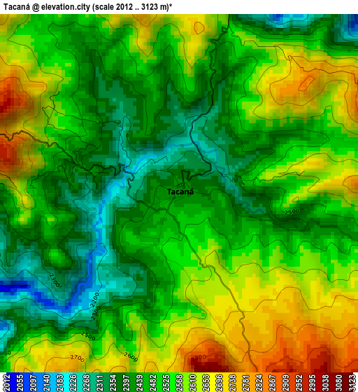
Below is the Elevation map of Tacaná, which displays elevation range with different colors. Scale of the first map is from 2012 to 3123 m (6601 to 10246 ft) with average elevation of 2517.2 meters (=8259 ft) [note 1]
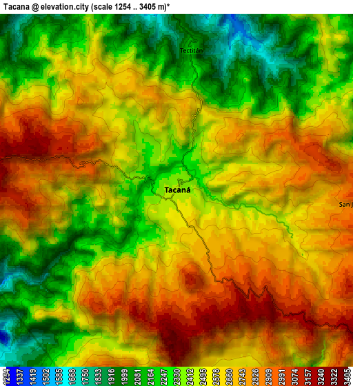
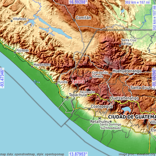
These maps also provides idea of topography and contour of this city, they are displayed at different zoom levels. More info about maps, scale and edge coordinates you can find below images.
| \ | Map #1 | Map #2 | Topo.Map |
| Scale [m] | 2012..3123 m | 1254..3405 m | × |
| Scale [ft] | 6601..10246 ft | 4114..11171 ft | × |
| Average | 2517.2 m = 8259 ft | 2525.4 m = 8285 ft | × |
| Width | 9.43 km = 5.9 mi | 18.86 km = 11.7 mi | 301.7 km = 187.5 mi |
| Height | 9.43 km = 5.9 mi | 18.86 km = 11.7 mi | 301.7 km = 187.5 mi |
| ↑Max Latitude | 15.282976° | 15.325362° | 16.59288° |
| Latitude at center | 15.24058° | 15.24058° | 15.24058° |
| ↓Min Latitude | 15.198176° | 15.155763° | 13.87953° |
| ← Min Longitude | -92.111155° | -92.155101° | -93.47346° |
| Longitude center | -92.06721° | -92.06721° | -92.06721° |
| →Max Longitude | -92.023265° | -91.979319° | -90.66096° |
Nearby cities:
Cities around Tacaná sort by population:
• Malacatán elevation 387 m
36.6 km,  178°
178°
• San Pablo 617 m
34.9 km,  168°
168°
• Tajumulco 2066 m
23.4 km,  138°
138°
• San Miguel Ixtahuacán 2057 m
34.4 km,  84°
84°
• Tejutla 2481 m
30.9 km,  115°
115°
• Ixchiguán 3214 m
16.8 km, 120°
• Cuilco 1148 m
22.6 km,  34°
34°
• Sibinal 2532 m
10.3 km, 169°
• San José Ojetenán 3254 m
11.1 km,  103°
103°
• Concepción Tutuapa 2922 m
23.9 km,  90°
90°
• Tectitán 2210 m
7.3 km,  5°
5°
• San José Ojetenam 3056 m
10.1 km, 93°
Multilingual:
 En español:
Tacaná elevación 2427 m.
 En France:
Tacaná élévation 2427 m.


Sources and notes:
- [note 1] Map square and city borders are not equal. Map elevation data is calculated only from area inside that square.
- [src 1] Elevation data from geonames database provided with same terms of usage.
- [src 2] The elevation map of Tacaná is generated using elevation data from NASA's 3 arcsec (90m) resolution SRTM data.
- [src 3] Base (background) map © OpenStreetMap contributors tiles are generated by Geofabrik and OpenTopoMap.
Copyright & License:
This Tacaná Elevation Map is licensed under CC BY-SA. You may reuse any part from this page, if you give a proper credit by linking to this URL:
 More info on terms of use page.