Polýkastro elevation
Polýkastro (Central Macedonia, Nomós Kilkís), Greece elevation is 36 meters and Polýkastro elevation in feet is 118 ft above sea level [src 1]. Polýkastro is a seat of a third-order administrative division (feature code) with elevation that is 115 meters (377 ft) smaller than average city elevation in Greece.
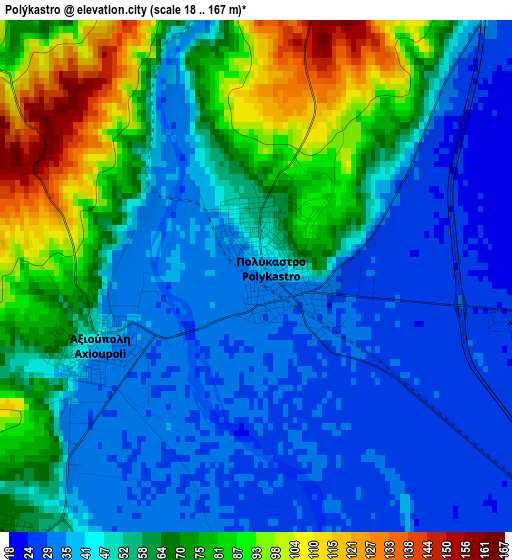
Below is the Elevation map of Polýkastro, which displays elevation range with different colors. Scale of the first map is from 18 to 167 m (59 to 548 ft) with average elevation of 55.3 meters (=181 ft) [note 1]
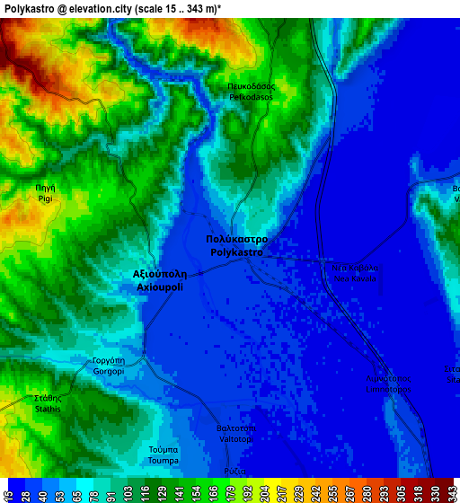
These maps also provides idea of topography and contour of this city, they are displayed at different zoom levels. More info about maps, scale and edge coordinates you can find below images.
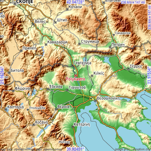
| \ | Map #1 | Map #2 | Topo.Map |
| Scale [m] | 18..167 m | 15..343 m | × |
| Scale [ft] | 59..548 ft | 49..1125 ft | × |
| Average | 55.3 m = 181 ft | 84.2 m = 276 ft | × |
| Width | 7.38 km = 4.6 mi | 14.75 km = 9.2 mi | 236 km = 146.6 mi |
| Height | 7.38 km = 4.6 mi | 14.75 km = 9.2 mi | 236 km = 146.6 mi |
| ↑Max Latitude | 41.0276° | 41.060744° | 42.04728° |
| Latitude at center | 40.99444° | 40.99444° | 40.99444° |
| ↓Min Latitude | 40.961263° | 40.928069° | 39.92451° |
| ← Min Longitude | 22.525145° | 22.481199° | 21.16284° |
| Longitude center | 22.56909° | 22.56909° | 22.56909° |
| →Max Longitude | 22.613035° | 22.656981° | 23.97534° |
Nearby cities:
Cities around Polýkastro sort by population:
• Kilkís elevation 277 m
25.6 km,  90°
90°
• Koufália 47 m
24.1 km,  179°
179°
• Gouménissa 234 m
11.4 km,  241°
241°
• Axioúpoli 41 m
2.5 km,  247°
247°
• Pélla 62 m
26.1 km,  187°
187°
• Evropós 84 m
10.9 km, 187°
• Áthyra 28 m
18.8 km,  173°
173°
• Ágios Pétros 26 m
14.2 km, 175°
• Próchoma 87 m
23.3 km,  159°
159°
• Néo Agionéri 137 m
23.7 km,  150°
150°
• Ampeleíes 148 m
23.5 km,  220°
220°
• Pentaplátano 135 m
23.2 km,  212°
212°
Multilingual:
 En español:
Polýkastro elevación 36 m.
 En France:
Polýkastro élévation 36 m.
 Auf Deutsch:
Polýkastro höhe über dem Meeresspiegel ist 36 m.

Sources and notes:
- [note 1] Map square and city borders are not equal. Map elevation data is calculated only from area inside that square.
- [src 1] Elevation data from geonames database provided with same terms of usage.
- [src 2] The elevation map of Polýkastro is generated using elevation data from NASA's 3 arcsec (90m) resolution SRTM data.
- [src 3] Base (background) map © OpenStreetMap contributors tiles are generated by Geofabrik and OpenTopoMap.
Copyright & License:
This Polýkastro Elevation Map is licensed under CC BY-SA. You may reuse any part from this page, if you give a proper credit by linking to this URL:
 More info on terms of use page.