Kilkís elevation
Kilkís (Central Macedonia, Nomós Kilkís), Greece elevation is 277 meters and Kilkís elevation in feet is 909 ft above sea level [src 1]. Kilkís is a seat of a second-order administrative division (feature code) with elevation that is 126 meters (413 ft) bigger than average city elevation in Greece.
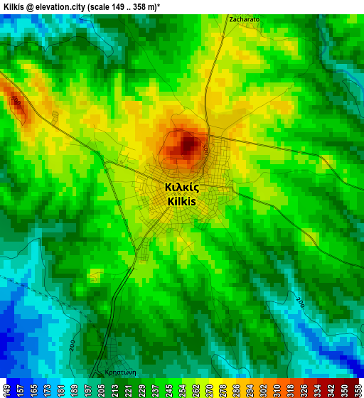
Below is the Elevation map of Kilkís, which displays elevation range with different colors. Scale of the first map is from 149 to 358 m (489 to 1175 ft) with average elevation of 235.9 meters (=774 ft) [note 1]
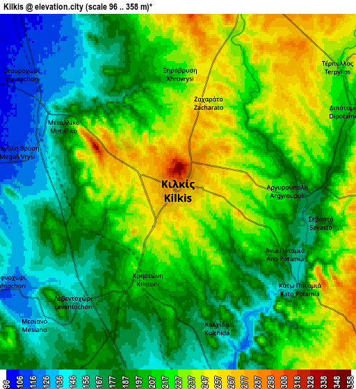
These maps also provides idea of topography and contour of this city, they are displayed at different zoom levels. More info about maps, scale and edge coordinates you can find below images.
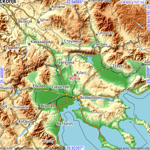
| \ | Map #1 | Map #2 | Topo.Map |
| Scale [m] | 149..358 m | 96..358 m | × |
| Scale [ft] | 489..1175 ft | 315..1175 ft | × |
| Average | 235.9 m = 774 ft | 202.1 m = 663 ft | × |
| Width | 7.38 km = 4.6 mi | 14.75 km = 9.2 mi | 236 km = 146.6 mi |
| Height | 7.38 km = 4.6 mi | 14.75 km = 9.2 mi | 236 km = 146.6 mi |
| ↑Max Latitude | 41.026181° | 41.059326° | 42.04588° |
| Latitude at center | 40.99302° | 40.99302° | 40.99302° |
| ↓Min Latitude | 40.959842° | 40.926648° | 39.92307° |
| ← Min Longitude | 22.830385° | 22.786439° | 21.46808° |
| Longitude center | 22.87433° | 22.87433° | 22.87433° |
| →Max Longitude | 22.918275° | 22.962221° | 24.28058° |
Nearby cities:
Cities around Kilkís sort by population:
• Polýkastro elevation 36 m
25.6 km,  270°
270°
• Axioúpoli 41 m
27.9 km, 268°
• Ássiros 191 m
23.1 km,  145°
145°
• Pentálofos 120 m
27.9 km,  183°
183°
• Drymós 189 m
24.6 km,  163°
163°
• Melissochóri 221 m
25.4 km,  169°
169°
• Néa Sánta 122 m
17.4 km, 166°
• Xilópolis 563 m
26.6 km,  105°
105°
• Próchoma 87 m
27.8 km,  218°
218°
• Krithiá 209 m
19.1 km, 151°
• Néo Agionéri 137 m
24.9 km,  214°
214°
• Kampánis 114 m
12 km, 162°
Multilingual:
 En español:
Kilkís elevación 277 m.
 En France:
Kilkís élévation 277 m.


Sources and notes:
- [note 1] Map square and city borders are not equal. Map elevation data is calculated only from area inside that square.
- [src 1] Elevation data from geonames database provided with same terms of usage.
- [src 2] The elevation map of Kilkís is generated using elevation data from NASA's 3 arcsec (90m) resolution SRTM data.
- [src 3] Base (background) map © OpenStreetMap contributors tiles are generated by Geofabrik and OpenTopoMap.
Copyright & License:
This Kilkís Elevation Map is licensed under CC BY-SA. You may reuse any part from this page, if you give a proper credit by linking to this URL:
 More info on terms of use page.