Lykóvrysi elevation
Lykóvrysi (Attica, Nomarchía Athínas), Greece elevation is 225 meters and Lykóvrysi elevation in feet is 738 ft above sea level [src 1]. Lykóvrysi is a populated place (feature code) with elevation that is 74 meters (243 ft) bigger than average city elevation in Greece.
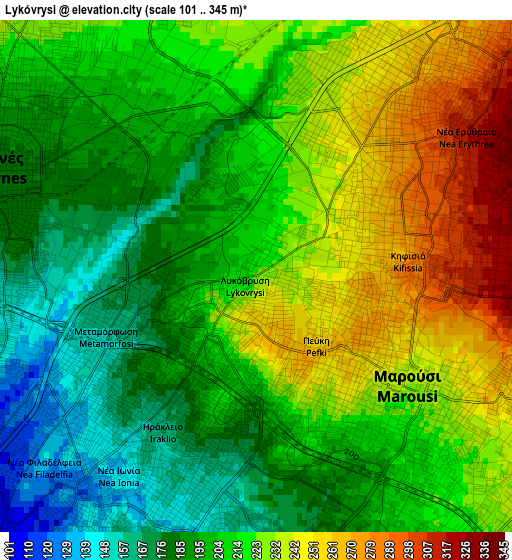
Below is the Elevation map of Lykóvrysi, which displays elevation range with different colors. Scale of the first map is from 101 to 345 m (331 to 1132 ft) with average elevation of 212.7 meters (=698 ft) [note 1]
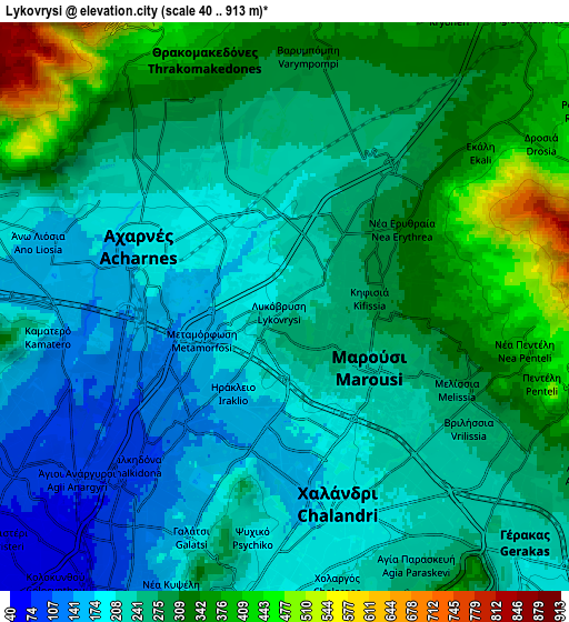
These maps also provides idea of topography and contour of this city, they are displayed at different zoom levels. More info about maps, scale and edge coordinates you can find below images.
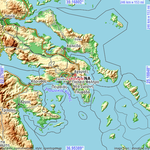
| \ | Map #1 | Map #2 | Topo.Map |
| Scale [m] | 101..345 m | 40..913 m | × |
| Scale [ft] | 331..1132 ft | 131..2995 ft | × |
| Average | 212.7 m = 698 ft | 261.9 m = 859 ft | × |
| Width | 7.69 km = 4.8 mi | 15.39 km = 9.6 mi | 246.2 km = 153 mi |
| Height | 7.69 km = 4.8 mi | 15.39 km = 9.6 mi | 246.2 km = 153 mi |
| ↑Max Latitude | 38.103918° | 38.138491° | 39.16802° |
| Latitude at center | 38.06933° | 38.06933° | 38.06933° |
| ↓Min Latitude | 38.034725° | 38.000104° | 36.95389° |
| ← Min Longitude | 23.738285° | 23.694339° | 22.37598° |
| Longitude center | 23.78223° | 23.78223° | 23.78223° |
| →Max Longitude | 23.826175° | 23.870121° | 25.18848° |
Nearby cities:
Cities around Lykóvrysi sort by population:
• Acharnés elevation 171 m
4.6 km,  289°
289°
• Khalándrion 194 m
5.3 km,  162°
162°
• Maroúsi 220 m
2.7 km,  144°
144°
• Néa Ionía 152 m
4.3 km,  210°
210°
• Irákleio 169 m
2.4 km,  219°
219°
• Kifisiá 290 m
2.6 km,  77°
77°
• Metamórfosi 173 m
1.7 km,  256°
256°
• Néa Filadélfeia 104 m
5.4 km,  225°
225°
• Melíssia 273 m
5 km,  115°
115°
• Péfki 257 m
1.4 km, 138°
• Néa Erythraía 321 m
4.4 km,  53°
53°
• Filothéi 162 m
4.9 km,  179°
179°
Multilingual:
 En español:
Lykóvrysi elevación 225 m.
 En France:
Lykóvrysi élévation 225 m.
 Auf Deutsch:
Lykóvrysi höhe über dem Meeresspiegel ist 225 m.

Sources and notes:
- [note 1] Map square and city borders are not equal. Map elevation data is calculated only from area inside that square.
- [src 1] Elevation data from geonames database provided with same terms of usage.
- [src 2] The elevation map of Lykóvrysi is generated using elevation data from NASA's 3 arcsec (90m) resolution SRTM data.
- [src 3] Base (background) map © OpenStreetMap contributors tiles are generated by Geofabrik and OpenTopoMap.
Copyright & License:
This Lykóvrysi Elevation Map is licensed under CC BY-SA. You may reuse any part from this page, if you give a proper credit by linking to this URL:
 More info on terms of use page.