Acharnés elevation
Acharnés (Attica, Nomarchía Anatolikís Attikís), Greece elevation is 171 meters and Acharnés elevation in feet is 561 ft above sea level [src 1]. Acharnés is a seat of a third-order administrative division (feature code) with elevation that is 20 meters (66 ft) bigger than average city elevation in Greece.
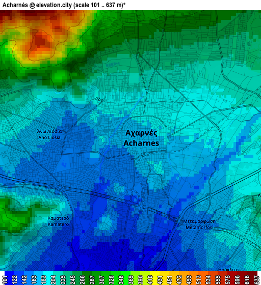
Below is the Elevation map of Acharnés, which displays elevation range with different colors. Scale of the first map is from 101 to 637 m (331 to 2090 ft) with average elevation of 210 meters (=689 ft) [note 1]
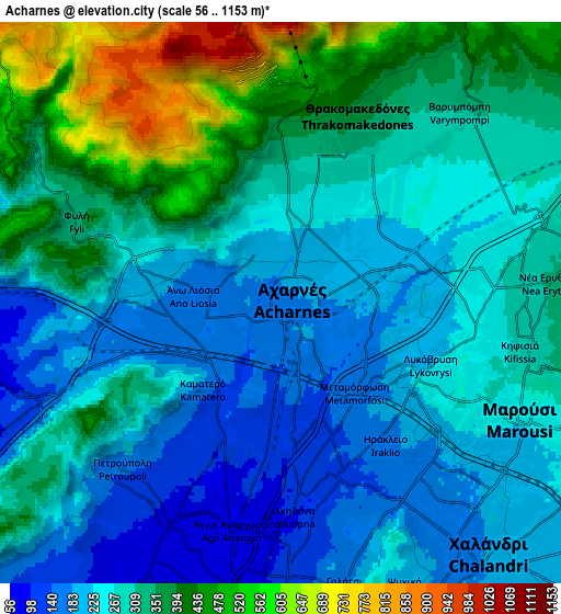
These maps also provides idea of topography and contour of this city, they are displayed at different zoom levels. More info about maps, scale and edge coordinates you can find below images.
| \ | Map #1 | Map #2 | Topo.Map |
| Scale [m] | 101..637 m | 56..1153 m | × |
| Scale [ft] | 331..2090 ft | 184..3783 ft | × |
| Average | 210 m = 689 ft | 298.6 m = 980 ft | × |
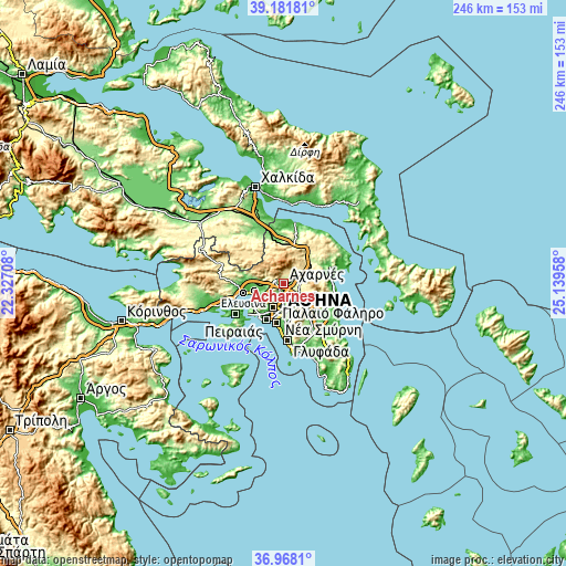
| Width | 7.69 km = 4.8 mi | 15.38 km = 9.6 mi | 246.1 km = 152.9 mi |
| Height | 7.69 km = 4.8 mi | 15.38 km = 9.6 mi | 246.1 km = 152.9 mi |
| ↑Max Latitude | 38.117912° | 38.152477° | 39.18181° |
| Latitude at center | 38.08333° | 38.08333° | 38.08333° |
| ↓Min Latitude | 38.048732° | 38.014117° | 36.9681° |
| ← Min Longitude | 23.689385° | 23.645439° | 22.32708° |
| Longitude center | 23.73333° | 23.73333° | 23.73333° |
| →Max Longitude | 23.777275° | 23.821221° | 25.13958° |
Nearby cities:
Cities around Acharnés sort by population:
• Néa Ionía elevation 152 m
5.7 km,  158°
158°
• Irákleio 169 m
4.4 km,  140°
140°
• Ágioi Anárgyroi 84 m
6 km,  188°
188°
• Áno Liósia 174 m
2.9 km,  270°
270°
• Metamórfosi 173 m
3.3 km,  126°
126°
• Kamaterón 142 m
3.9 km,  218°
218°
• Néa Filadélfeia 104 m
5.4 km,  175°
175°
• Péfki 257 m
5.8 km,  116°
116°
• Lykóvrysi 225 m
4.6 km,  109°
109°
• Zefyri 148 m
2.4 km, 217°
• Thrakomakedónes 370 m
5.6 km,  22°
22°
• Fylí 333 m
6 km,  290°
290°
Multilingual:
 En español:
Acharnés elevación 171 m.
 En France:
Acharnés élévation 171 m.
 Auf Deutsch:
Acharnés höhe über dem Meeresspiegel ist 171 m.

Sources and notes:
- [note 1] Map square and city borders are not equal. Map elevation data is calculated only from area inside that square.
- [src 1] Elevation data from geonames database provided with same terms of usage.
- [src 2] The elevation map of Acharnés is generated using elevation data from NASA's 3 arcsec (90m) resolution SRTM data.
- [src 3] Base (background) map © OpenStreetMap contributors tiles are generated by Geofabrik and OpenTopoMap.
Copyright & License:
This Acharnés Elevation Map is licensed under CC BY-SA. You may reuse any part from this page, if you give a proper credit by linking to this URL:
 More info on terms of use page.