Bolgatanga elevation
Bolgatanga (Upper East), Ghana elevation is 191 meters and Bolgatanga elevation in feet is 627 ft above sea level [src 1]. Bolgatanga is a seat of a first-order administrative division (feature code) with elevation that is 21 meters (69 ft) bigger than average city elevation in Ghana.
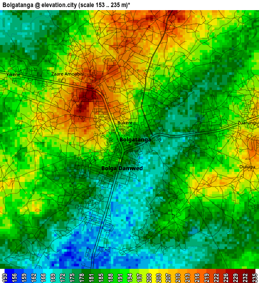
Below is the Elevation map of Bolgatanga, which displays elevation range with different colors. Scale of the first map is from 153 to 235 m (502 to 771 ft) with average elevation of 188.6 meters (=619 ft) [note 1]
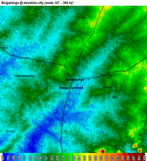
These maps also provides idea of topography and contour of this city, they are displayed at different zoom levels. More info about maps, scale and edge coordinates you can find below images.
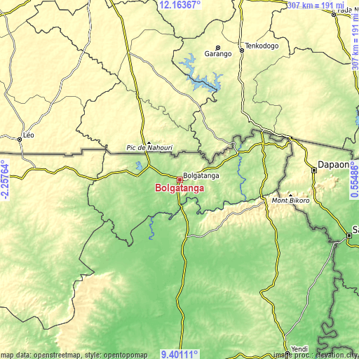
| \ | Map #1 | Map #2 | Topo.Map |
| Scale [m] | 153..235 m | 147..309 m | × |
| Scale [ft] | 502..771 ft | 482..1014 ft | × |
| Average | 188.6 m = 619 ft | 191.8 m = 629 ft | × |
| Width | 9.6 km = 6 mi | 19.2 km = 11.9 mi | 307.2 km = 190.9 mi |
| Height | 9.6 km = 6 mi | 19.2 km = 11.9 mi | 307.2 km = 190.9 mi |
| ↑Max Latitude | 10.828726° | 10.871886° | 12.16367° |
| Latitude at center | 10.78556° | 10.78556° | 10.78556° |
| ↓Min Latitude | 10.742388° | 10.69921° | 9.40111° |
| ← Min Longitude | -0.895335° | -0.939281° | -2.25764° |
| Longitude center | -0.85139° | -0.85139° | -0.85139° |
| →Max Longitude | -0.807445° | -0.763499° | 0.55486° |
Nearby cities:
Cities around Bolgatanga sort by population:
• Tamale elevation 196 m
154 km,  179°
179°
• Wa 326 m
197.7 km,  245°
245°
• Techiman 390 m
375.4 km,  198°
198°
• Bawku 252 m
73.3 km,  65°
65°
• Kintampo 343 m
318.4 km, 197°
• Yendi 208 m
175.4 km,  148°
148°
• Wenchi 308 m
365.6 km, 202°
• Savelugu 169 m
129.1 km, 178°
• Salaga 163 m
251.1 km,  171°
171°
• Navrongo 198 m
29 km,  294°
294°
• Kete Krachi 117 m
344.1 km, 165°
• Kpandae 183 m
273.6 km,  160°
160°
Multilingual:
 En español:
Bolgatanga elevación 191 m.
 En France:
Bolgatanga élévation 191 m.
 Auf Deutsch:
Bolgatanga höhe über dem Meeresspiegel ist 191 m.
 На русском:
Болгатанге, Болгатанга высота над уровнем моря 191 м
Sources and notes:
- [note 1] Map square and city borders are not equal. Map elevation data is calculated only from area inside that square.
- [src 1] Elevation data from geonames database provided with same terms of usage.
- [src 2] The elevation map of Bolgatanga is generated using elevation data from NASA's 3 arcsec (90m) resolution SRTM data.
- [src 3] Base (background) map © OpenStreetMap contributors tiles are generated by Geofabrik and OpenTopoMap.
Copyright & License:
This Bolgatanga Elevation Map is licensed under CC BY-SA. You may reuse any part from this page, if you give a proper credit by linking to this URL:
 More info on terms of use page.