Rossendale elevation
Rossendale (England, Lancashire), United Kingdom elevation is 380 meters and Rossendale elevation in feet is 1247 ft above sea level [src 1]. Rossendale is a populated locality (feature code) with elevation that is 308 meters (1010 ft) bigger than average city elevation in United Kingdom.
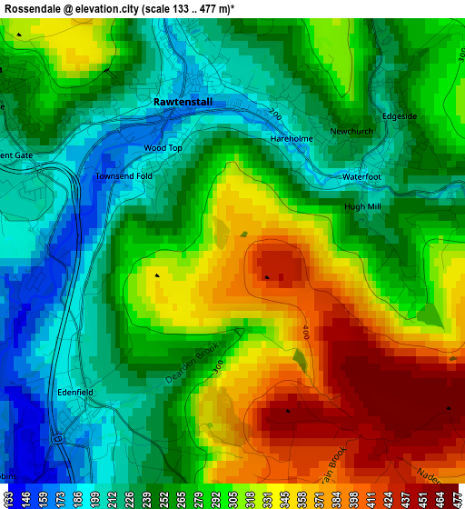
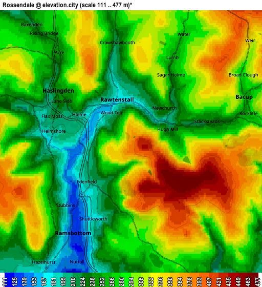
Below is the Elevation map of Rossendale, which displays elevation range with different colors. Scale of the first map is from 133 to 477 m (436 to 1565 ft) with average elevation of 280.3 meters (=920 ft) [note 1]
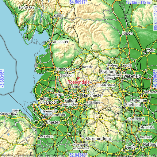
These maps also provides idea of topography and contour of this city, they are displayed at different zoom levels. More info about maps, scale and edge coordinates you can find below images.
| \ | Map #1 | Map #2 | Topo.Map |
| Scale [m] | 133..477 m | 111..477 m | × |
| Scale [ft] | 436..1565 ft | 364..1565 ft | × |
| Average | 280.3 m = 920 ft | 288.5 m = 947 ft | × |
| Width | 5.79 km = 3.6 mi | 11.58 km = 7.2 mi | 185.2 km = 115.1 mi |
| Height | 5.79 km = 3.6 mi | 11.58 km = 7.2 mi | 185.2 km = 115.1 mi |
| ↑Max Latitude | 53.710578° | 53.736579° | 54.50917° |
| Latitude at center | 53.68456° | 53.68456° | 53.68456° |
| ↓Min Latitude | 53.658526° | 53.632476° | 52.84348° |
| ← Min Longitude | -2.320845° | -2.364791° | -3.68315° |
| Longitude center | -2.2769° | -2.2769° | -2.2769° |
| →Max Longitude | -2.232955° | -2.189009° | -0.87065° |
Nearby cities:
Cities around Rossendale sort by population:
• Bury elevation 93 m
9.5 km,  189°
189°
• Accrington 148 m
9.4 km,  325°
325°
• Rawtenstall 171 m
1.9 km,  344°
344°
• Ramsbottom 133 m
4.9 km,  212°
212°
• Haslingden 244 m
3.7 km,  303°
303°
• Bacup 257 m
5.4 km,  67°
67°
• Tottington 150 m
9 km, 207°
• Wardle 200 m
10.2 km,  112°
112°
• Whitworth 222 m
7.3 km,  115°
115°
• Edgworth 198 m
8.8 km,  241°
241°
• Edenfield 193 m
2.7 km,  222°
222°
• Hameldon Hill 401 m
8 km,  352°
352°
Multilingual:
 En español:
Rossendale elevación 380 m.
 En France:
Rossendale élévation 380 m.
 Auf Deutsch:
Rossendale höhe über dem Meeresspiegel ist 380 m.

Sources and notes:
- [note 1] Map square and city borders are not equal. Map elevation data is calculated only from area inside that square.
- [src 1] Elevation data from geonames database provided with same terms of usage.
- [src 2] The elevation map of Rossendale is generated using elevation data from NASA's 3 arcsec (90m) resolution SRTM data.
- [src 3] Base (background) map © OpenStreetMap contributors tiles are generated by Geofabrik and OpenTopoMap.
Copyright & License:
This Rossendale Elevation Map is licensed under CC BY-SA. You may reuse any part from this page, if you give a proper credit by linking to this URL:
 More info on terms of use page.