Edgworth elevation
Edgworth (England, Blackburn with Darwen), United Kingdom elevation is 198 meters and Edgworth elevation in feet is 650 ft above sea level [src 1]. Edgworth is a populated place (feature code) with elevation that is 126 meters (413 ft) bigger than average city elevation in United Kingdom.
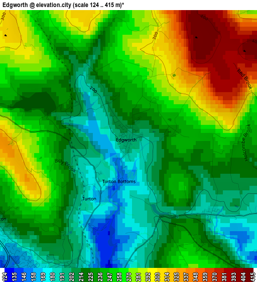
Below is the Elevation map of Edgworth, which displays elevation range with different colors. Scale of the first map is from 124 to 415 m (407 to 1362 ft) with average elevation of 243.8 meters (=800 ft) [note 1]
These maps also provides idea of topography and contour of this city, they are displayed at different zoom levels. More info about maps, scale and edge coordinates you can find below images.
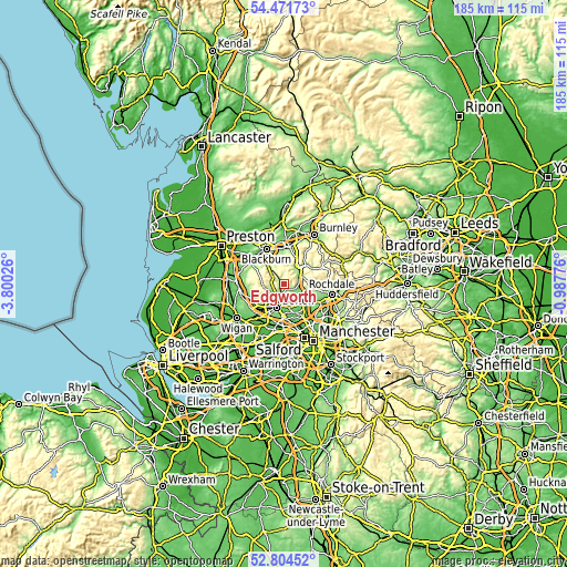
| \ | Map #1 | Topo.Map |
| Scale [m] | 124..415 m | × |
| Scale [ft] | 407..1362 ft | × |
| Average | 243.8 m = 800 ft | × |
| Width | 5.79 km = 3.6 mi | 185.4 km = 115.2 mi |
| Height | 5.79 km = 3.6 mi | 185.4 km = 115.2 mi |
| ↑Max Latitude | 53.672401° | 54.47173° |
| Latitude at center | 53.64636° | 53.64636° |
| ↓Min Latitude | 53.620303° | 52.80452° |
| ← Min Longitude | -2.437955° | -3.80026° |
| Longitude center | -2.39401° | -2.39401° |
| →Max Longitude | -2.350065° | -0.98776° |
Nearby cities:
Cities around Edgworth sort by population:
• Bolton elevation 105 m
7.5 km,  200°
200°
• Rossendale 380 m
8.8 km,  61°
61°
• Bury 93 m
8.1 km,  129°
129°
• Radcliffe 76 m
10.5 km,  154°
154°
• Darwen 172 m
7.4 km,  320°
320°
• Farnworth 102 m
10.7 km,  182°
182°
• Rawtenstall 171 m
9.4 km,  50°
50°
• Ramsbottom 133 m
5.1 km,  88°
88°
• Haslingden 244 m
7.8 km,  36°
36°
• Little Lever 85 m
9.3 km,  173°
173°
• Tottington 150 m
5.1 km,  136°
136°
• Edenfield 193 m
6.3 km,  68°
68°
Multilingual:
 En español:
Edgworth elevación 198 m.
 En France:
Edgworth élévation 198 m.
 Auf Deutsch:
Edgworth höhe über dem Meeresspiegel ist 198 m.

Sources and notes:
- [note 1] Map square and city borders are not equal. Map elevation data is calculated only from area inside that square.
- [src 1] Elevation data from geonames database provided with same terms of usage.
- [src 2] The elevation map of Edgworth is generated using elevation data from NASA's 3 arcsec (90m) resolution SRTM data.
- [src 3] Base (background) map © OpenStreetMap contributors tiles are generated by Geofabrik and OpenTopoMap.
Copyright & License:
This Edgworth Elevation Map is licensed under CC BY-SA. You may reuse any part from this page, if you give a proper credit by linking to this URL:
 More info on terms of use page.