Failsworth elevation
Failsworth (England, Manchester), United Kingdom elevation is 97 meters and Failsworth elevation in feet is 318 ft above sea level [src 1]. Failsworth is a populated place (feature code) with elevation that is 25 meters (82 ft) bigger than average city elevation in United Kingdom.
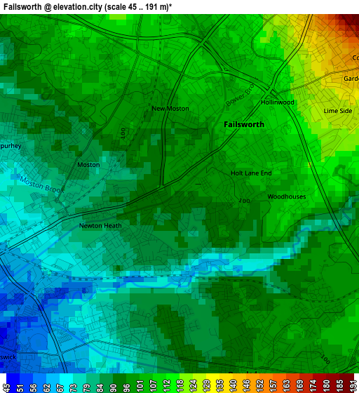
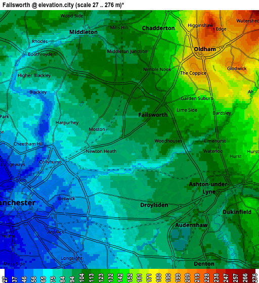
Below is the Elevation map of Failsworth, which displays elevation range with different colors. Scale of the first map is from 45 to 191 m (148 to 627 ft) with average elevation of 94 meters (=308 ft) [note 1]
These maps also provides idea of topography and contour of this city, they are displayed at different zoom levels. More info about maps, scale and edge coordinates you can find below images.
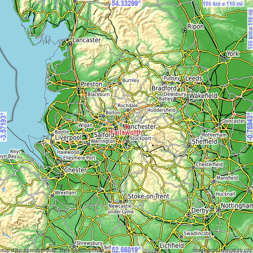
| \ | Map #1 | Map #2 | Topo.Map |
| Scale [m] | 45..191 m | 27..276 m | × |
| Scale [ft] | 148..627 ft | 89..906 ft | × |
| Average | 94 m = 308 ft | 99.9 m = 328 ft | × |
| Width | 5.81 km = 3.6 mi | 11.62 km = 7.2 mi | 186 km = 115.6 mi |
| Height | 5.81 km = 3.6 mi | 11.62 km = 7.2 mi | 186 km = 115.6 mi |
| ↑Max Latitude | 53.530969° | 53.557081° | 54.33299° |
| Latitude at center | 53.50484° | 53.50484° | 53.50484° |
| ↓Min Latitude | 53.478695° | 53.452534° | 52.66019° |
| ← Min Longitude | -2.209625° | -2.253571° | -3.57193° |
| Longitude center | -2.16568° | -2.16568° | -2.16568° |
| →Max Longitude | -2.121735° | -2.077789° | -0.75943° |
Nearby cities:
Cities around Failsworth sort by population:
• Manchester elevation 51 m
5.4 km,  240°
240°
• Oldham 204 m
5.1 km,  38°
38°
• Middleton 87 m
5.5 km,  335°
335°
• Ashton-under-Lyne 108 m
4.8 km,  112°
112°
• Denton 101 m
6.2 km,  149°
149°
• Droylsden 100 m
3.1 km, 154°
• Dukinfield 128 m
6.1 km,  122°
122°
• Longsight 54 m
5.7 km,  204°
204°
• Cheetham Hill 58 m
4.9 km,  261°
261°
• Crumpsall 80 m
5.4 km,  285°
285°
• Blackley 81 m
3.5 km, 293°
• Hulme 36 m
7 km,  231°
231°
Multilingual:
 En español:
Failsworth elevación 97 m.
 En France:
Failsworth élévation 97 m.
 Auf Deutsch:
Failsworth höhe über dem Meeresspiegel ist 97 m.

Sources and notes:
- [note 1] Map square and city borders are not equal. Map elevation data is calculated only from area inside that square.
- [src 1] Elevation data from geonames database provided with same terms of usage.
- [src 2] The elevation map of Failsworth is generated using elevation data from NASA's 3 arcsec (90m) resolution SRTM data.
- [src 3] Base (background) map © OpenStreetMap contributors tiles are generated by Geofabrik and OpenTopoMap.
Copyright & License:
This Failsworth Elevation Map is licensed under CC BY-SA. You may reuse any part from this page, if you give a proper credit by linking to this URL:
 More info on terms of use page.