Stockton elevation
Stockton (England, Wiltshire), United Kingdom elevation is 82 meters and Stockton elevation in feet is 269 ft above sea level [src 1]. Stockton is a seat of a third-order administrative division (feature code) with elevation that is 10 meters (33 ft) bigger than average city elevation in United Kingdom.
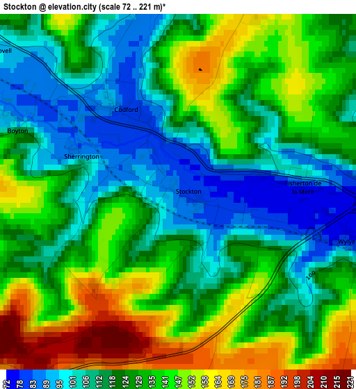
Below is the Elevation map of Stockton, which displays elevation range with different colors. Scale of the first map is from 72 to 221 m (236 to 725 ft) with average elevation of 126.8 meters (=416 ft) [note 1]
These maps also provides idea of topography and contour of this city, they are displayed at different zoom levels. More info about maps, scale and edge coordinates you can find below images.
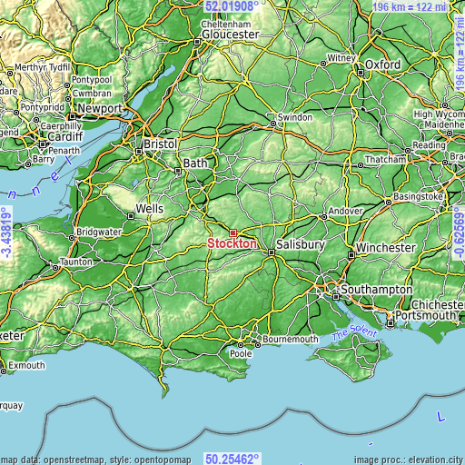
| \ | Map #1 | Topo.Map |
| Scale [m] | 72..221 m | × |
| Scale [ft] | 236..725 ft | × |
| Average | 126.8 m = 416 ft | × |
| Width | 6.13 km = 3.8 mi | 196.2 km = 121.9 mi |
| Height | 6.13 km = 3.8 mi | 196.2 km = 121.9 mi |
| ↑Max Latitude | 51.172841° | 52.01908° |
| Latitude at center | 51.14528° | 51.14528° |
| ↓Min Latitude | 51.117703° | 50.25462° |
| ← Min Longitude | -2.075885° | -3.43819° |
| Longitude center | -2.03194° | -2.03194° |
| →Max Longitude | -1.987995° | -0.62569° |
Nearby cities:
Cities around Stockton sort by population:
• Warminster elevation 120 m
12.2 km,  302°
302°
• Boreham 120 m
11.1 km, 302°
• Tisbury 96 m
9.8 km,  200°
200°
• Shrewton 85 m
10.4 km,  60°
60°
• Dinton 89 m
7.7 km,  153°
153°
• Hindon 131 m
8.8 km,  228°
228°
• Bishopstrow 114 m
10.1 km, 301°
• Stapleford 116 m
9.7 km,  109°
109°
• Winterbourne Stoke 93 m
9.7 km,  75°
75°
• Chicklade 144 m
7.7 km,  238°
238°
• Boyton 95 m
2.9 km,  291°
291°
• Codford 87 m
1.4 km, 292°
Multilingual:
 En español:
Stockton elevación 82 m.
 En France:
Stockton élévation 82 m.


Sources and notes:
- [note 1] Map square and city borders are not equal. Map elevation data is calculated only from area inside that square.
- [src 1] Elevation data from geonames database provided with same terms of usage.
- [src 2] The elevation map of Stockton is generated using elevation data from NASA's 3 arcsec (90m) resolution SRTM data.
- [src 3] Base (background) map © OpenStreetMap contributors tiles are generated by Geofabrik and OpenTopoMap.
Copyright & License:
This Stockton Elevation Map is licensed under CC BY-SA. You may reuse any part from this page, if you give a proper credit by linking to this URL:
 More info on terms of use page.