Tumble elevation
Tumble (Wales, Carmarthenshire), United Kingdom elevation is 197 meters and Tumble elevation in feet is 646 ft above sea level [src 1]. Tumble is a populated place (feature code) with elevation that is 125 meters (410 ft) bigger than average city elevation in United Kingdom.
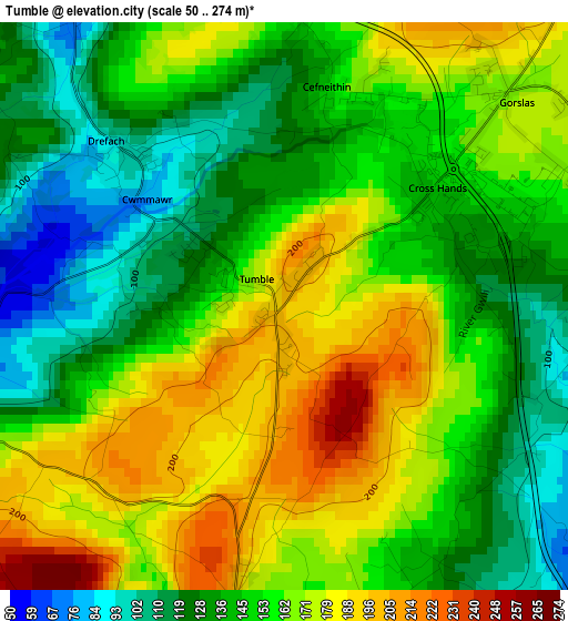
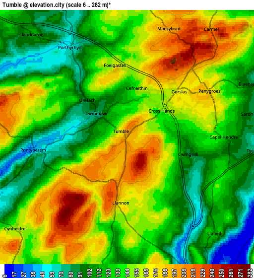
Below is the Elevation map of Tumble, which displays elevation range with different colors. Scale of the first map is from 50 to 274 m (164 to 899 ft) with average elevation of 153.7 meters (=504 ft) [note 1]
These maps also provides idea of topography and contour of this city, they are displayed at different zoom levels. More info about maps, scale and edge coordinates you can find below images.
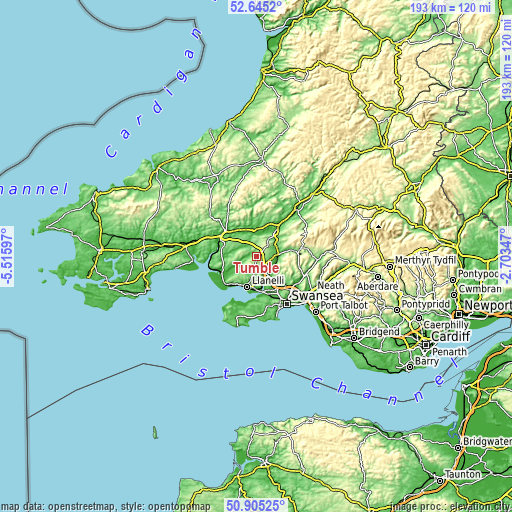
| \ | Map #1 | Map #2 | Topo.Map |
| Scale [m] | 50..274 m | 6..282 m | × |
| Scale [ft] | 164..899 ft | 20..925 ft | × |
| Average | 153.7 m = 504 ft | 138.4 m = 454 ft | × |
| Width | 6.05 km = 3.8 mi | 12.09 km = 7.5 mi | 193.5 km = 120.2 mi |
| Height | 6.05 km = 3.8 mi | 12.09 km = 7.5 mi | 193.4 km = 120.2 mi |
| ↑Max Latitude | 51.810788° | 51.837949° | 52.6452° |
| Latitude at center | 51.78361° | 51.78361° | 51.78361° |
| ↓Min Latitude | 51.756416° | 51.729205° | 50.90525° |
| ← Min Longitude | -4.153665° | -4.197611° | -5.51597° |
| Longitude center | -4.10972° | -4.10972° | -4.10972° |
| →Max Longitude | -4.065775° | -4.021829° | -2.70347° |
Nearby cities:
Cities around Tumble sort by population:
• Llanelli elevation 13 m
11.9 km,  197°
197°
• Ammanford 39 m
8.4 km,  83°
83°
• Pontarddulais 15 m
9.1 km,  147°
147°
• Cross Hands 139 m
1.9 km,  55°
55°
• Llandybie 60 m
8.2 km, 59°
• Tycroes 78 m
6.2 km,  95°
95°
• Pontyberem 50 m
4.1 km,  261°
261°
• Trimsaran 56 m
11.5 km,  232°
232°
• Pontyates 15 m
8.2 km,  244°
244°
• Grovesend 49 m
12 km,  155°
155°
• Llangathen 103 m
11.3 km,  19°
19°
• Llanddarog 114 m
6.6 km,  317°
317°
Multilingual:
 En español:
Tumble elevación 197 m.
 En France:
Tumble élévation 197 m.


Sources and notes:
- [note 1] Map square and city borders are not equal. Map elevation data is calculated only from area inside that square.
- [src 1] Elevation data from geonames database provided with same terms of usage.
- [src 2] The elevation map of Tumble is generated using elevation data from NASA's 3 arcsec (90m) resolution SRTM data.
- [src 3] Base (background) map © OpenStreetMap contributors tiles are generated by Geofabrik and OpenTopoMap.
Copyright & License:
This Tumble Elevation Map is licensed under CC BY-SA. You may reuse any part from this page, if you give a proper credit by linking to this URL:
 More info on terms of use page.