Abbey Dore elevation
Abbey Dore (England, Herefordshire), United Kingdom elevation is 161 meters and Abbey Dore elevation in feet is 528 ft above sea level [src 1]. Abbey Dore is a seat of a third-order administrative division (feature code) with elevation that is 89 meters (292 ft) bigger than average city elevation in United Kingdom.
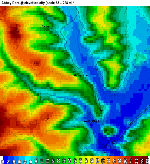
Below is the Elevation map of Abbey Dore, which displays elevation range with different colors. Scale of the first map is from 68 to 228 m (223 to 748 ft) with average elevation of 131.1 meters (=430 ft) [note 1]
These maps also provides idea of topography and contour of this city, they are displayed at different zoom levels. More info about maps, scale and edge coordinates you can find below images.
| \ | Map #1 | Topo.Map |
| Scale [m] | 68..228 m | × |
| Scale [ft] | 223..748 ft | × |
| Average | 131.1 m = 430 ft | × |
| Width | 6.02 km = 3.7 mi | 192.7 km = 119.7 mi |
| Height | 6.02 km = 3.7 mi | 192.7 km = 119.7 mi |
| ↑Max Latitude | 51.993737° | 52.82474° |
| Latitude at center | 51.96667° | 51.96667° |
| ↓Min Latitude | 51.939586° | 51.09186° |
| ← Min Longitude | -2.943945° | -4.30625° |
| Longitude center | -2.9° | -2.9° |
| →Max Longitude | -2.856055° | -1.49375° |
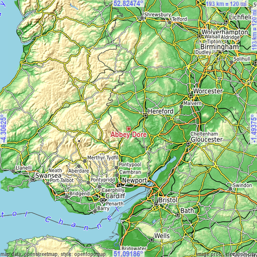
Nearby cities:
Cities around Abbey Dore sort by population:
• Longtown elevation 137 m
6 km,  252°
252°
• Ewyas Harold 77 m
1.5 km,  162°
162°
• Much Birch 163 m
12.1 km,  87°
87°
• Tyberton 87 m
8.8 km,  358°
358°
• Turnastone 128 m
7.2 km,  332°
332°
• Kingstone 90 m
7.2 km,  39°
39°
• Llanveynoe 251 m
6.9 km,  270°
270°
• Thruxton 103 m
6.8 km,  56°
56°
• Llancillo 106 m
6 km,  202°
202°
• Grosmont 117 m
6 km, 157°
• Rowlstone 149 m
3.9 km, 197°
• Bacton 137 m
2.2 km, 328°
Multilingual:
 En español:
Abbey Dore elevación 161 m.
 En France:
Abbey Dore élévation 161 m.
 Auf Deutsch:
Abbey Dore höhe über dem Meeresspiegel ist 161 m.

Sources and notes:
- [note 1] Map square and city borders are not equal. Map elevation data is calculated only from area inside that square.
- [src 1] Elevation data from geonames database provided with same terms of usage.
- [src 2] The elevation map of Abbey Dore is generated using elevation data from NASA's 3 arcsec (90m) resolution SRTM data.
- [src 3] Base (background) map © OpenStreetMap contributors tiles are generated by Geofabrik and OpenTopoMap.
Copyright & License:
This Abbey Dore Elevation Map is licensed under CC BY-SA. You may reuse any part from this page, if you give a proper credit by linking to this URL:
 More info on terms of use page.