Abram elevation
Abram (England, Borough of Wigan), United Kingdom elevation is 38 meters and Abram elevation in feet is 125 ft above sea level [src 1]. Abram is a populated place (feature code) with elevation that is 34 meters (112 ft) smaller than average city elevation in United Kingdom.
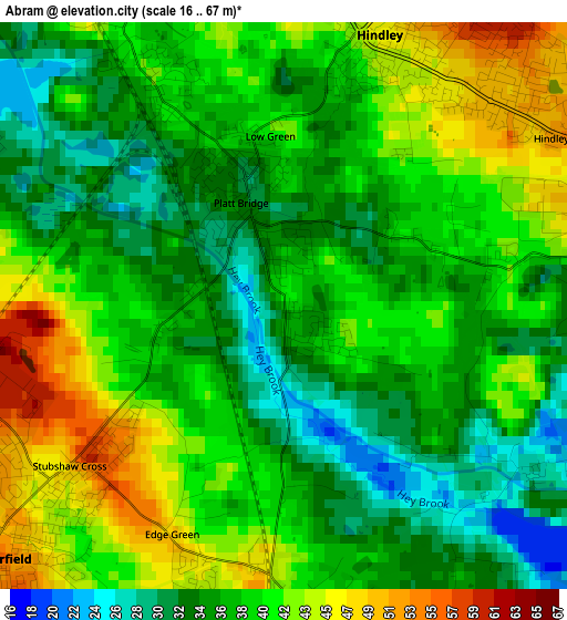
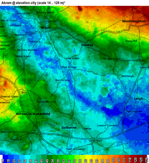
Below is the Elevation map of Abram, which displays elevation range with different colors. Scale of the first map is from 16 to 67 m (52 to 220 ft) with average elevation of 37.9 meters (=124 ft) [note 1]
These maps also provides idea of topography and contour of this city, they are displayed at different zoom levels. More info about maps, scale and edge coordinates you can find below images.
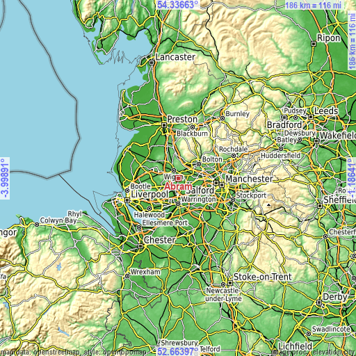
| \ | Map #1 | Map #2 | Topo.Map |
| Scale [m] | 16..67 m | 14..129 m | × |
| Scale [ft] | 52..220 ft | 46..423 ft | × |
| Average | 37.9 m = 124 ft | 48.2 m = 158 ft | × |
| Width | 5.81 km = 3.6 mi | 11.62 km = 7.2 mi | 186 km = 115.6 mi |
| Height | 5.81 km = 3.6 mi | 11.62 km = 7.2 mi | 186 km = 115.6 mi |
| ↑Max Latitude | 53.534676° | 53.560787° | 54.33663° |
| Latitude at center | 53.50855° | 53.50855° | 53.50855° |
| ↓Min Latitude | 53.482408° | 53.456249° | 52.66397° |
| ← Min Longitude | -2.636605° | -2.680551° | -3.99891° |
| Longitude center | -2.59266° | -2.59266° | -2.59266° |
| →Max Longitude | -2.548715° | -2.504769° | -1.18641° |
Nearby cities:
Cities around Abram sort by population:
• Wigan elevation 32 m
4.8 km,  322°
322°
• Leigh 32 m
5 km,  105°
105°
• Ashton in Makerfield 64 m
4.7 km,  233°
233°
• Westhoughton 107 m
6.4 km,  44°
44°
• Hindley 42 m
2.8 km,  12°
12°
• Golborne 40 m
3.5 km,  184°
184°
• Newton-le-Willows 35 m
6.5 km, 184°
• Atherton 60 m
6.8 km,  75°
75°
• Haydock 41 m
7.5 km, 232°
• Ince-in-Makerfield 41 m
3.2 km,  330°
330°
• Billinge 111 m
7.7 km,  261°
261°
• Glazebury 17 m
7.5 km,  123°
123°
Multilingual:
 En español:
Abram elevación 38 m.
 En France:
Abram élévation 38 m.


Sources and notes:
- [note 1] Map square and city borders are not equal. Map elevation data is calculated only from area inside that square.
- [src 1] Elevation data from geonames database provided with same terms of usage.
- [src 2] The elevation map of Abram is generated using elevation data from NASA's 3 arcsec (90m) resolution SRTM data.
- [src 3] Base (background) map © OpenStreetMap contributors tiles are generated by Geofabrik and OpenTopoMap.
Copyright & License:
This Abram Elevation Map is licensed under CC BY-SA. You may reuse any part from this page, if you give a proper credit by linking to this URL:
 More info on terms of use page.