Hindley elevation
Hindley (England, Borough of Wigan), United Kingdom elevation is 42 meters and Hindley elevation in feet is 138 ft above sea level [src 1]. Hindley is a populated place (feature code) with elevation that is 30 meters (98 ft) smaller than average city elevation in United Kingdom.
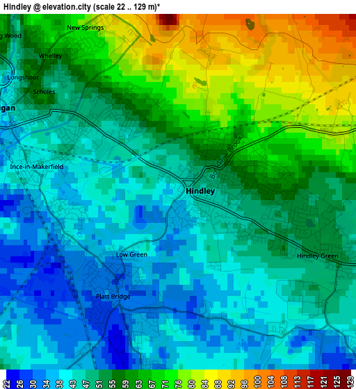
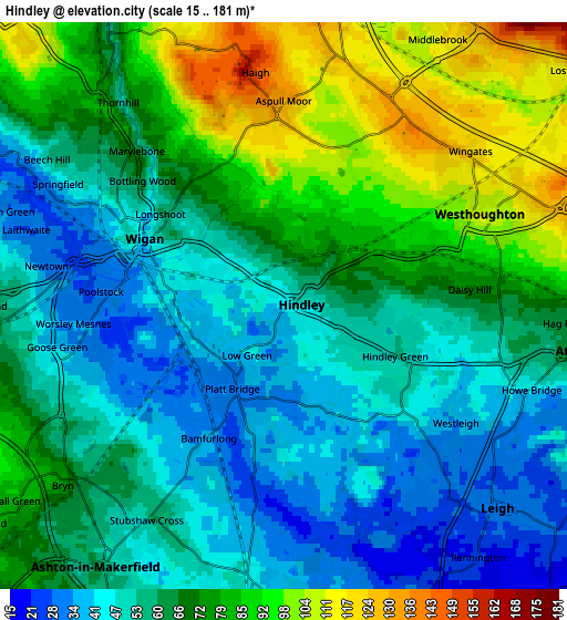
Below is the Elevation map of Hindley, which displays elevation range with different colors. Scale of the first map is from 22 to 129 m (72 to 423 ft) with average elevation of 53.4 meters (=175 ft) [note 1]
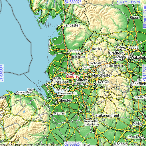
These maps also provides idea of topography and contour of this city, they are displayed at different zoom levels. More info about maps, scale and edge coordinates you can find below images.
| \ | Map #1 | Map #2 | Topo.Map |
| Scale [m] | 22..129 m | 15..181 m | × |
| Scale [ft] | 72..423 ft | 49..594 ft | × |
| Average | 53.4 m = 175 ft | 64.8 m = 213 ft | × |
| Width | 5.81 km = 3.6 mi | 11.62 km = 7.2 mi | 185.9 km = 115.5 mi |
| Height | 5.81 km = 3.6 mi | 11.62 km = 7.2 mi | 185.9 km = 115.5 mi |
| ↑Max Latitude | 53.559441° | 53.585536° | 54.36092° |
| Latitude at center | 53.53333° | 53.53333° | 53.53333° |
| ↓Min Latitude | 53.507203° | 53.48106° | 52.68925° |
| ← Min Longitude | -2.627275° | -2.671221° | -3.98958° |
| Longitude center | -2.58333° | -2.58333° | -2.58333° |
| →Max Longitude | -2.539385° | -2.495439° | -1.17708° |
Nearby cities:
Cities around Hindley sort by population:
• Wigan elevation 32 m
3.7 km,  286°
286°
• Leigh 32 m
5.9 km,  134°
134°
• Tyldesley 58 m
8 km,  105°
105°
• Ashton in Makerfield 64 m
7.1 km,  218°
218°
• Westhoughton 107 m
4.3 km,  65°
65°
• Golborne 40 m
6.3 km,  187°
187°
• Atherton 60 m
6 km,  100°
100°
• Horwich 135 m
7.9 km,  16°
16°
• Ince-in-Makerfield 41 m
2.2 km,  270°
270°
• Abram 38 m
2.8 km, 192°
• Blackrod 155 m
6.6 km,  1°
1°
• Haigh 110 m
7.4 km, 0°
Multilingual:
 En español:
Hindley elevación 42 m.
 En France:
Hindley élévation 42 m.


Sources and notes:
- [note 1] Map square and city borders are not equal. Map elevation data is calculated only from area inside that square.
- [src 1] Elevation data from geonames database provided with same terms of usage.
- [src 2] The elevation map of Hindley is generated using elevation data from NASA's 3 arcsec (90m) resolution SRTM data.
- [src 3] Base (background) map © OpenStreetMap contributors tiles are generated by Geofabrik and OpenTopoMap.
Copyright & License:
This Hindley Elevation Map is licensed under CC BY-SA. You may reuse any part from this page, if you give a proper credit by linking to this URL:
 More info on terms of use page.