Banbridge elevation
Banbridge (Northern Ireland, Armagh City Banbridge and Craigavon), United Kingdom elevation is 94 meters and Banbridge elevation in feet is 308 ft above sea level [src 1]. Banbridge is a seat of a second-order administrative division (feature code) with elevation that is 22 meters (72 ft) bigger than average city elevation in United Kingdom.
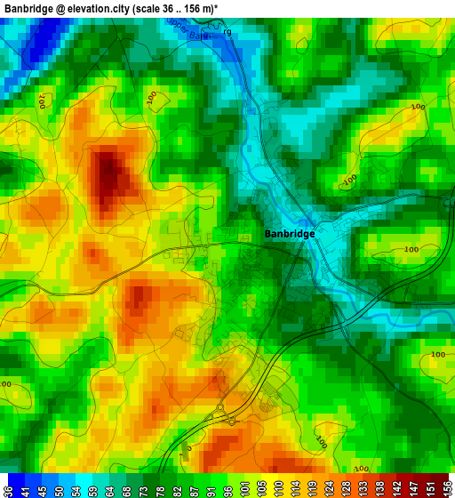
Below is the Elevation map of Banbridge, which displays elevation range with different colors. Scale of the first map is from 36 to 156 m (118 to 512 ft) with average elevation of 91.2 meters (=299 ft) [note 1]
These maps also provides idea of topography and contour of this city, they are displayed at different zoom levels. More info about maps, scale and edge coordinates you can find below images.
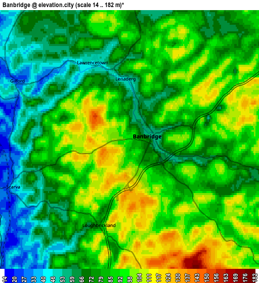
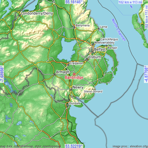
| \ | Map #1 | Map #2 | Topo.Map |
| Scale [m] | 36..156 m | 14..182 m | × |
| Scale [ft] | 118..512 ft | 46..597 ft | × |
| Average | 91.2 m = 299 ft | 81.8 m = 268 ft | × |
| Width | 5.7 km = 3.5 mi | 11.39 km = 7.1 mi | 182.3 km = 113.3 mi |
| Height | 5.7 km = 3.5 mi | 11.39 km = 7.1 mi | 182.3 km = 113.3 mi |
| ↑Max Latitude | 54.375605° | 54.401194° | 55.16146° |
| Latitude at center | 54.35° | 54.35° | 54.35° |
| ↓Min Latitude | 54.324379° | 54.298743° | 53.52219° |
| ← Min Longitude | -6.327275° | -6.371221° | -7.68958° |
| Longitude center | -6.28333° | -6.28333° | -6.28333° |
| →Max Longitude | -6.239385° | -6.195439° | -4.87708° |
Nearby cities:
Cities around Banbridge sort by population:
• Craigavon elevation 34 m
12.7 km,  328°
328°
• Newry 6 m
19.4 km,  190°
190°
• Portadown 22 m
13.2 km,  307°
307°
• Moira 69 m
14.9 km,  13°
13°
• Hillsborough 113 m
18.4 km,  46°
46°
• Tandragee 63 m
8.5 km,  273°
273°
• Waringstown 50 m
9.4 km,  353°
353°
• Castlewellan 113 m
24.3 km,  115°
115°
• Rathfriland 84 m
13.5 km,  145°
145°
• Gilford 28 m
5.6 km,  296°
296°
• Magheralin 38 m
13.1 km, 6°
• Annahilt 92 m
20.5 km,  63°
63°
Multilingual:
 En español:
Banbridge elevación 94 m.
 En France:
Banbridge élévation 94 m.
 Auf Deutsch:
Banbridge höhe über dem Meeresspiegel ist 94 m.

Sources and notes:
- [note 1] Map square and city borders are not equal. Map elevation data is calculated only from area inside that square.
- [src 1] Elevation data from geonames database provided with same terms of usage.
- [src 2] The elevation map of Banbridge is generated using elevation data from NASA's 3 arcsec (90m) resolution SRTM data.
- [src 3] Base (background) map © OpenStreetMap contributors tiles are generated by Geofabrik and OpenTopoMap.
Copyright & License:
This Banbridge Elevation Map is licensed under CC BY-SA. You may reuse any part from this page, if you give a proper credit by linking to this URL:
 More info on terms of use page.