Barrhead elevation
Barrhead (Scotland, East Renfrewshire), United Kingdom elevation is 58 meters and Barrhead elevation in feet is 190 ft above sea level [src 1]. Barrhead is a populated place (feature code) with elevation that is 14 meters (46 ft) smaller than average city elevation in United Kingdom.
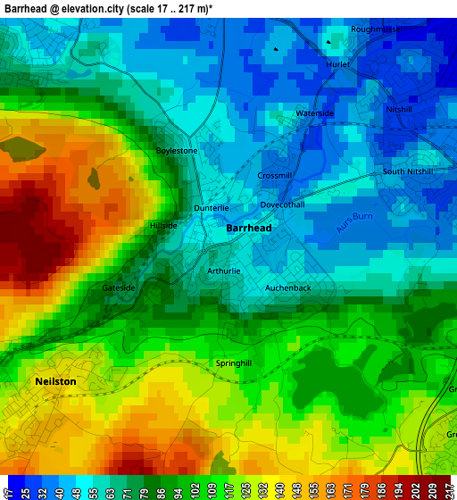
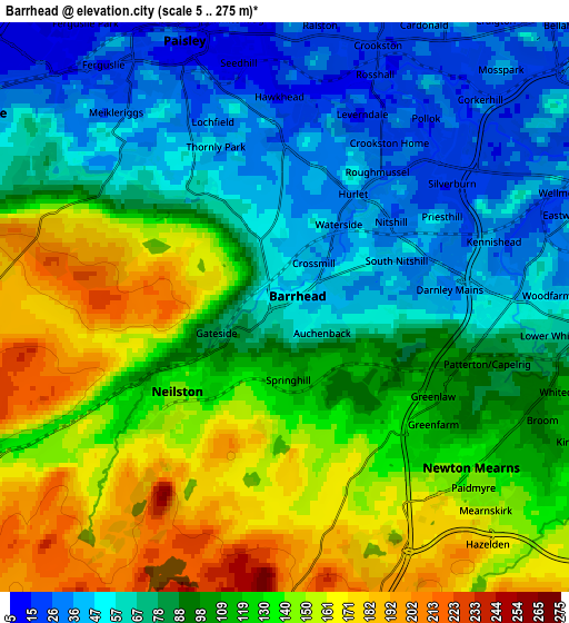
Below is the Elevation map of Barrhead, which displays elevation range with different colors. Scale of the first map is from 17 to 217 m (56 to 712 ft) with average elevation of 91.5 meters (=300 ft) [note 1]
These maps also provides idea of topography and contour of this city, they are displayed at different zoom levels. More info about maps, scale and edge coordinates you can find below images.
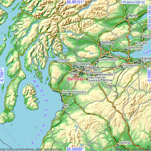
| \ | Map #1 | Map #2 | Topo.Map |
| Scale [m] | 17..217 m | 5..275 m | × |
| Scale [ft] | 56..712 ft | 16..902 ft | × |
| Average | 91.5 m = 300 ft | 104 m = 341 ft | × |
| Width | 5.49 km = 3.4 mi | 10.99 km = 6.8 mi | 175.8 km = 109.2 mi |
| Height | 5.49 km = 3.4 mi | 10.99 km = 6.8 mi | 175.8 km = 109.2 mi |
| ↑Max Latitude | 55.823854° | 55.848532° | 56.58161° |
| Latitude at center | 55.79916° | 55.79916° | 55.79916° |
| ↓Min Latitude | 55.774451° | 55.749726° | 55.00066° |
| ← Min Longitude | -4.436795° | -4.480741° | -5.7991° |
| Longitude center | -4.39285° | -4.39285° | -4.39285° |
| →Max Longitude | -4.348905° | -4.304959° | -2.9866° |
Nearby cities:
Cities around Barrhead sort by population:
• Paisley elevation 50 m
4.4 km,  325°
325°
• Newton Mearns 137 m
4.7 km,  127°
127°
• Renfrew 7 m
8.1 km,  0°
0°
• Giffnock 45 m
6.1 km,  85°
85°
• Clarkston 95 m
7.4 km,  101°
101°
• Linwood 11 m
8.3 km,  311°
311°
• Elderslie 32 m
6.9 km,  303°
303°
• Neilston 136 m
2.6 km,  234°
234°
• Netherlee 55 m
7.5 km, 87°
• Thornliebank 48 m
4.7 km,  82°
82°
• Busby 97 m
7.5 km,  106°
106°
• Waterfoot 99 m
7.6 km,  115°
115°
Multilingual:
 En español:
Barrhead elevación 58 m.
 En France:
Barrhead élévation 58 m.


Sources and notes:
- [note 1] Map square and city borders are not equal. Map elevation data is calculated only from area inside that square.
- [src 1] Elevation data from geonames database provided with same terms of usage.
- [src 2] The elevation map of Barrhead is generated using elevation data from NASA's 3 arcsec (90m) resolution SRTM data.
- [src 3] Base (background) map © OpenStreetMap contributors tiles are generated by Geofabrik and OpenTopoMap.
Copyright & License:
This Barrhead Elevation Map is licensed under CC BY-SA. You may reuse any part from this page, if you give a proper credit by linking to this URL:
 More info on terms of use page.