Renfrew elevation
Renfrew (Scotland, Renfrewshire), United Kingdom elevation is 7 meters and Renfrew elevation in feet is 23 ft above sea level [src 1]. Renfrew is a populated place (feature code) with elevation that is 65 meters (213 ft) smaller than average city elevation in United Kingdom.
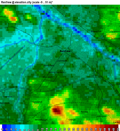
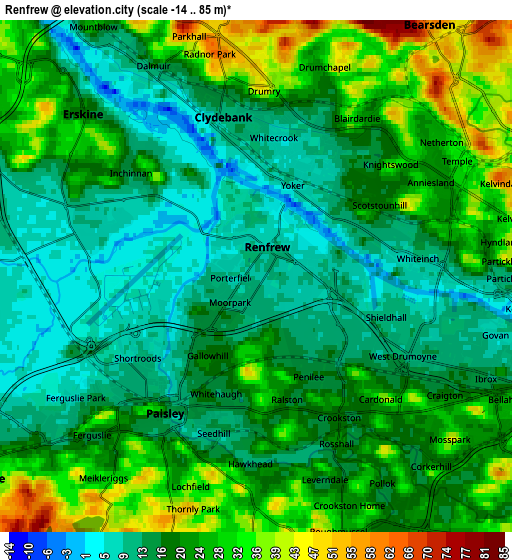
Below is the Elevation map of Renfrew, which displays elevation range with different colors. Scale of the first map is from -9 to 51 m (-30 to 167 ft) with average elevation of 10.4 meters (=34 ft) [note 1]
These maps also provides idea of topography and contour of this city, they are displayed at different zoom levels. More info about maps, scale and edge coordinates you can find below images.
| \ | Map #1 | Map #2 | Topo.Map |
| Scale [m] | -9..51 m | -14..85 m | × |
| Scale [ft] | -30..167 ft | -46..279 ft | × |
| Average | 10.4 m = 34 ft | 20.2 m = 66 ft | × |
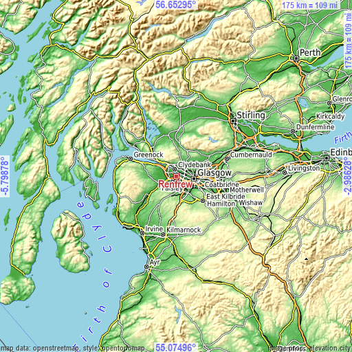
| Width | 5.48 km = 3.4 mi | 10.97 km = 6.8 mi | 175.5 km = 109.1 mi |
| Height | 5.48 km = 3.4 mi | 10.97 km = 6.8 mi | 175.4 km = 109 mi |
| ↑Max Latitude | 55.896617° | 55.921249° | 56.65295° |
| Latitude at center | 55.87197° | 55.87197° | 55.87197° |
| ↓Min Latitude | 55.847307° | 55.822628° | 55.07496° |
| ← Min Longitude | -4.436475° | -4.480421° | -5.79878° |
| Longitude center | -4.39253° | -4.39253° | -4.39253° |
| →Max Longitude | -4.348585° | -4.304639° | -2.98628° |
Nearby cities:
Cities around Renfrew sort by population:
• Paisley elevation 50 m
5.1 km,  209°
209°
• Bearsden 49 m
6.1 km,  37°
37°
• Clydebank 9 m
3.4 km,  345°
345°
• Barrhead 58 m
8.1 km,  180°
180°
• Erskine 25 m
4.8 km,  311°
311°
• Linwood 11 m
6.8 km,  247°
247°
• Duntocher 57 m
6 km, 346°
• Elderslie 32 m
7.2 km,  233°
233°
• Faifley 104 m
6.3 km,  4°
4°
• Old Kilpatrick 26 m
6.9 km,  324°
324°
• Bishopton 31 m
8.2 km,  300°
300°
• Inchinnan 16 m
3.5 km, 304°
Multilingual:
 En español:
Renfrew elevación 7 m.
 En France:
Renfrew élévation 7 m.


Sources and notes:
- [note 1] Map square and city borders are not equal. Map elevation data is calculated only from area inside that square.
- [src 1] Elevation data from geonames database provided with same terms of usage.
- [src 2] The elevation map of Renfrew is generated using elevation data from NASA's 3 arcsec (90m) resolution SRTM data.
- [src 3] Base (background) map © OpenStreetMap contributors tiles are generated by Geofabrik and OpenTopoMap.
Copyright & License:
This Renfrew Elevation Map is licensed under CC BY-SA. You may reuse any part from this page, if you give a proper credit by linking to this URL:
 More info on terms of use page.