Bedworth elevation
Bedworth (England, Warwickshire), United Kingdom elevation is 112 meters and Bedworth elevation in feet is 367 ft above sea level [src 1]. Bedworth is a populated place (feature code) with elevation that is 40 meters (131 ft) bigger than average city elevation in United Kingdom.
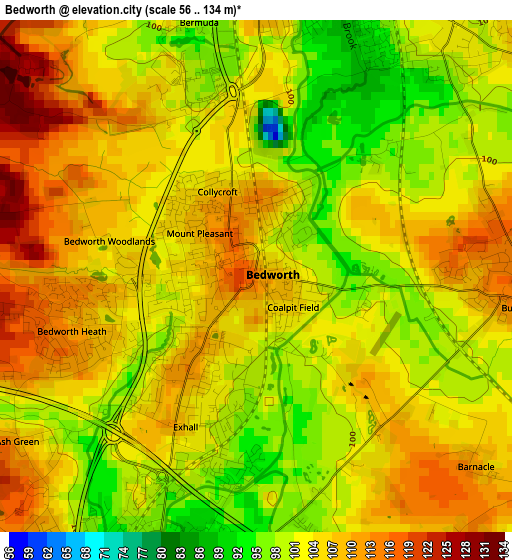
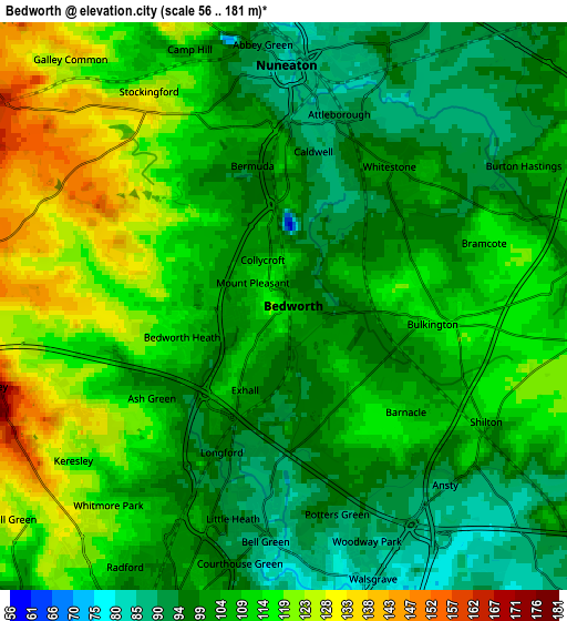
Below is the Elevation map of Bedworth, which displays elevation range with different colors. Scale of the first map is from 56 to 134 m (184 to 440 ft) with average elevation of 103.9 meters (=341 ft) [note 1]
These maps also provides idea of topography and contour of this city, they are displayed at different zoom levels. More info about maps, scale and edge coordinates you can find below images.
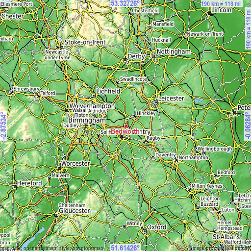
| \ | Map #1 | Map #2 | Topo.Map |
| Scale [m] | 56..134 m | 56..181 m | × |
| Scale [ft] | 184..440 ft | 184..594 ft | × |
| Average | 103.9 m = 341 ft | 107.4 m = 352 ft | × |
| Width | 5.95 km = 3.7 mi | 11.9 km = 7.4 mi | 190.5 km = 118.4 mi |
| Height | 5.95 km = 3.7 mi | 11.9 km = 7.4 mi | 190.5 km = 118.4 mi |
| ↑Max Latitude | 52.505857° | 52.532597° | 53.32726° |
| Latitude at center | 52.4791° | 52.4791° | 52.4791° |
| ↓Min Latitude | 52.452327° | 52.425538° | 51.61426° |
| ← Min Longitude | -1.513035° | -1.556981° | -2.87534° |
| Longitude center | -1.46909° | -1.46909° | -1.46909° |
| →Max Longitude | -1.425145° | -1.381199° | -0.06284° |
Nearby cities:
Cities around Bedworth sort by population:
• Coventry elevation 89 m
8.6 km,  199°
199°
• Nuneaton 85 m
4.9 km,  3°
3°
• Hinckley 113 m
9.2 km,  43°
43°
• Hartshill 127 m
8.5 km,  334°
334°
• Atherstone 89 m
11.9 km, 333°
• Attleborough 87 m
3.9 km,  14°
14°
• Brandon 84 m
11.5 km,  155°
155°
• Wolston 75 m
12.4 km, 156°
• Keresley 124 m
5.3 km,  234°
234°
• Exhall 104 m
1.8 km,  207°
207°
• Stoke Golding 113 m
10.9 km,  21°
21°
• Brinklow 93 m
10.4 km,  136°
136°
Multilingual:
 En español:
Bedworth elevación 112 m.
 En France:
Bedworth élévation 112 m.
 Auf Deutsch:
Bedworth höhe über dem Meeresspiegel ist 112 m.

Sources and notes:
- [note 1] Map square and city borders are not equal. Map elevation data is calculated only from area inside that square.
- [src 1] Elevation data from geonames database provided with same terms of usage.
- [src 2] The elevation map of Bedworth is generated using elevation data from NASA's 3 arcsec (90m) resolution SRTM data.
- [src 3] Base (background) map © OpenStreetMap contributors tiles are generated by Geofabrik and OpenTopoMap.
Copyright & License:
This Bedworth Elevation Map is licensed under CC BY-SA. You may reuse any part from this page, if you give a proper credit by linking to this URL:
 More info on terms of use page.