Brandon elevation
Brandon (England, Warwickshire), United Kingdom elevation is 84 meters and Brandon elevation in feet is 276 ft above sea level [src 1]. Brandon is a populated place (feature code) with elevation that is 12 meters (39 ft) bigger than average city elevation in United Kingdom.
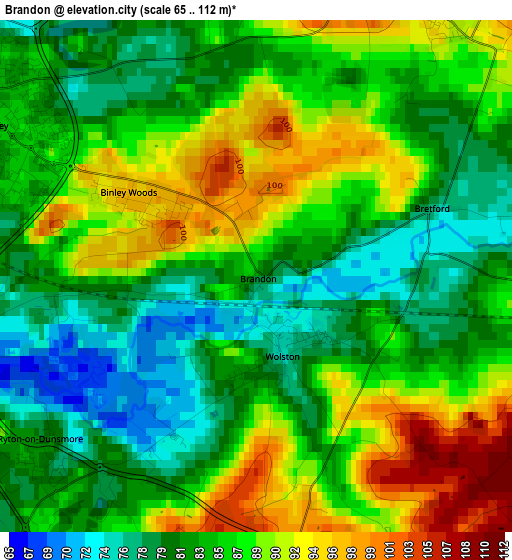
Below is the Elevation map of Brandon, which displays elevation range with different colors. Scale of the first map is from 65 to 112 m (213 to 367 ft) with average elevation of 85.4 meters (=280 ft) [note 1]
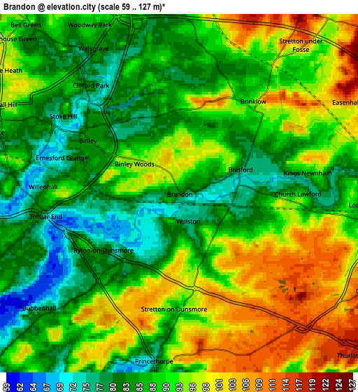
These maps also provides idea of topography and contour of this city, they are displayed at different zoom levels. More info about maps, scale and edge coordinates you can find below images.
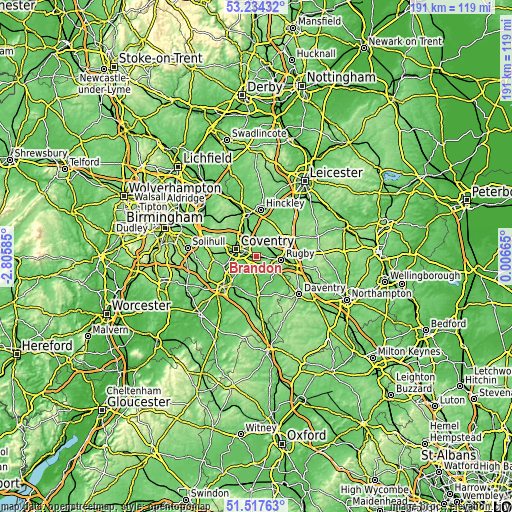
| \ | Map #1 | Map #2 | Topo.Map |
| Scale [m] | 65..112 m | 59..127 m | × |
| Scale [ft] | 213..367 ft | 194..417 ft | × |
| Average | 85.4 m = 280 ft | 90.2 m = 296 ft | × |
| Width | 5.96 km = 3.7 mi | 11.93 km = 7.4 mi | 190.9 km = 118.6 mi |
| Height | 5.96 km = 3.7 mi | 11.93 km = 7.4 mi | 190.9 km = 118.6 mi |
| ↑Max Latitude | 52.411134° | 52.437933° | 53.23432° |
| Latitude at center | 52.38432° | 52.38432° | 52.38432° |
| ↓Min Latitude | 52.357489° | 52.330642° | 51.51763° |
| ← Min Longitude | -1.443545° | -1.487491° | -2.80585° |
| Longitude center | -1.3996° | -1.3996° | -1.3996° |
| →Max Longitude | -1.355655° | -1.311709° | 0.00665° |
Nearby cities:
Cities around Brandon sort by population:
• Coventry elevation 89 m
8 km,  287°
287°
• Rugby 120 m
9.3 km,  99°
99°
• Bedworth 112 m
11.5 km,  335°
335°
• Long Lawford 92 m
6.3 km,  92°
92°
• Wolston 75 m
0.8 km,  160°
160°
• Keresley 124 m
11.7 km,  309°
309°
• Dunchurch 122 m
9 km,  125°
125°
• Exhall 104 m
10.5 km,  328°
328°
• Ryton on Dunsmore 80 m
3 km,  229°
229°
• Long Itchington 75 m
11.2 km,  177°
177°
• Stockton 102 m
12.8 km,  168°
168°
• Brinklow 93 m
3.8 km,  39°
39°
Multilingual:
 En español:
Brandon elevación 84 m.
 En France:
Brandon élévation 84 m.


Sources and notes:
- [note 1] Map square and city borders are not equal. Map elevation data is calculated only from area inside that square.
- [src 1] Elevation data from geonames database provided with same terms of usage.
- [src 2] The elevation map of Brandon is generated using elevation data from NASA's 3 arcsec (90m) resolution SRTM data.
- [src 3] Base (background) map © OpenStreetMap contributors tiles are generated by Geofabrik and OpenTopoMap.
Copyright & License:
This Brandon Elevation Map is licensed under CC BY-SA. You may reuse any part from this page, if you give a proper credit by linking to this URL:
 More info on terms of use page.