Bridgnorth elevation
Bridgnorth (England, Shropshire), United Kingdom elevation is 74 meters and Bridgnorth elevation in feet is 243 ft above sea level [src 1]. Bridgnorth is a populated place (feature code) with elevation that is 2 meters (7 ft) bigger than average city elevation in United Kingdom.
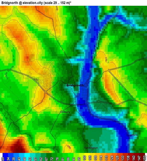
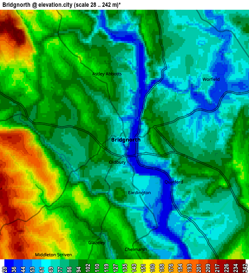
Below is the Elevation map of Bridgnorth, which displays elevation range with different colors. Scale of the first map is from 29 to 152 m (95 to 499 ft) with average elevation of 80.5 meters (=264 ft) [note 1]
These maps also provides idea of topography and contour of this city, they are displayed at different zoom levels. More info about maps, scale and edge coordinates you can find below images.
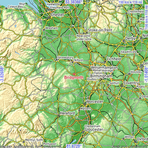
| \ | Map #1 | Map #2 | Topo.Map |
| Scale [m] | 29..152 m | 28..242 m | × |
| Scale [ft] | 95..499 ft | 92..794 ft | × |
| Average | 80.5 m = 264 ft | 100 m = 328 ft | × |
| Width | 5.94 km = 3.7 mi | 11.89 km = 7.4 mi | 190.2 km = 118.2 mi |
| Height | 5.94 km = 3.7 mi | 11.89 km = 7.4 mi | 190.2 km = 118.2 mi |
| ↑Max Latitude | 52.563332° | 52.590037° | 53.38366° |
| Latitude at center | 52.53661° | 52.53661° | 52.53661° |
| ↓Min Latitude | 52.509872° | 52.483118° | 51.6729° |
| ← Min Longitude | -2.464275° | -2.508221° | -3.82658° |
| Longitude center | -2.42033° | -2.42033° | -2.42033° |
| →Max Longitude | -2.376385° | -2.332439° | -1.01408° |
Nearby cities:
Cities around Bridgnorth sort by population:
• Ryton elevation 66 m
10.1 km,  28°
28°
• Shifnal 91 m
15.2 km,  12°
12°
• Broseley 155 m
9.5 km,  333°
333°
• Albrighton 95 m
14.6 km,  40°
40°
• Highley 108 m
10.1 km,  165°
165°
• Much Wenlock 157 m
11.4 km,  305°
305°
• Pattingham 121 m
12 km,  60°
60°
• Ironbridge 71 m
11 km,  336°
336°
• Alveley 115 m
9.9 km,  153°
153°
• Harley 95 m
14 km,  300°
300°
• Romsley 133 m
11.9 km,  143°
143°
• Madeley 107 m
10.8 km,  355°
355°
Multilingual:
 En español:
Bridgnorth elevación 74 m.
 En France:
Bridgnorth élévation 74 m.
 Auf Deutsch:
Bridgnorth höhe über dem Meeresspiegel ist 74 m.

Sources and notes:
- [note 1] Map square and city borders are not equal. Map elevation data is calculated only from area inside that square.
- [src 1] Elevation data from geonames database provided with same terms of usage.
- [src 2] The elevation map of Bridgnorth is generated using elevation data from NASA's 3 arcsec (90m) resolution SRTM data.
- [src 3] Base (background) map © OpenStreetMap contributors tiles are generated by Geofabrik and OpenTopoMap.
Copyright & License:
This Bridgnorth Elevation Map is licensed under CC BY-SA. You may reuse any part from this page, if you give a proper credit by linking to this URL:
 More info on terms of use page.