Briton Ferry elevation
Briton Ferry (Wales, Neath Port Talbot), United Kingdom elevation is 25 meters and Briton Ferry elevation in feet is 82 ft above sea level [src 1]. Briton Ferry is a populated place (feature code) with elevation that is 47 meters (154 ft) smaller than average city elevation in United Kingdom.
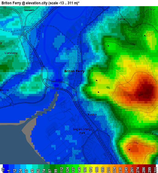
Below is the Elevation map of Briton Ferry, which displays elevation range with different colors. Scale of the first map is from -13 to 311 m (-43 to 1020 ft) with average elevation of 67.4 meters (=221 ft) [note 1]
These maps also provides idea of topography and contour of this city, they are displayed at different zoom levels. More info about maps, scale and edge coordinates you can find below images.
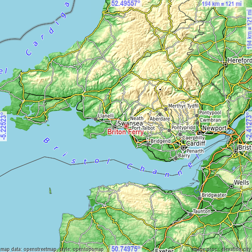
| \ | Map #1 | Map #2 | Topo.Map |
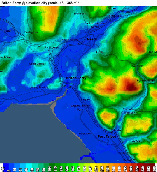
| Scale [m] | -13..311 m | -13..368 m | × |
| Scale [ft] | -43..1020 ft | -43..1207 ft | × |
| Average | 67.4 m = 221 ft | 89.6 m = 294 ft | × |
| Width | 6.07 km = 3.8 mi | 12.13 km = 7.5 mi | 194.1 km = 120.6 mi |
| Height | 6.07 km = 3.8 mi | 12.13 km = 7.5 mi | 194.1 km = 120.6 mi |
| ↑Max Latitude | 51.65833° | 51.685583° | 52.49557° |
| Latitude at center | 51.63106° | 51.63106° | 51.63106° |
| ↓Min Latitude | 51.603774° | 51.576471° | 50.74975° |
| ← Min Longitude | -3.862925° | -3.906871° | -5.22523° |
| Longitude center | -3.81898° | -3.81898° | -3.81898° |
| →Max Longitude | -3.775035° | -3.731089° | -2.41273° |
Nearby cities:
Cities around Briton Ferry sort by population:
• Swansea elevation 18 m
8.7 km,  262°
262°
• Neath 13 m
3.7 km,  15°
15°
• Maesteg 129 m
11.4 km,  102°
102°
• Clydach 12 m
8.1 km,  316°
316°
• Cwmafan 50 m
4.2 km,  112°
112°
• Taibach 12 m
6.4 km,  145°
145°
• Resolven 28 m
12.3 km,  42°
42°
• Crynant 112 m
11.9 km, 24°
• Bryn 132 m
7.6 km, 102°
• Morriston 71 m
8.8 km,  299°
299°
• Landore 43 m
8.6 km,  279°
279°
• Port Talbot 10 m
5.1 km, 148°
Multilingual:
 En español:
Briton Ferry elevación 25 m.
 En France:
Briton Ferry élévation 25 m.
 Auf Deutsch:
Briton Ferry höhe über dem Meeresspiegel ist 25 m.

Sources and notes:
- [note 1] Map square and city borders are not equal. Map elevation data is calculated only from area inside that square.
- [src 1] Elevation data from geonames database provided with same terms of usage.
- [src 2] The elevation map of Briton Ferry is generated using elevation data from NASA's 3 arcsec (90m) resolution SRTM data.
- [src 3] Base (background) map © OpenStreetMap contributors tiles are generated by Geofabrik and OpenTopoMap.
Copyright & License:
This Briton Ferry Elevation Map is licensed under CC BY-SA. You may reuse any part from this page, if you give a proper credit by linking to this URL:
 More info on terms of use page.