Bulford elevation
Bulford (England, Wiltshire), United Kingdom elevation is 80 meters and Bulford elevation in feet is 262 ft above sea level [src 1]. Bulford is a seat of a third-order administrative division (feature code) with elevation that is 8 meters (26 ft) bigger than average city elevation in United Kingdom.
Below is the Elevation map of Bulford, which displays elevation range with different colors. Scale of the first map is from 62 to 197 m (203 to 646 ft) with average elevation of 100.2 meters (=329 ft) [note 1]
These maps also provides idea of topography and contour of this city, they are displayed at different zoom levels. More info about maps, scale and edge coordinates you can find below images.
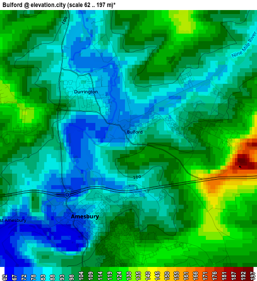
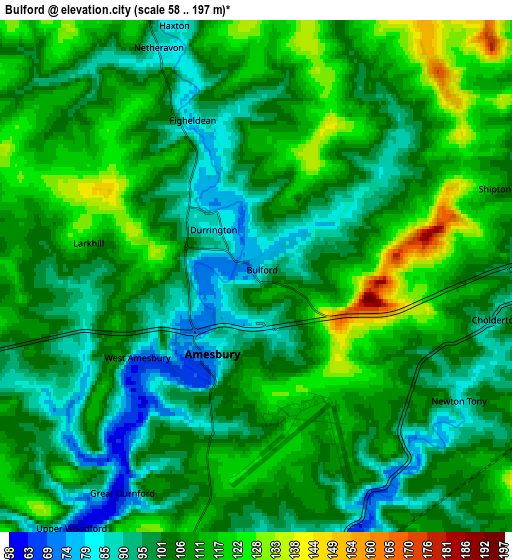
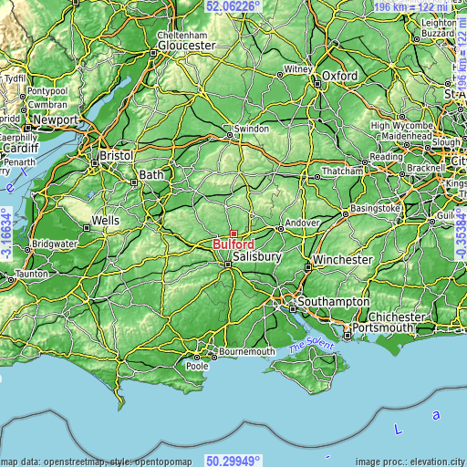
| \ | Map #1 | Map #2 | Topo.Map |
| Scale [m] | 62..197 m | 58..197 m | × |
| Scale [ft] | 203..646 ft | 190..646 ft | × |
| Average | 100.2 m = 329 ft | 105.9 m = 347 ft | × |
| Width | 6.12 km = 3.8 mi | 12.25 km = 7.6 mi | 196 km = 121.8 mi |
| Height | 6.12 km = 3.8 mi | 12.25 km = 7.6 mi | 196 km = 121.8 mi |
| ↑Max Latitude | 51.216834° | 51.244352° | 52.06226° |
| Latitude at center | 51.1893° | 51.1893° | 51.1893° |
| ↓Min Latitude | 51.161749° | 51.134182° | 50.29949° |
| ← Min Longitude | -1.804035° | -1.847981° | -3.16634° |
| Longitude center | -1.76009° | -1.76009° | -1.76009° |
| →Max Longitude | -1.716145° | -1.672199° | -0.35384° |
Nearby cities:
Cities around Bulford sort by population:
• Amesbury elevation 81 m
2.1 km,  222°
222°
• Tidworth 110 m
8.2 km,  55°
55°
• Lark Hill 126 m
4.1 km,  286°
286°
• Shrewton 85 m
9.9 km,  271°
271°
• Netheravon 83 m
5.6 km,  337°
337°
• Rushall 145 m
11.2 km, 339°
• Winterbourne Stoke 93 m
9.9 km,  255°
255°
• Woodford 85 m
9.6 km,  212°
212°
• Durnford 70 m
7.4 km, 212°
• Allington 103 m
6.1 km,  136°
136°
• Milston 77 m
2 km, 341°
• Durrington 80 m
1.3 km,  321°
321°
Multilingual:
 En español:
Bulford elevación 80 m.
 En France:
Bulford élévation 80 m.


Sources and notes:
- [note 1] Map square and city borders are not equal. Map elevation data is calculated only from area inside that square.
- [src 1] Elevation data from geonames database provided with same terms of usage.
- [src 2] The elevation map of Bulford is generated using elevation data from NASA's 3 arcsec (90m) resolution SRTM data.
- [src 3] Base (background) map © OpenStreetMap contributors tiles are generated by Geofabrik and OpenTopoMap.
Copyright & License:
This Bulford Elevation Map is licensed under CC BY-SA. You may reuse any part from this page, if you give a proper credit by linking to this URL:
 More info on terms of use page.