Tidworth elevation
Tidworth (England, Wiltshire), United Kingdom elevation is 110 meters and Tidworth elevation in feet is 361 ft above sea level [src 1]. Tidworth is a populated place (feature code) with elevation that is 38 meters (125 ft) bigger than average city elevation in United Kingdom.
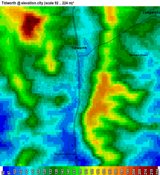
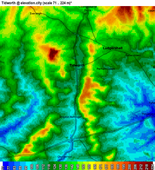
Below is the Elevation map of Tidworth, which displays elevation range with different colors. Scale of the first map is from 92 to 224 m (302 to 735 ft) with average elevation of 134.1 meters (=440 ft) [note 1]
These maps also provides idea of topography and contour of this city, they are displayed at different zoom levels. More info about maps, scale and edge coordinates you can find below images.
| \ | Map #1 | Map #2 | Topo.Map |
| Scale [m] | 92..224 m | 71..224 m | × |
| Scale [ft] | 302..735 ft | 233..735 ft | × |
| Average | 134.1 m = 440 ft | 126.4 m = 415 ft | × |
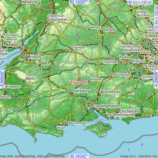
| Width | 6.12 km = 3.8 mi | 12.24 km = 7.6 mi | 195.8 km = 121.7 mi |
| Height | 6.12 km = 3.8 mi | 12.24 km = 7.6 mi | 195.8 km = 121.7 mi |
| ↑Max Latitude | 51.258929° | 51.286422° | 52.10357° |
| Latitude at center | 51.23142° | 51.23142° | 51.23142° |
| ↓Min Latitude | 51.203894° | 51.176352° | 50.34242° |
| ← Min Longitude | -1.707185° | -1.751131° | -3.06949° |
| Longitude center | -1.66324° | -1.66324° | -1.66324° |
| →Max Longitude | -1.619295° | -1.575349° | -0.25699° |
Nearby cities:
Cities around Tidworth sort by population:
• Andover elevation 71 m
12 km,  100°
100°
• Amesbury 81 m
10.3 km,  232°
232°
• Bulford 80 m
8.2 km,  235°
235°
• Ludgershall 128 m
3.9 km,  46°
46°
• Anna Valley 60 m
11.7 km,  111°
111°
• Lark Hill 126 m
11.2 km,  251°
251°
• Abbotts Ann 64 m
10.2 km,  116°
116°
• Netheravon 83 m
8.9 km,  273°
273°
• Collingbourne Kingston 144 m
7.7 km,  2°
2°
• Allington 103 m
9.4 km,  195°
195°
• Durrington 80 m
8.4 km, 244°
• Milston 77 m
7.9 km, 249°
Multilingual:
 En español:
Tidworth elevación 110 m.
 En France:
Tidworth élévation 110 m.
 Auf Deutsch:
Tidworth höhe über dem Meeresspiegel ist 110 m.

Sources and notes:
- [note 1] Map square and city borders are not equal. Map elevation data is calculated only from area inside that square.
- [src 1] Elevation data from geonames database provided with same terms of usage.
- [src 2] The elevation map of Tidworth is generated using elevation data from NASA's 3 arcsec (90m) resolution SRTM data.
- [src 3] Base (background) map © OpenStreetMap contributors tiles are generated by Geofabrik and OpenTopoMap.
Copyright & License:
This Tidworth Elevation Map is licensed under CC BY-SA. You may reuse any part from this page, if you give a proper credit by linking to this URL:
 More info on terms of use page.