Burry Port elevation
Burry Port (Wales, Carmarthenshire), United Kingdom elevation is 8 meters and Burry Port elevation in feet is 26 ft above sea level [src 1]. Burry Port is a populated place (feature code) with elevation that is 64 meters (210 ft) smaller than average city elevation in United Kingdom.
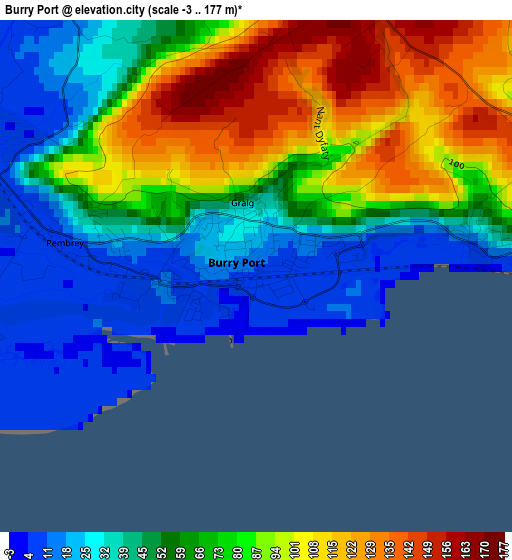
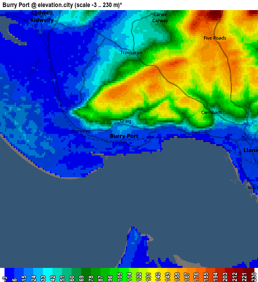
Below is the Elevation map of Burry Port, which displays elevation range with different colors. Scale of the first map is from -3 to 177 m (-10 to 581 ft) with average elevation of 65.1 meters (=214 ft) [note 1]
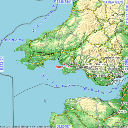
These maps also provides idea of topography and contour of this city, they are displayed at different zoom levels. More info about maps, scale and edge coordinates you can find below images.
| \ | Map #1 | Map #2 | Topo.Map |
| Scale [m] | -3..177 m | -3..230 m | × |
| Scale [ft] | -10..581 ft | -10..755 ft | × |
| Average | 65.1 m = 214 ft | 58.7 m = 193 ft | × |
| Width | 6.06 km = 3.8 mi | 12.12 km = 7.5 mi | 193.9 km = 120.5 mi |
| Height | 6.06 km = 3.8 mi | 12.12 km = 7.5 mi | 193.9 km = 120.5 mi |
| ↑Max Latitude | 51.711588° | 51.738809° | 52.54784° |
| Latitude at center | 51.68435° | 51.68435° | 51.68435° |
| ↓Min Latitude | 51.657096° | 51.629826° | 50.80407° |
| ← Min Longitude | -4.290815° | -4.334761° | -5.65312° |
| Longitude center | -4.24687° | -4.24687° | -4.24687° |
| →Max Longitude | -4.202925° | -4.158979° | -2.84062° |
Nearby cities:
Cities around Burry Port sort by population:
• Llanelli elevation 13 m
5.9 km,  92°
92°
• Gorseinon 23 m
14.2 km,  96°
96°
• Tumble 197 m
14.5 km,  40°
40°
• Kidwelly 16 m
7 km,  326°
326°
• Pen-clawdd 30 m
11.3 km,  115°
115°
• Pontyberem 50 m
11.7 km,  27°
27°
• Trimsaran 56 m
4 km,  5°
5°
• Three Crosses 132 m
14.1 km, 115°
• Pontyates 15 m
7.8 km,  15°
15°
• Grovesend 49 m
14.4 km, 89°
• Crofty 12 m
9.8 km, 124°
• Llansteffan 32 m
13.9 km,  314°
314°
Multilingual:
 En español:
Burry Port elevación 8 m.
 En France:
Burry Port élévation 8 m.
 Auf Deutsch:
Burry Port höhe über dem Meeresspiegel ist 8 m.

Sources and notes:
- [note 1] Map square and city borders are not equal. Map elevation data is calculated only from area inside that square.
- [src 1] Elevation data from geonames database provided with same terms of usage.
- [src 2] The elevation map of Burry Port is generated using elevation data from NASA's 3 arcsec (90m) resolution SRTM data.
- [src 3] Base (background) map © OpenStreetMap contributors tiles are generated by Geofabrik and OpenTopoMap.
Copyright & License:
This Burry Port Elevation Map is licensed under CC BY-SA. You may reuse any part from this page, if you give a proper credit by linking to this URL:
 More info on terms of use page.