Bury St Edmunds elevation
Bury St Edmunds (England, Suffolk), United Kingdom elevation is 52 meters and Bury St Edmunds elevation in feet is 171 ft above sea level [src 1]. Bury St Edmunds is a populated place (feature code) with elevation that is 20 meters (66 ft) smaller than average city elevation in United Kingdom.
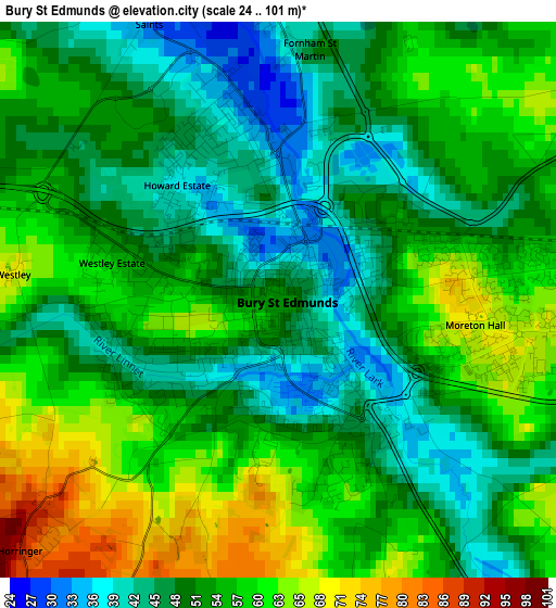
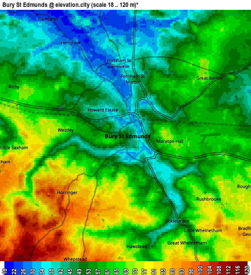
Below is the Elevation map of Bury St Edmunds, which displays elevation range with different colors. Scale of the first map is from 24 to 101 m (79 to 331 ft) with average elevation of 52.8 meters (=173 ft) [note 1]
These maps also provides idea of topography and contour of this city, they are displayed at different zoom levels. More info about maps, scale and edge coordinates you can find below images.
| \ | Map #1 | Map #2 | Topo.Map |
| Scale [m] | 24..101 m | 18..120 m | × |
| Scale [ft] | 79..331 ft | 59..394 ft | × |
| Average | 52.8 m = 173 ft | 59.9 m = 197 ft | × |
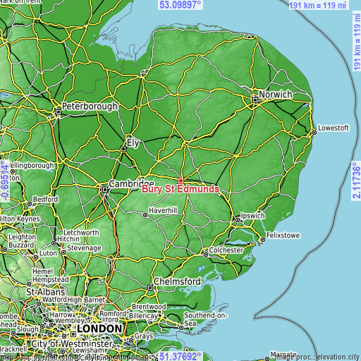
| Width | 5.98 km = 3.7 mi | 11.97 km = 7.4 mi | 191.5 km = 119 mi |
| Height | 5.98 km = 3.7 mi | 11.97 km = 7.4 mi | 191.5 km = 119 mi |
| ↑Max Latitude | 52.273198° | 52.30008° | 53.09897° |
| Latitude at center | 52.2463° | 52.2463° | 52.2463° |
| ↓Min Latitude | 52.219386° | 52.192455° | 51.37692° |
| ← Min Longitude | 0.667165° | 0.623219° | -0.69514° |
| Longitude center | 0.71111° | 0.71111° | 0.71111° |
| →Max Longitude | 0.755055° | 0.799001° | 2.11736° |
Nearby cities:
Cities around Bury St Edmunds sort by population:
• Thetford elevation 24 m
19.1 km,  7°
7°
• Stowmarket 32 m
20.5 km,  108°
108°
• Mildenhall 11 m
17.5 km,  308°
308°
• Elmswell 70 m
13.8 km,  94°
94°
• Glemsford 70 m
16.1 km,  190°
190°
• Thurston 46 m
6.6 km,  84°
84°
• Long Melford 36 m
19.1 km,  178°
178°
• Ixworth 39 m
10.2 km,  55°
55°
• Woolpit 65 m
12.3 km,  101°
101°
• Great Barton 67 m
4.8 km,  52°
52°
• Lavenham 66 m
16.4 km,  159°
159°
• Haughley 49 m
17.8 km, 99°
Multilingual:
 En español:
Bury St Edmunds elevación 52 m.
 En France:
Bury St Edmunds élévation 52 m.
 Auf Deutsch:
Bury St Edmunds höhe über dem Meeresspiegel ist 52 m.

Sources and notes:
- [note 1] Map square and city borders are not equal. Map elevation data is calculated only from area inside that square.
- [src 1] Elevation data from geonames database provided with same terms of usage.
- [src 2] The elevation map of Bury St Edmunds is generated using elevation data from NASA's 3 arcsec (90m) resolution SRTM data.
- [src 3] Base (background) map © OpenStreetMap contributors tiles are generated by Geofabrik and OpenTopoMap.
Copyright & License:
This Bury St Edmunds Elevation Map is licensed under CC BY-SA. You may reuse any part from this page, if you give a proper credit by linking to this URL:
 More info on terms of use page.