Camborne elevation
Camborne (England, Cornwall), United Kingdom elevation is 101 meters and Camborne elevation in feet is 331 ft above sea level [src 1]. Camborne is a populated place (feature code) with elevation that is 29 meters (95 ft) bigger than average city elevation in United Kingdom.
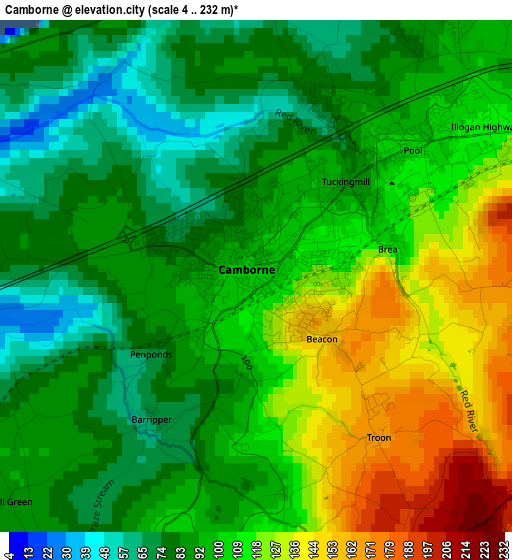
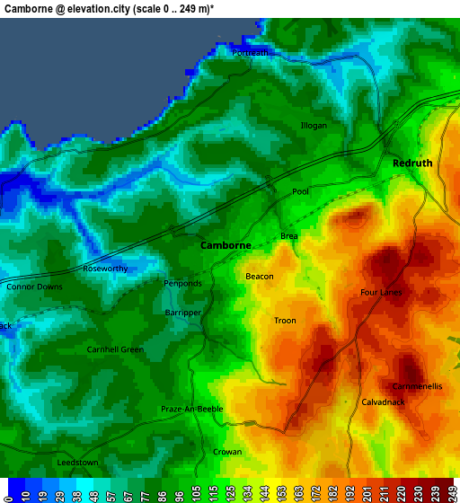
Below is the Elevation map of Camborne, which displays elevation range with different colors. Scale of the first map is from 4 to 232 m (13 to 761 ft) with average elevation of 101 meters (=331 ft) [note 1]
These maps also provides idea of topography and contour of this city, they are displayed at different zoom levels. More info about maps, scale and edge coordinates you can find below images.
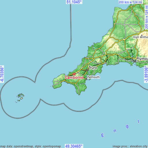
| \ | Map #1 | Map #2 | Topo.Map |
| Scale [m] | 4..232 m | 0..249 m | × |
| Scale [ft] | 13..761 ft | 0..817 ft | × |
| Average | 101 m = 331 ft | 109.7 m = 360 ft | × |
| Width | 6.25 km = 3.9 mi | 12.51 km = 7.8 mi | 200.1 km = 124.3 mi |
| Height | 6.25 km = 3.9 mi | 12.51 km = 7.8 mi | 200.1 km = 124.3 mi |
| ↑Max Latitude | 50.241174° | 50.269271° | 51.1045° |
| Latitude at center | 50.21306° | 50.21306° | 50.21306° |
| ↓Min Latitude | 50.18493° | 50.156783° | 49.30465° |
| ← Min Longitude | -5.341255° | -5.385201° | -6.70356° |
| Longitude center | -5.29731° | -5.29731° | -5.29731° |
| →Max Longitude | -5.253365° | -5.209419° | -3.89106° |
Nearby cities:
Cities around Camborne sort by population:
• Redruth elevation 135 m
5.7 km,  66°
66°
• Helston 60 m
12.4 km,  171°
171°
• Hayle 6 m
9.4 km,  249°
249°
• Mount Hawke 115 m
10 km,  39°
39°
• Stithians 134 m
8.9 km,  107°
107°
• Four Lanes 216 m
4.3 km, 107°
• Chacewater 61 m
11.1 km,  63°
63°
• Perranwell 22 m
12.6 km,  89°
89°
• Uny Lelant 34 m
10.7 km, 251°
• St. Day 128 m
8.5 km, 69°
• Germoe 76 m
12.3 km,  208°
208°
• Wendron 135 m
9.5 km,  159°
159°
Multilingual:
 En español:
Camborne elevación 101 m.
 En France:
Camborne élévation 101 m.
 Auf Deutsch:
Camborne höhe über dem Meeresspiegel ist 101 m.

Sources and notes:
- [note 1] Map square and city borders are not equal. Map elevation data is calculated only from area inside that square.
- [src 1] Elevation data from geonames database provided with same terms of usage.
- [src 2] The elevation map of Camborne is generated using elevation data from NASA's 3 arcsec (90m) resolution SRTM data.
- [src 3] Base (background) map © OpenStreetMap contributors tiles are generated by Geofabrik and OpenTopoMap.
Copyright & License:
This Camborne Elevation Map is licensed under CC BY-SA. You may reuse any part from this page, if you give a proper credit by linking to this URL:
 More info on terms of use page.