Chalford elevation
Chalford (England, Gloucestershire), United Kingdom elevation is 160 meters and Chalford elevation in feet is 525 ft above sea level [src 1]. Chalford is a populated place (feature code) with elevation that is 88 meters (289 ft) bigger than average city elevation in United Kingdom.
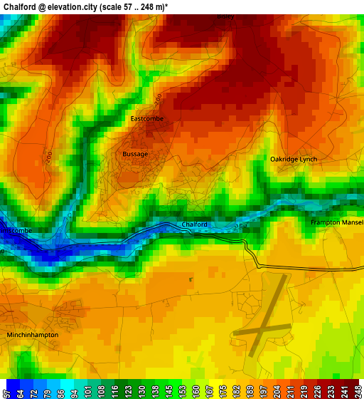
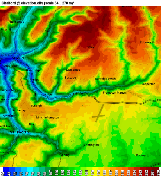
Below is the Elevation map of Chalford, which displays elevation range with different colors. Scale of the first map is from 57 to 248 m (187 to 814 ft) with average elevation of 179.1 meters (=588 ft) [note 1]
These maps also provides idea of topography and contour of this city, they are displayed at different zoom levels. More info about maps, scale and edge coordinates you can find below images.
| \ | Map #1 | Map #2 | Topo.Map |
| Scale [m] | 57..248 m | 34..270 m | × |
| Scale [ft] | 187..814 ft | 112..886 ft | × |
| Average | 179.1 m = 588 ft | 165.2 m = 542 ft | × |
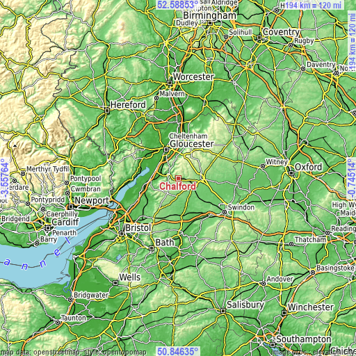
| Width | 6.05 km = 3.8 mi | 12.11 km = 7.5 mi | 193.7 km = 120.4 mi |
| Height | 6.05 km = 3.8 mi | 12.11 km = 7.5 mi | 193.7 km = 120.4 mi |
| ↑Max Latitude | 51.753043° | 51.780239° | 52.58853° |
| Latitude at center | 51.72583° | 51.72583° | 51.72583° |
| ↓Min Latitude | 51.698601° | 51.671356° | 50.84635° |
| ← Min Longitude | -2.195335° | -2.239281° | -3.55764° |
| Longitude center | -2.15139° | -2.15139° | -2.15139° |
| →Max Longitude | -2.107445° | -2.063499° | -0.74514° |
Nearby cities:
Cities around Chalford sort by population:
• Stroud elevation 83 m
4.3 km,  308°
308°
• Cirencester 112 m
12.4 km,  93°
93°
• Stonehouse 42 m
9.5 km,  286°
286°
• Tetbury 118 m
9.6 km,  184°
184°
• Nailsworth 67 m
5.9 km,  232°
232°
• Stratton 142 m
11.9 km, 85°
• Minchinhampton 191 m
3.1 km, 227°
• Coates 145 m
8.3 km,  104°
104°
• Painswick 148 m
7.3 km,  335°
335°
• Brimscombe 98 m
2.4 km,  253°
253°
• Eastington 32 m
12.3 km,  281°
281°
• Avening 119 m
5.2 km,  193°
193°
Multilingual:
 En español:
Chalford elevación 160 m.
 En France:
Chalford élévation 160 m.
 Auf Deutsch:
Chalford höhe über dem Meeresspiegel ist 160 m.

Sources and notes:
- [note 1] Map square and city borders are not equal. Map elevation data is calculated only from area inside that square.
- [src 1] Elevation data from geonames database provided with same terms of usage.
- [src 2] The elevation map of Chalford is generated using elevation data from NASA's 3 arcsec (90m) resolution SRTM data.
- [src 3] Base (background) map © OpenStreetMap contributors tiles are generated by Geofabrik and OpenTopoMap.
Copyright & License:
This Chalford Elevation Map is licensed under CC BY-SA. You may reuse any part from this page, if you give a proper credit by linking to this URL:
 More info on terms of use page.