Tetbury elevation
Tetbury (England, Gloucestershire), United Kingdom elevation is 118 meters and Tetbury elevation in feet is 387 ft above sea level [src 1]. Tetbury is a populated place (feature code) with elevation that is 46 meters (151 ft) bigger than average city elevation in United Kingdom.
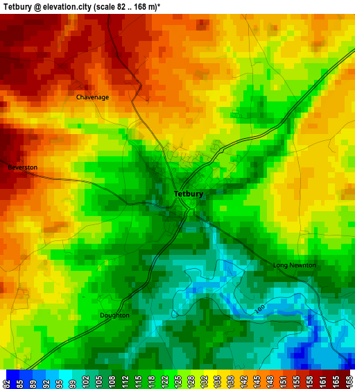
Below is the Elevation map of Tetbury, which displays elevation range with different colors. Scale of the first map is from 82 to 168 m (269 to 551 ft) with average elevation of 127.8 meters (=419 ft) [note 1]
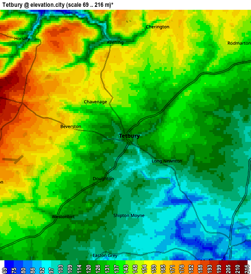
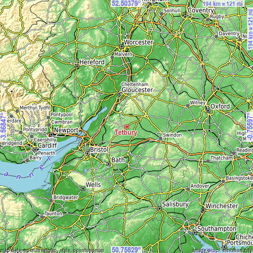
These maps also provides idea of topography and contour of this city, they are displayed at different zoom levels. More info about maps, scale and edge coordinates you can find below images.
| \ | Map #1 | Map #2 | Topo.Map |
| Scale [m] | 82..168 m | 69..216 m | × |
| Scale [ft] | 269..551 ft | 226..709 ft | × |
| Average | 127.8 m = 419 ft | 132.3 m = 434 ft | × |
| Width | 6.06 km = 3.8 mi | 12.13 km = 7.5 mi | 194.1 km = 120.6 mi |
| Height | 6.06 km = 3.8 mi | 12.13 km = 7.5 mi | 194.1 km = 120.6 mi |
| ↑Max Latitude | 51.666705° | 51.693953° | 52.50379° |
| Latitude at center | 51.63944° | 51.63944° | 51.63944° |
| ↓Min Latitude | 51.612159° | 51.584862° | 50.75829° |
| ← Min Longitude | -2.206165° | -2.250111° | -3.56847° |
| Longitude center | -2.16222° | -2.16222° | -2.16222° |
| →Max Longitude | -2.118275° | -2.074329° | -0.75597° |
Nearby cities:
Cities around Tetbury sort by population:
• Chalford elevation 160 m
9.6 km,  4°
4°
• Malmesbury 82 m
7.8 km,  144°
144°
• Nailsworth 67 m
7.2 km,  326°
326°
• Minchinhampton 191 m
7.6 km,  348°
348°
• Coates 145 m
11.6 km,  49°
49°
• Brimscombe 98 m
9.1 km, 349°
• Sherston 116 m
8.3 km,  204°
204°
• Avening 119 m
4.5 km, 354°
• Luckington 124 m
10.9 km,  210°
210°
• Norton 97 m
8.9 km,  181°
181°
• Charlton 92 m
8.6 km,  121°
121°
• Hankerton 93 m
8.6 km,  108°
108°
Multilingual:
 En español:
Tetbury elevación 118 m.
 En France:
Tetbury élévation 118 m.


Sources and notes:
- [note 1] Map square and city borders are not equal. Map elevation data is calculated only from area inside that square.
- [src 1] Elevation data from geonames database provided with same terms of usage.
- [src 2] The elevation map of Tetbury is generated using elevation data from NASA's 3 arcsec (90m) resolution SRTM data.
- [src 3] Base (background) map © OpenStreetMap contributors tiles are generated by Geofabrik and OpenTopoMap.
Copyright & License:
This Tetbury Elevation Map is licensed under CC BY-SA. You may reuse any part from this page, if you give a proper credit by linking to this URL:
 More info on terms of use page.