Cheshunt elevation
Cheshunt (England, Hertfordshire), United Kingdom elevation is 24 meters and Cheshunt elevation in feet is 79 ft above sea level [src 1]. Cheshunt is a populated place (feature code) with elevation that is 48 meters (157 ft) smaller than average city elevation in United Kingdom.
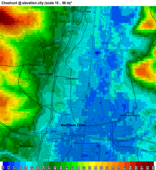
Below is the Elevation map of Cheshunt, which displays elevation range with different colors. Scale of the first map is from 10 to 98 m (33 to 322 ft) with average elevation of 34.3 meters (=113 ft) [note 1]
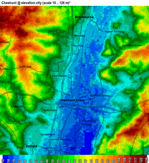
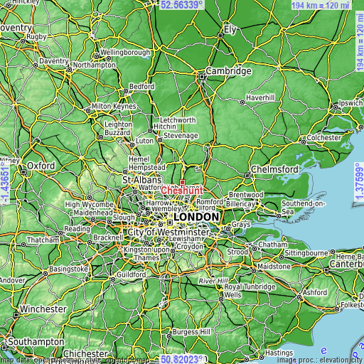
These maps also provides idea of topography and contour of this city, they are displayed at different zoom levels. More info about maps, scale and edge coordinates you can find below images.
| \ | Map #1 | Map #2 | Topo.Map |
| Scale [m] | 10..98 m | 10..126 m | × |
| Scale [ft] | 33..322 ft | 33..413 ft | × |
| Average | 34.3 m = 113 ft | 52 m = 171 ft | × |
| Width | 6.06 km = 3.8 mi | 12.11 km = 7.5 mi | 193.8 km = 120.4 mi |
| Height | 6.06 km = 3.8 mi | 12.11 km = 7.5 mi | 193.8 km = 120.4 mi |
| ↑Max Latitude | 51.727428° | 51.75464° | 52.56339° |
| Latitude at center | 51.7002° | 51.7002° | 51.7002° |
| ↓Min Latitude | 51.672956° | 51.645695° | 50.82023° |
| ← Min Longitude | -0.074205° | -0.118151° | -1.43651° |
| Longitude center | -0.03026° | -0.03026° | -0.03026° |
| →Max Longitude | 0.013685° | 0.057631° | 1.37599° |
Nearby cities:
Cities around Cheshunt sort by population:
• Enfield Town elevation 33 m
6.6 km,  214°
214°
• Hoddesdon 46 m
6.9 km,  10°
10°
• Waltham Abbey 20 m
2.3 km,  129°
129°
• Broxbourne 41 m
5.3 km, 8°
• Buckhurst Hill 82 m
9.5 km,  152°
152°
• Epping 110 m
9.7 km,  91°
91°
• Waltham Cross 20 m
1.6 km,  193°
193°
• Cuffley 69 m
5.7 km,  278°
278°
• Theydon Bois 60 m
9.3 km,  108°
108°
• Little Amwell 96 m
9.2 km,  358°
358°
• Roydon 44 m
9.3 km,  31°
31°
• Great Amwell 57 m
10 km, 5°
Multilingual:
 En español:
Cheshunt elevación 24 m.
 En France:
Cheshunt élévation 24 m.


Sources and notes:
- [note 1] Map square and city borders are not equal. Map elevation data is calculated only from area inside that square.
- [src 1] Elevation data from geonames database provided with same terms of usage.
- [src 2] The elevation map of Cheshunt is generated using elevation data from NASA's 3 arcsec (90m) resolution SRTM data.
- [src 3] Base (background) map © OpenStreetMap contributors tiles are generated by Geofabrik and OpenTopoMap.
Copyright & License:
This Cheshunt Elevation Map is licensed under CC BY-SA. You may reuse any part from this page, if you give a proper credit by linking to this URL:
 More info on terms of use page.