Hoddesdon elevation
Hoddesdon (England, Hertfordshire), United Kingdom elevation is 46 meters and Hoddesdon elevation in feet is 151 ft above sea level [src 1]. Hoddesdon is a populated place (feature code) with elevation that is 26 meters (85 ft) smaller than average city elevation in United Kingdom.
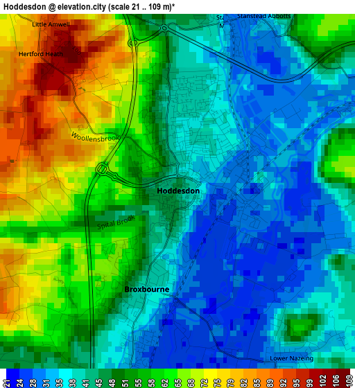
Below is the Elevation map of Hoddesdon, which displays elevation range with different colors. Scale of the first map is from 21 to 109 m (69 to 358 ft) with average elevation of 49.6 meters (=163 ft) [note 1]
These maps also provides idea of topography and contour of this city, they are displayed at different zoom levels. More info about maps, scale and edge coordinates you can find below images.
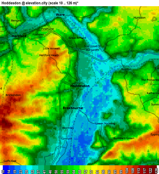
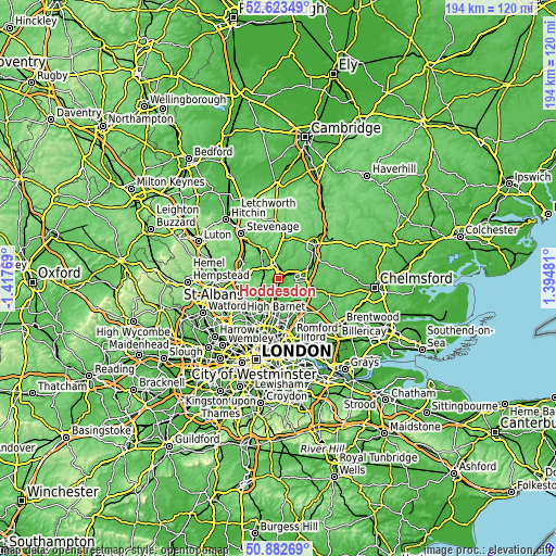
| \ | Map #1 | Map #2 | Topo.Map |
| Scale [m] | 21..109 m | 10..126 m | × |
| Scale [ft] | 69..358 ft | 33..413 ft | × |
| Average | 49.6 m = 163 ft | 59.3 m = 195 ft | × |
| Width | 6.05 km = 3.8 mi | 12.1 km = 7.5 mi | 193.6 km = 120.3 mi |
| Height | 6.05 km = 3.8 mi | 12.1 km = 7.5 mi | 193.5 km = 120.2 mi |
| ↑Max Latitude | 51.788671° | 51.815846° | 52.62349° |
| Latitude at center | 51.76148° | 51.76148° | 51.76148° |
| ↓Min Latitude | 51.734272° | 51.707049° | 50.88269° |
| ← Min Longitude | -0.055385° | -0.099331° | -1.41769° |
| Longitude center | -0.01144° | -0.01144° | -0.01144° |
| →Max Longitude | 0.032505° | 0.076451° | 1.39481° |
Nearby cities:
Cities around Hoddesdon sort by population:
• Harlow elevation 68 m
8.6 km,  78°
78°
• Cheshunt 24 m
6.9 km,  190°
190°
• Hertford 45 m
6 km,  309°
309°
• Waltham Abbey 20 m
8.3 km,  176°
176°
• Ware 36 m
5.6 km,  347°
347°
• Broxbourne 41 m
1.7 km,  198°
198°
• Waltham Cross 20 m
8.6 km, 191°
• Old Harlow 72 m
10.3 km, 76°
• Cuffley 69 m
9.1 km,  229°
229°
• Little Amwell 96 m
2.9 km,  328°
328°
• Roydon 44 m
3.7 km,  72°
72°
• Great Amwell 57 m
3.2 km, 353°
Multilingual:
 En español:
Hoddesdon elevación 46 m.
 En France:
Hoddesdon élévation 46 m.
 Auf Deutsch:
Hoddesdon höhe über dem Meeresspiegel ist 46 m.

Sources and notes:
- [note 1] Map square and city borders are not equal. Map elevation data is calculated only from area inside that square.
- [src 1] Elevation data from geonames database provided with same terms of usage.
- [src 2] The elevation map of Hoddesdon is generated using elevation data from NASA's 3 arcsec (90m) resolution SRTM data.
- [src 3] Base (background) map © OpenStreetMap contributors tiles are generated by Geofabrik and OpenTopoMap.
Copyright & License:
This Hoddesdon Elevation Map is licensed under CC BY-SA. You may reuse any part from this page, if you give a proper credit by linking to this URL:
 More info on terms of use page.