Chester elevation
Chester (England, Cheshire West and Chester), United Kingdom elevation is 34 meters and Chester elevation in feet is 112 ft above sea level [src 1]. Chester is a seat of a second-order administrative division (feature code) with elevation that is 38 meters (125 ft) smaller than average city elevation in United Kingdom.
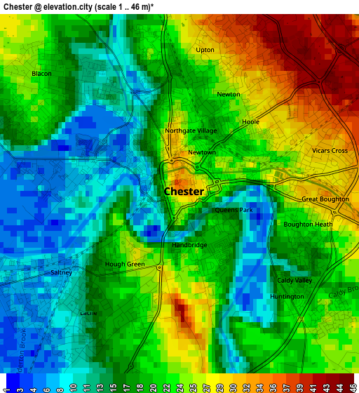
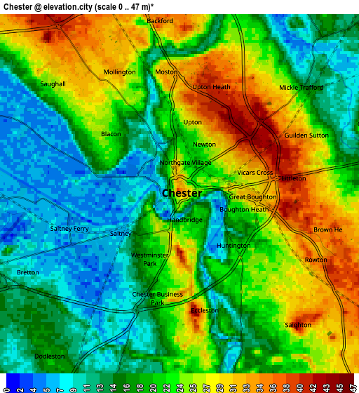
Below is the Elevation map of Chester, which displays elevation range with different colors. Scale of the first map is from 1 to 46 m (3 to 151 ft) with average elevation of 19.7 meters (=65 ft) [note 1]
These maps also provides idea of topography and contour of this city, they are displayed at different zoom levels. More info about maps, scale and edge coordinates you can find below images.
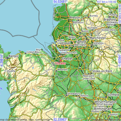
| \ | Map #1 | Map #2 | Topo.Map |
| Scale [m] | 1..46 m | 0..47 m | × |
| Scale [ft] | 3..151 ft | 0..154 ft | × |
| Average | 19.7 m = 65 ft | 20.4 m = 67 ft | × |
| Width | 5.86 km = 3.6 mi | 11.71 km = 7.3 mi | 187.4 km = 116.4 mi |
| Height | 5.86 km = 3.6 mi | 11.71 km = 7.3 mi | 187.4 km = 116.4 mi |
| ↑Max Latitude | 53.216822° | 53.243128° | 54.02481° |
| Latitude at center | 53.1905° | 53.1905° | 53.1905° |
| ↓Min Latitude | 53.164162° | 53.137807° | 52.33963° |
| ← Min Longitude | -2.935835° | -2.979781° | -4.29814° |
| Longitude center | -2.89189° | -2.89189° | -2.89189° |
| →Max Longitude | -2.847945° | -2.803999° | -1.48564° |
Nearby cities:
Cities around Chester sort by population:
• Blacon elevation 21 m
3 km,  311°
311°
• Broughton 27 m
7.4 km,  245°
245°
• Saughall 27 m
5.9 km, 312°
• Tarvin 40 m
8.5 km,  84°
84°
• Mickle Trafford 17 m
5.3 km,  49°
49°
• Guilden Sutton 31 m
4.6 km,  64°
64°
• Hoole 25 m
1.4 km,  44°
44°
• Mollington 30 m
4.7 km,  335°
335°
• Aldford 16 m
7.2 km,  167°
167°
• Stoke 13 m
6.8 km,  14°
14°
• Waverton 34 m
6.7 km,  113°
113°
• Eccleston 34 m
4.5 km, 172°
Multilingual:
 En español:
Chester elevación 34 m.
 En France:
Chester élévation 34 m.


Sources and notes:
- [note 1] Map square and city borders are not equal. Map elevation data is calculated only from area inside that square.
- [src 1] Elevation data from geonames database provided with same terms of usage.
- [src 2] The elevation map of Chester is generated using elevation data from NASA's 3 arcsec (90m) resolution SRTM data.
- [src 3] Base (background) map © OpenStreetMap contributors tiles are generated by Geofabrik and OpenTopoMap.
Copyright & License:
This Chester Elevation Map is licensed under CC BY-SA. You may reuse any part from this page, if you give a proper credit by linking to this URL:
 More info on terms of use page.