Church Stretton elevation
Church Stretton (England, Shropshire), United Kingdom elevation is 189 meters and Church Stretton elevation in feet is 620 ft above sea level [src 1]. Church Stretton is a populated place (feature code) with elevation that is 117 meters (384 ft) bigger than average city elevation in United Kingdom.
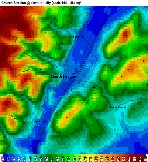
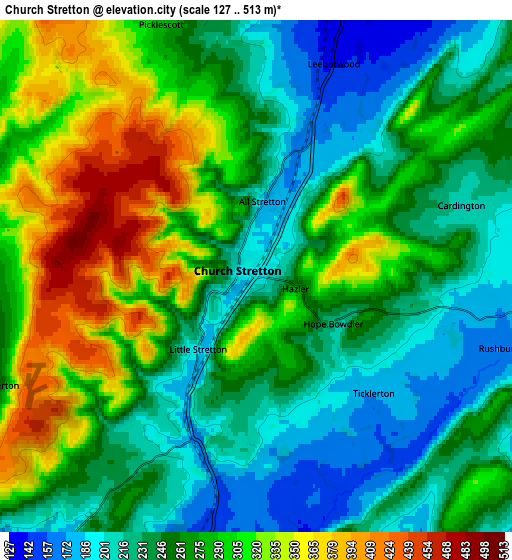
Below is the Elevation map of Church Stretton, which displays elevation range with different colors. Scale of the first map is from 164 to 484 m (538 to 1588 ft) with average elevation of 279.9 meters (=918 ft) [note 1]
These maps also provides idea of topography and contour of this city, they are displayed at different zoom levels. More info about maps, scale and edge coordinates you can find below images.
| \ | Map #1 | Map #2 | Topo.Map |
| Scale [m] | 164..484 m | 127..513 m | × |
| Scale [ft] | 538..1588 ft | 417..1683 ft | × |
| Average | 279.9 m = 918 ft | 267.9 m = 879 ft | × |
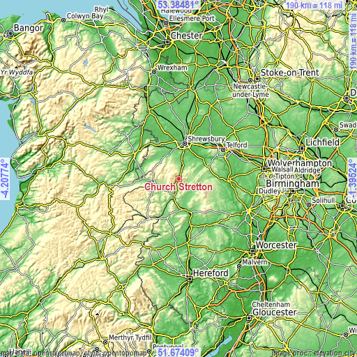
| Width | 5.94 km = 3.7 mi | 11.89 km = 7.4 mi | 190.2 km = 118.2 mi |
| Height | 5.94 km = 3.7 mi | 11.89 km = 7.4 mi | 190.2 km = 118.2 mi |
| ↑Max Latitude | 52.564501° | 52.591206° | 53.38481° |
| Latitude at center | 52.53778° | 52.53778° | 52.53778° |
| ↓Min Latitude | 52.511043° | 52.484289° | 51.67409° |
| ← Min Longitude | -2.845435° | -2.889381° | -4.20774° |
| Longitude center | -2.80149° | -2.80149° | -2.80149° |
| →Max Longitude | -2.757545° | -2.713599° | -1.39524° |
Nearby cities:
Cities around Church Stretton sort by population:
• Bayston Hill elevation 88 m
15.5 km,  9°
9°
• Craven Arms 123 m
10.8 km,  192°
192°
• Bishop's Castle 200 m
14.5 km,  249°
249°
• Pontesbury 108 m
13.7 km,  333°
333°
• Minsterley 107 m
14.2 km,  323°
323°
• Harley 95 m
15.3 km,  63°
63°
• Berrington 65 m
14.2 km,  28°
28°
• Kenley 149 m
13.3 km, 58°
• Lydham 182 m
12.3 km,  258°
258°
• Norbury 267 m
10.1 km,  267°
267°
• Longnor 124 m
7.7 km, 26°
• Cardington 212 m
4.8 km,  73°
73°
Multilingual:
 En español:
Church Stretton elevación 189 m.
 En France:
Church Stretton élévation 189 m.
 Auf Deutsch:
Church Stretton höhe über dem Meeresspiegel ist 189 m.

Sources and notes:
- [note 1] Map square and city borders are not equal. Map elevation data is calculated only from area inside that square.
- [src 1] Elevation data from geonames database provided with same terms of usage.
- [src 2] The elevation map of Church Stretton is generated using elevation data from NASA's 3 arcsec (90m) resolution SRTM data.
- [src 3] Base (background) map © OpenStreetMap contributors tiles are generated by Geofabrik and OpenTopoMap.
Copyright & License:
This Church Stretton Elevation Map is licensed under CC BY-SA. You may reuse any part from this page, if you give a proper credit by linking to this URL:
 More info on terms of use page.