Collington elevation
Collington (England, Herefordshire), United Kingdom elevation is 110 meters and Collington elevation in feet is 361 ft above sea level [src 1]. Collington is a seat of a third-order administrative division (feature code) with elevation that is 38 meters (125 ft) bigger than average city elevation in United Kingdom.
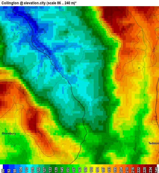
Below is the Elevation map of Collington, which displays elevation range with different colors. Scale of the first map is from 86 to 240 m (282 to 787 ft) with average elevation of 155 meters (=509 ft) [note 1]
These maps also provides idea of topography and contour of this city, they are displayed at different zoom levels. More info about maps, scale and edge coordinates you can find below images.
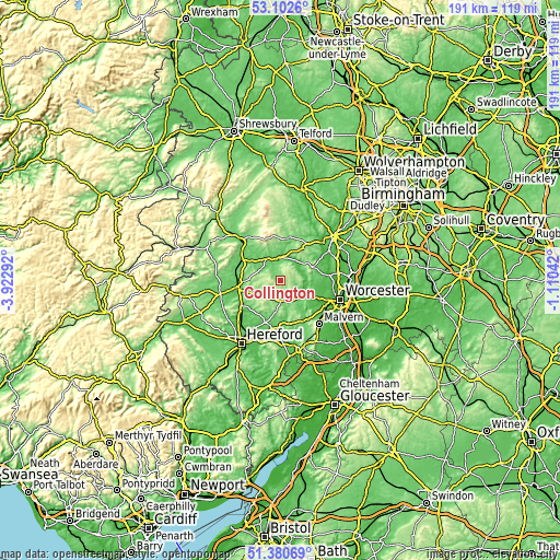
| \ | Map #1 | Topo.Map |
| Scale [m] | 86..240 m | × |
| Scale [ft] | 282..787 ft | × |
| Average | 155 m = 509 ft | × |
| Width | 5.98 km = 3.7 mi | 191.5 km = 119 mi |
| Height | 5.98 km = 3.7 mi | 191.4 km = 118.9 mi |
| ↑Max Latitude | 52.276896° | 53.1026° |
| Latitude at center | 52.25° | 52.25° |
| ↓Min Latitude | 52.223088° | 51.38069° |
| ← Min Longitude | -2.560615° | -3.92292° |
| Longitude center | -2.51667° | -2.51667° |
| →Max Longitude | -2.472725° | -1.11042° |
Nearby cities:
Cities around Collington sort by population:
• Leominster elevation 89 m
15.8 km,  260°
260°
• Bromyard 128 m
6.7 km,  175°
175°
• Tenbury Wells 56 m
8.7 km,  321°
321°
• Cleobury Mortimer 133 m
14.5 km,  9°
9°
• Ocle Pychard 80 m
15.9 km,  200°
200°
• Hope under Dinmore 77 m
15.5 km,  241°
241°
• Evesbatch 146 m
13.7 km,  160°
160°
• Moreton Jeffries 98 m
13.4 km, 198°
• Kimbolton 101 m
12.5 km,  270°
270°
• Humber 129 m
11.6 km, 241°
• Wacton 173 m
5 km,  222°
222°
• Thornbury 173 m
2.9 km,  230°
230°
Multilingual:
 En español:
Collington elevación 110 m.
 En France:
Collington élévation 110 m.
 Auf Deutsch:
Collington höhe über dem Meeresspiegel ist 110 m.

Sources and notes:
- [note 1] Map square and city borders are not equal. Map elevation data is calculated only from area inside that square.
- [src 1] Elevation data from geonames database provided with same terms of usage.
- [src 2] The elevation map of Collington is generated using elevation data from NASA's 3 arcsec (90m) resolution SRTM data.
- [src 3] Base (background) map © OpenStreetMap contributors tiles are generated by Geofabrik and OpenTopoMap.
Copyright & License:
This Collington Elevation Map is licensed under CC BY-SA. You may reuse any part from this page, if you give a proper credit by linking to this URL:
 More info on terms of use page.