Corby elevation
Corby (England, Northamptonshire), United Kingdom elevation is 114 meters and Corby elevation in feet is 374 ft above sea level [src 1]. Corby is a populated place (feature code) with elevation that is 42 meters (138 ft) bigger than average city elevation in United Kingdom.
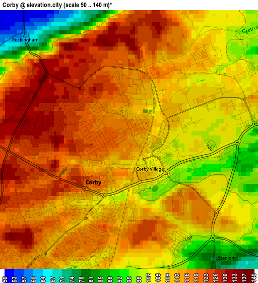
Below is the Elevation map of Corby, which displays elevation range with different colors. Scale of the first map is from 50 to 140 m (164 to 459 ft) with average elevation of 110.4 meters (=362 ft) [note 1]
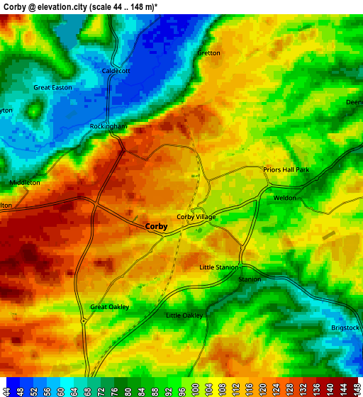
These maps also provides idea of topography and contour of this city, they are displayed at different zoom levels. More info about maps, scale and edge coordinates you can find below images.
| \ | Map #1 | Map #2 | Topo.Map |
| Scale [m] | 50..140 m | 44..148 m | × |
| Scale [ft] | 164..459 ft | 144..486 ft | × |
| Average | 110.4 m = 362 ft | 97.8 m = 321 ft | × |
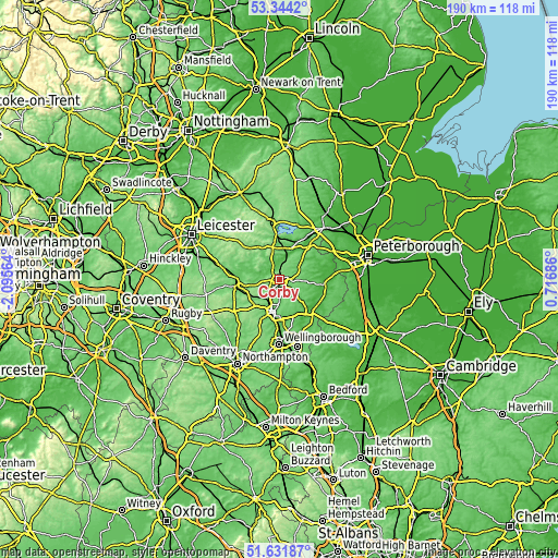
| Width | 5.95 km = 3.7 mi | 11.9 km = 7.4 mi | 190.4 km = 118.3 mi |
| Height | 5.95 km = 3.7 mi | 11.9 km = 7.4 mi | 190.4 km = 118.3 mi |
| ↑Max Latitude | 52.523116° | 52.549846° | 53.3442° |
| Latitude at center | 52.49637° | 52.49637° | 52.49637° |
| ↓Min Latitude | 52.469607° | 52.442829° | 51.63187° |
| ← Min Longitude | -0.733335° | -0.777281° | -2.09564° |
| Longitude center | -0.68939° | -0.68939° | -0.68939° |
| →Max Longitude | -0.645445° | -0.601499° | 0.71686° |
Nearby cities:
Cities around Corby sort by population:
• Kettering elevation 95 m
11.2 km,  192°
192°
• Desborough 126 m
10.8 km,  235°
235°
• Rothwell 101 m
11.6 km,  220°
220°
• Uppingham 150 m
10.4 km,  347°
347°
• Geddington 74 m
6.5 km,  180°
180°
• Brigstock 60 m
7 km,  128°
128°
• Cottingham 100 m
4.5 km,  278°
278°
• South Luffenham 56 m
13.5 km,  22°
22°
• Morcott 78 m
11.7 km, 17°
• Seaton 93 m
8.9 km,  9°
9°
• Wing 120 m
13.5 km,  1°
1°
• Preston 140 m
13 km, 352°
Multilingual:
 En español:
Corby elevación 114 m.
 En France:
Corby élévation 114 m.


Sources and notes:
- [note 1] Map square and city borders are not equal. Map elevation data is calculated only from area inside that square.
- [src 1] Elevation data from geonames database provided with same terms of usage.
- [src 2] The elevation map of Corby is generated using elevation data from NASA's 3 arcsec (90m) resolution SRTM data.
- [src 3] Base (background) map © OpenStreetMap contributors tiles are generated by Geofabrik and OpenTopoMap.
Copyright & License:
This Corby Elevation Map is licensed under CC BY-SA. You may reuse any part from this page, if you give a proper credit by linking to this URL:
 More info on terms of use page.