Cranleigh elevation
Cranleigh (England, Surrey), United Kingdom elevation is 60 meters and Cranleigh elevation in feet is 197 ft above sea level [src 1]. Cranleigh is a populated place (feature code) with elevation that is 12 meters (39 ft) smaller than average city elevation in United Kingdom.
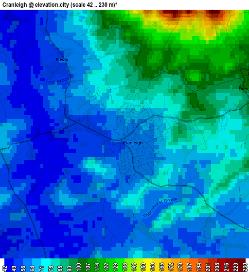
Below is the Elevation map of Cranleigh, which displays elevation range with different colors. Scale of the first map is from 42 to 230 m (138 to 755 ft) with average elevation of 72 meters (=236 ft) [note 1]
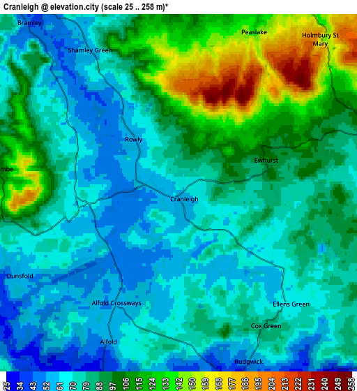
These maps also provides idea of topography and contour of this city, they are displayed at different zoom levels. More info about maps, scale and edge coordinates you can find below images.
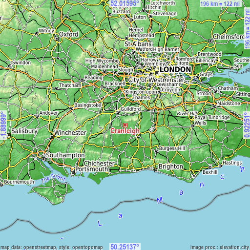
| \ | Map #1 | Map #2 | Topo.Map |
| Scale [m] | 42..230 m | 25..258 m | × |
| Scale [ft] | 138..755 ft | 82..846 ft | × |
| Average | 72 m = 236 ft | 86.5 m = 284 ft | × |
| Width | 6.13 km = 3.8 mi | 12.26 km = 7.6 mi | 196.2 km = 121.9 mi |
| Height | 6.13 km = 3.8 mi | 12.26 km = 7.6 mi | 196.2 km = 121.9 mi |
| ↑Max Latitude | 51.169653° | 51.197199° | 52.01595° |
| Latitude at center | 51.14209° | 51.14209° | 51.14209° |
| ↓Min Latitude | 51.114511° | 51.086915° | 50.25137° |
| ← Min Longitude | -0.527685° | -0.571631° | -1.88999° |
| Longitude center | -0.48374° | -0.48374° | -0.48374° |
| →Max Longitude | -0.439795° | -0.395849° | 0.92251° |
Nearby cities:
Cities around Cranleigh sort by population:
• Godalming elevation 46 m
10.4 km,  297°
297°
• Witley 88 m
11.5 km,  274°
274°
• Bramley 46 m
7.9 km,  317°
317°
• Peaslake 130 m
6.1 km,  25°
25°
• Chiddingfold 51 m
10 km,  254°
254°
• Rudgwick 41 m
6.5 km,  159°
159°
• Chilworth 50 m
8.9 km,  338°
338°
• Wormley 111 m
11.4 km, 266°
• Ewhurst 97 m
3.1 km,  63°
63°
• Capel 89 m
11.2 km,  85°
85°
• Warnham 59 m
11 km,  120°
120°
• Slinfold 34 m
9.5 km,  145°
145°
Multilingual:
 En español:
Cranleigh elevación 60 m.
 En France:
Cranleigh élévation 60 m.
 Auf Deutsch:
Cranleigh höhe über dem Meeresspiegel ist 60 m.

Sources and notes:
- [note 1] Map square and city borders are not equal. Map elevation data is calculated only from area inside that square.
- [src 1] Elevation data from geonames database provided with same terms of usage.
- [src 2] The elevation map of Cranleigh is generated using elevation data from NASA's 3 arcsec (90m) resolution SRTM data.
- [src 3] Base (background) map © OpenStreetMap contributors tiles are generated by Geofabrik and OpenTopoMap.
Copyright & License:
This Cranleigh Elevation Map is licensed under CC BY-SA. You may reuse any part from this page, if you give a proper credit by linking to this URL:
 More info on terms of use page.