Warnham elevation
Warnham (England, West Sussex), United Kingdom elevation is 59 meters and Warnham elevation in feet is 194 ft above sea level [src 1]. Warnham is a populated place (feature code) with elevation that is 13 meters (43 ft) smaller than average city elevation in United Kingdom.
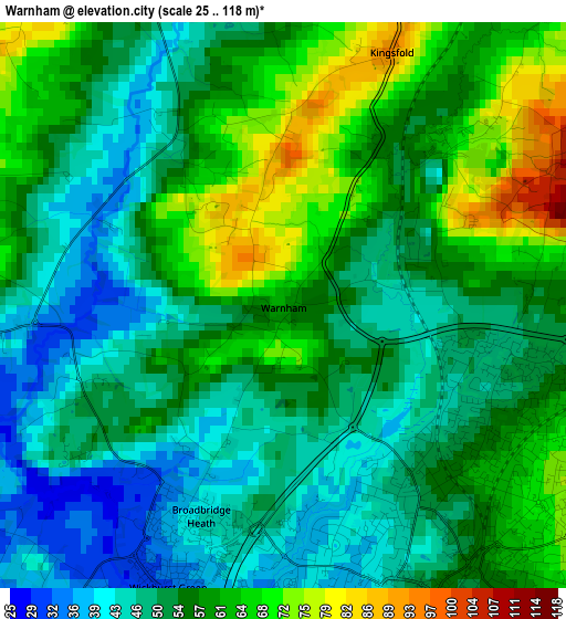
Below is the Elevation map of Warnham, which displays elevation range with different colors. Scale of the first map is from 25 to 118 m (82 to 387 ft) with average elevation of 55 meters (=180 ft) [note 1]
These maps also provides idea of topography and contour of this city, they are displayed at different zoom levels. More info about maps, scale and edge coordinates you can find below images.
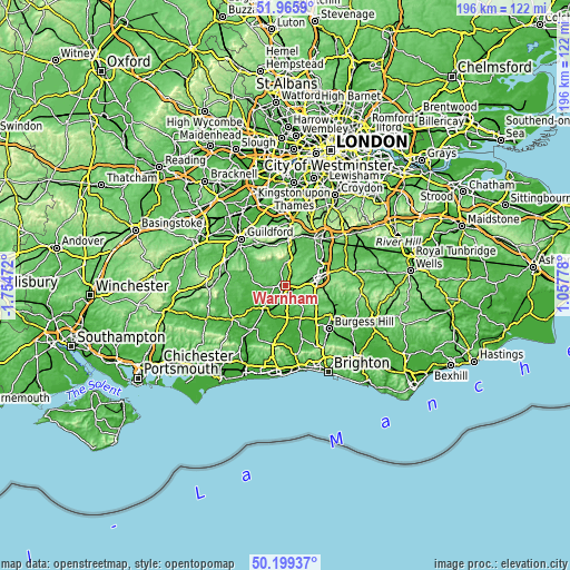
| \ | Map #1 | Topo.Map |
| Scale [m] | 25..118 m | × |
| Scale [ft] | 82..387 ft | × |
| Average | 55 m = 180 ft | × |
| Width | 6.14 km = 3.8 mi | 196.4 km = 122 mi |
| Height | 6.14 km = 3.8 mi | 196.4 km = 122 mi |
| ↑Max Latitude | 51.118663° | 51.9659° |
| Latitude at center | 51.09107° | 51.09107° |
| ↓Min Latitude | 51.06346° | 50.19937° |
| ← Min Longitude | -0.392415° | -1.75472° |
| Longitude center | -0.34847° | -0.34847° |
| →Max Longitude | -0.304525° | 1.05778° |
Nearby cities:
Cities around Warnham sort by population:
• Horsham elevation 52 m
3.4 km,  154°
154°
• Broadfield 92 m
9.9 km,  86°
86°
• Cranleigh 60 m
11 km,  300°
300°
• Bewbush 75 m
8.9 km,  81°
81°
• Southwater 44 m
7.5 km,  181°
181°
• Billingshurst 29 m
10.5 km,  224°
224°
• Gossops Green 83 m
9.4 km, 76°
• Rudgwick 41 m
7.2 km,  266°
266°
• Ewhurst 97 m
9.7 km,  316°
316°
• Capel 89 m
6.7 km,  14°
14°
• Slinfold 34 m
4.6 km,  242°
242°
• Holmwood 100 m
10.1 km, 10°
Multilingual:
 En español:
Warnham elevación 59 m.
 En France:
Warnham élévation 59 m.


Sources and notes:
- [note 1] Map square and city borders are not equal. Map elevation data is calculated only from area inside that square.
- [src 1] Elevation data from geonames database provided with same terms of usage.
- [src 2] The elevation map of Warnham is generated using elevation data from NASA's 3 arcsec (90m) resolution SRTM data.
- [src 3] Base (background) map © OpenStreetMap contributors tiles are generated by Geofabrik and OpenTopoMap.
Copyright & License:
This Warnham Elevation Map is licensed under CC BY-SA. You may reuse any part from this page, if you give a proper credit by linking to this URL:
 More info on terms of use page.