Currie elevation
Currie (Scotland, City of Edinburgh), United Kingdom elevation is 146 meters and Currie elevation in feet is 479 ft above sea level [src 1]. Currie is a populated place (feature code) with elevation that is 74 meters (243 ft) bigger than average city elevation in United Kingdom.
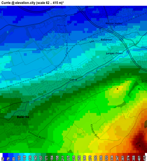
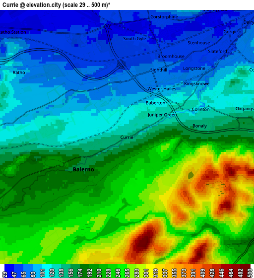
Below is the Elevation map of Currie, which displays elevation range with different colors. Scale of the first map is from 62 to 415 m (203 to 1362 ft) with average elevation of 164.8 meters (=541 ft) [note 1]
These maps also provides idea of topography and contour of this city, they are displayed at different zoom levels. More info about maps, scale and edge coordinates you can find below images.
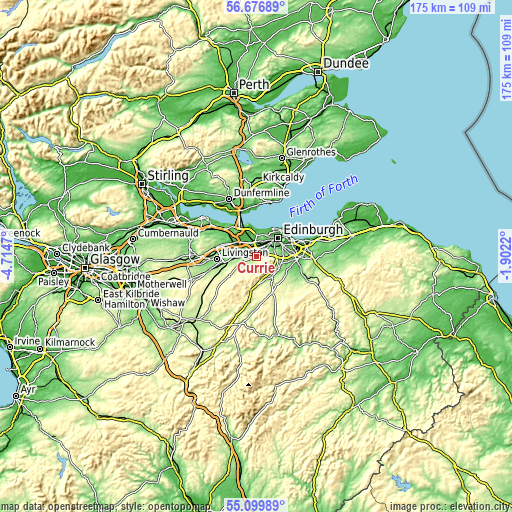
| \ | Map #1 | Map #2 | Topo.Map |
| Scale [m] | 62..415 m | 29..500 m | × |
| Scale [ft] | 203..1362 ft | 95..1640 ft | × |
| Average | 164.8 m = 541 ft | 171.5 m = 563 ft | × |
| Width | 5.48 km = 3.4 mi | 10.96 km = 6.8 mi | 175.3 km = 108.9 mi |
| Height | 5.48 km = 3.4 mi | 10.96 km = 6.8 mi | 175.3 km = 108.9 mi |
| ↑Max Latitude | 55.921032° | 55.945648° | 56.67689° |
| Latitude at center | 55.8964° | 55.8964° | 55.8964° |
| ↓Min Latitude | 55.871752° | 55.847089° | 55.09989° |
| ← Min Longitude | -3.352395° | -3.396341° | -4.7147° |
| Longitude center | -3.30845° | -3.30845° | -3.30845° |
| →Max Longitude | -3.264505° | -3.220559° | -1.9022° |
Nearby cities:
Cities around Currie sort by population:
• Edinburgh elevation 66 m
9.3 km,  48°
48°
• Penicuik 187 m
8.9 km,  144°
144°
• Colinton 112 m
3.5 km,  69°
69°
• Loanhead 152 m
9.5 km,  101°
101°
• Balerno 165 m
2.4 km,  235°
235°
• Kirkliston 37 m
8.7 km,  317°
317°
• Kirknewton 171 m
7 km,  261°
261°
• Ratho 89 m
5.3 km,  302°
302°
• Roslin 158 m
9.7 km,  116°
116°
• Bilston 161 m
8.6 km,  109°
109°
• Ratho Station 45 m
6.7 km,  311°
311°
• Newbridge 62 m
7 km, 305°
Multilingual:
 En español:
Currie elevación 146 m.
 En France:
Currie élévation 146 m.


Sources and notes:
- [note 1] Map square and city borders are not equal. Map elevation data is calculated only from area inside that square.
- [src 1] Elevation data from geonames database provided with same terms of usage.
- [src 2] The elevation map of Currie is generated using elevation data from NASA's 3 arcsec (90m) resolution SRTM data.
- [src 3] Base (background) map © OpenStreetMap contributors tiles are generated by Geofabrik and OpenTopoMap.
Copyright & License:
This Currie Elevation Map is licensed under CC BY-SA. You may reuse any part from this page, if you give a proper credit by linking to this URL:
 More info on terms of use page.