Loanhead elevation
Loanhead (Scotland, Midlothian), United Kingdom elevation is 152 meters and Loanhead elevation in feet is 499 ft above sea level [src 1]. Loanhead is a populated place (feature code) with elevation that is 80 meters (262 ft) bigger than average city elevation in United Kingdom.
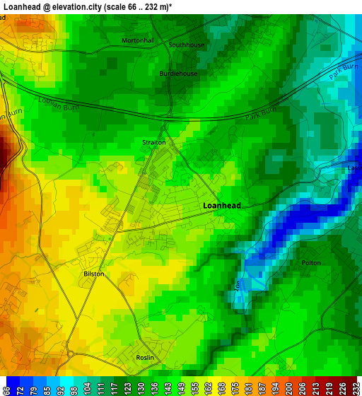
Below is the Elevation map of Loanhead, which displays elevation range with different colors. Scale of the first map is from 66 to 232 m (217 to 761 ft) with average elevation of 140 meters (=459 ft) [note 1]
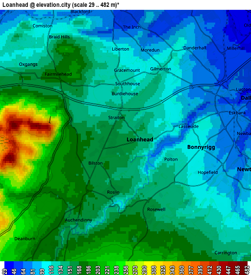
These maps also provides idea of topography and contour of this city, they are displayed at different zoom levels. More info about maps, scale and edge coordinates you can find below images.
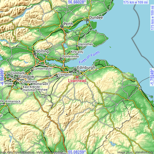
| \ | Map #1 | Map #2 | Topo.Map |
| Scale [m] | 66..232 m | 29..482 m | × |
| Scale [ft] | 217..761 ft | 95..1581 ft | × |
| Average | 140 m = 459 ft | 144.9 m = 475 ft | × |
| Width | 5.48 km = 3.4 mi | 10.96 km = 6.8 mi | 175.4 km = 109 mi |
| Height | 5.48 km = 3.4 mi | 10.96 km = 6.8 mi | 175.4 km = 109 mi |
| ↑Max Latitude | 55.904093° | 55.92872° | 56.66028° |
| Latitude at center | 55.87945° | 55.87945° | 55.87945° |
| ↓Min Latitude | 55.854792° | 55.830118° | 55.08259° |
| ← Min Longitude | -3.202685° | -3.246631° | -4.56499° |
| Longitude center | -3.15874° | -3.15874° | -3.15874° |
| →Max Longitude | -3.114795° | -3.070849° | -1.75249° |
Nearby cities:
Cities around Loanhead sort by population:
• Edinburgh elevation 66 m
8.4 km,  343°
343°
• Bonnyrigg 103 m
3.4 km,  101°
101°
• Penicuik 187 m
6.8 km,  218°
218°
• Mayfield 156 m
7.5 km, 96°
• Dalkeith 58 m
5.9 km,  74°
74°
• Colinton 112 m
6.8 km,  297°
297°
• Gorebridge 187 m
8 km,  117°
117°
• Danderhall 83 m
4.9 km,  37°
37°
• Roslin 158 m
2.5 km,  194°
194°
• Rosewell 154 m
3.5 km,  156°
156°
• Bilston 161 m
1.6 km,  229°
229°
• Whitecraig 32 m
8.5 km,  58°
58°
Multilingual:
 En español:
Loanhead elevación 152 m.
 En France:
Loanhead élévation 152 m.
 Auf Deutsch:
Loanhead höhe über dem Meeresspiegel ist 152 m.

Sources and notes:
- [note 1] Map square and city borders are not equal. Map elevation data is calculated only from area inside that square.
- [src 1] Elevation data from geonames database provided with same terms of usage.
- [src 2] The elevation map of Loanhead is generated using elevation data from NASA's 3 arcsec (90m) resolution SRTM data.
- [src 3] Base (background) map © OpenStreetMap contributors tiles are generated by Geofabrik and OpenTopoMap.
Copyright & License:
This Loanhead Elevation Map is licensed under CC BY-SA. You may reuse any part from this page, if you give a proper credit by linking to this URL:
 More info on terms of use page.